
Magnitude |
:4.4 |
| Date & Time (UTC) | 2010-10-22 08:34:24.1 |
| Date & Time (Local) | 1389/7/30 12:04:24.1 |
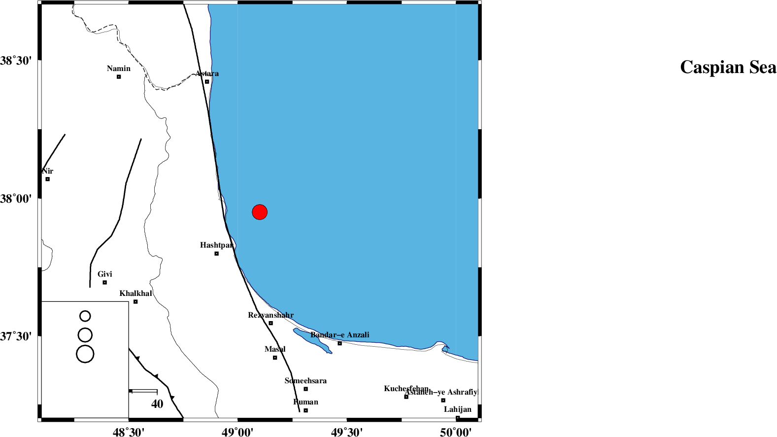
| Location | Lat:37.95 Lon: 49.1 |
| Region | Caspian Sea, 24 km North-East of Hashtpar |
Nearest Cities |
|
| 16 km East of Lisar, Gilan Province | |
| 19 km North East of Chelonasr, Gilan Province | |
| 24 km North East of Hashtpar, Gilan Province | |
| 24 km North East of Hashtpar, Gilan Province | |
| 26 km North East of Tularud, Gilan Province | |
| Depth | 15 km |
| Agency | |
Faults within 150 km: |
|
| TALESH_F (Length: 258 km) , Distance to epicenter: 14 km | |
| SANGAVAR_F (Length: 61 km) , Distance to epicenter: 55 km | |
| MASULEL_F (Length: 90 km) , Distance to epicenter: 72 km | |
| Number of Phases | 6 |
| RMS | 0.2 |
| Number of Stations | 7 |
| Error in Latitude | >7.3 km |
| Error in Longitude | 7.2 km |
| Error in Depth | 9.5 km |
Download waveform in seisan format
to download seisan software Click here
to access information about IIEES stations Click here
Amplitude | ||||||||
| UID | Agency | Station | Component | Amplitude | Period | Arrival Time | Proccessing Time | Signal Clip |
| 72214 | IIEES | ZNJK | N | 5757.1 | 0.3 | 2010-10-22 08:35:08 | 2010-10-22 08:55:00 | n |
| 72215 | IIEES | SNGE | E | 731.1 | 0.63 | 2010-10-22 08:36:10 | 2010-10-22 08:55:00 | n |
| 72216 | IIEES | MRVT | E | 383 | 0.13 | 2010-10-22 08:36:50 | 2010-10-22 08:55:00 | n |
| 72217 | IIEES | MRVT | N | 339.6 | 0.33 | 2010-10-22 08:36:51 | 2010-10-22 08:55:00 | n |
| 72218 | IIEES | SHRO | E | 76.5 | 0.36 | 2010-10-22 08:37:14 | 2010-10-22 08:55:00 | n |
Phase | ||||||||||||
| Agency | Station | Component | Phase Type | Phase Quality | First Motion | Observed Arrival Time | Time Residual | Loc. Flag | Input Weight | Distance | Azimuth | |
| IIEES | ZNJK | Z | Pg | E | 2010-10-22 08:34:48 | -0.3 | y | 147 | 195 | |||
| IIEES | CHTH | Z | Pn | E | 2010-10-22 08:35:08 | 0.1 | y | 290 | 141 | |||
| IIEES | SNGE | Z | Pn | E | 2010-10-22 08:35:16 | 0.2 | y | 354 | 207 | |||
| IIEES | MAKU | Z | Pn | E | 2010-10-22 08:35:23 | 0 | y | 415 | 293 | |||
| IIEES | KHMZ | Z | Pn | E | 2010-10-22 08:35:31 | 0.3 | y | 474 | 170 | |||
| IIEES | SHRO | Z | Pn | E | 2010-10-22 08:35:52 | -0.3 | y | 652 | 107 | |||