
Magnitude |
:2.6 |
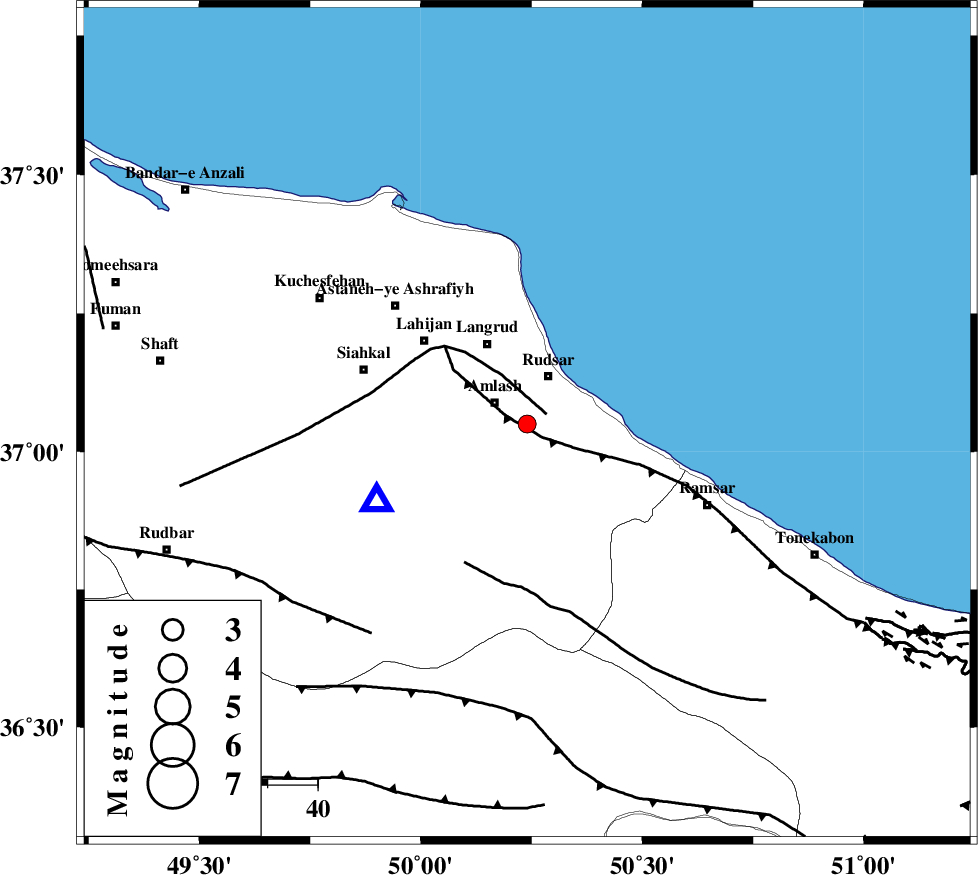
| Date & Time (UTC) | 2010-10-17 01:35:23.8 |
| Date & Time (Local) | 1389/7/25 05:05:23.8 |
| Location | Lat:37.05 Lon: 50.24 |
| Region | Gilan Province, 8 km Amlash |
Nearest Cities |
|
| 1 km North of Sanjus, Gilan Province | |
| 6 km North of Kalachay, Gilan Province | |
| 8 km of Amlash, Gilan Province | |
| 9 km North of Rahimabad, Gilan Province | |
| 11 km of Rudsar, Gilan Province | |
| Depth | 14 km |
| Agency | |
Faults within 150 km: |
|
| KHAZAR_F (Length: 523 km) , Distance to epicenter: 4 km | |
| LAHIJAN_F (Length: 92 km) , Distance to epicenter: 4 km | |
| BONAN_F (Length: 74 km) , Distance to epicenter: 31 km | |
| Number of Phases | 4 |
| RMS | 0 |
| Number of Stations | 3 |
| Error in Latitude | >4.1 km |
| Error in Longitude | 9.8 km |
| Error in Depth | 6 km |
Download waveform in seisan format
to download seisan software Click here
to access information about IIEES stations Click here
Amplitude | ||||||||
| UID | Agency | Station | Component | Amplitude | Period | Arrival Time | Proccessing Time | Signal Clip |
| 71890 | IIEES | CHTH | E | 58.5 | 0.5 | 2010-10-17 01:36:07 | 2010-10-17 02:22:00 | n |
| 71891 | IIEES | GHVR | E | 29.9 | 1.08 | 2010-10-17 01:36:53 | 2010-10-17 02:22:00 | n |
| 71892 | IIEES | GHVR | N | 30.1 | 0.19 | 2010-10-17 01:36:53 | 2010-10-17 02:22:00 | n |
Phase | ||||||||||||
| Agency | Station | Component | Phase Type | Phase Quality | First Motion | Observed Arrival Time | Time Residual | Loc. Flag | Input Weight | Distance | Azimuth | |
| IIEES | CHTH | Z | Pg | E | 2010-10-17 01:35:48 | 0 | y | 149 | 148 | |||
| IIEES | GRMI | Z | Pn | E | 2010-10-17 01:36:06 | 0 | y | 285 | 314 | |||
| IIEES | GHVR | Z | Pn | E | 2010-10-17 01:36:08 | 0.1 | y | 299 | 162 | |||
| IIEES | GHVR | N | Sg | E | 2010-10-17 01:36:47 | 0 | y | 299 | 162 | |||