
Magnitude |
:2.9 |
| Date & Time (UTC) | 2010-09-23 13:59:44.8 |
| Date & Time (Local) | 1389/7/1 17:29:44.8 |
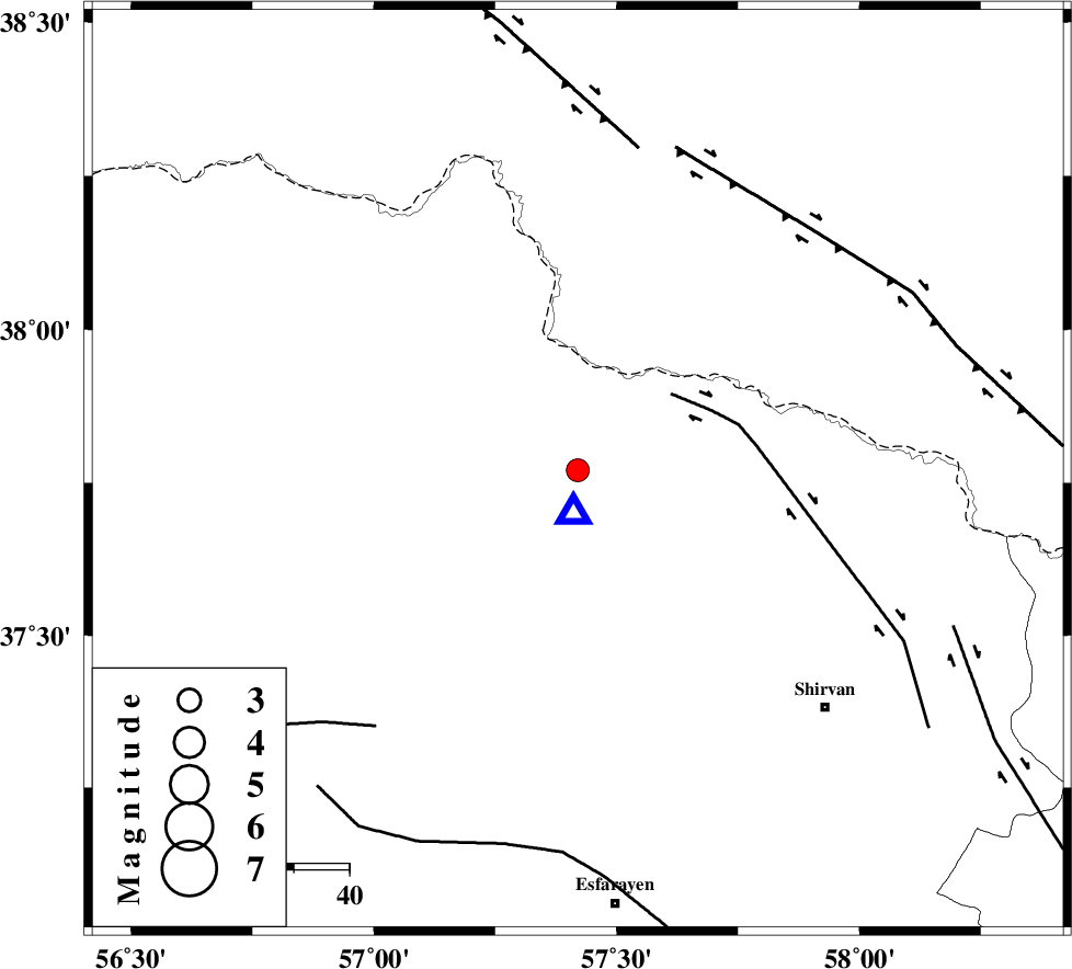
| Location | Lat:37.77 Lon: 57.42 |
| Region | Khorasan(north) Province, 34 km North of Bojnurd |
Nearest Cities |
|
| 15 km South of Gifan olia, Khorasan(north) Province | |
| 29 km North West of Yangi ghale-ye bala, Khorasan(north) Province | |
| 29 km North of Hesar-egarmkhanh, Khorasan(north) Province | |
| 32 km South East of Raz, Khorasan(north) Province | |
| 34 km North of Bojnurd, Khorasan(north) Province | |
| Depth | 14 km |
| Agency | |
Faults within 150 km: |
|
| BAGHAN_GERMAB_F (Length: 79 km) , Distance to epicenter: 22 km | |
| ROBATE_QARABIL_F (Length: 168 km) , Distance to epicenter: 59 km | |
| MAIN_KOPEHDAGH_F2 (Length: 131 km) , Distance to epicenter: 60 km | |
| Number of Phases | 6 |
| RMS | 0.1 |
| Number of Stations | 4 |
| Error in Latitude | >2.4 km |
| Error in Longitude | 2.3 km |
| Error in Depth | 2.1 km |
Download waveform in seisan format
to download seisan software Click here
to access information about IIEES stations Click here
Amplitude | ||||||||
| UID | Agency | Station | Component | Amplitude | Period | Arrival Time | Proccessing Time | Signal Clip |
| 70870 | IIEES | MRVT | E | 241.6 | 0.2 | 2010-09-23 14:00:24 | 2010-09-23 02:22:00 | n |
| 70871 | IIEES | MRVT | N | 298.9 | 0.44 | 2010-09-23 14:00:25 | 2010-09-23 02:22:00 | n |
Phase | ||||||||||||
| Agency | Station | Component | Phase Type | Phase Quality | First Motion | Observed Arrival Time | Time Residual | Loc. Flag | Input Weight | Distance | Azimuth | |
| IIEES | BJRD | Z | Pg | E | 2010-09-23 13:59:47 | -0.1 | y | 8.01 | 186 | |||
| IIEES | MRVT | Z | P | E | 2010-09-23 14:00:04 | -0.1 | y | 118 | 264 | |||
| IIEES | MRVT | E | Sg | E | 2010-09-23 14:00:19 | 0.1 | y | 118 | 264 | |||
| IIEES | SHRO | N | Pn | E | 2010-09-23 14:00:21 | 0.1 | y | 232 | 213 | |||
| IIEES | SHRO | E | Sg | E | 2010-09-23 14:00:50 | -0.1 | y | 232 | 213 | |||
| IIEES | TABS | Z | P | E | 2010-09-23 14:00:49 | 0.1 | y | 458 | 183 | |||