
Magnitude |
:2.6 |
| Date & Time (UTC) | 2010-09-13 13:45:14.0 |
| Date & Time (Local) | 1389/6/22 18:15:14.0 |
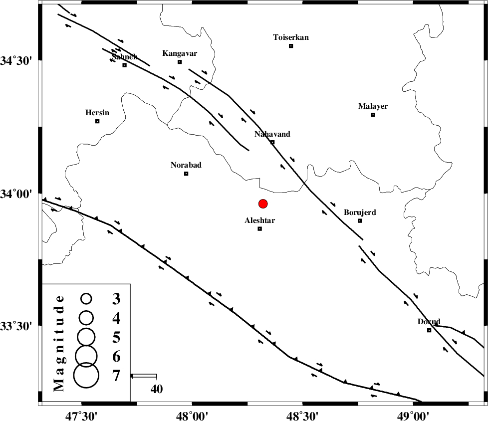
| Location | Lat:33.96 Lon: 48.32 |
| Region | Lorestan Province, 10 km Aleshtar |
Nearest Cities |
|
| 11 km North of Aleshtar, Lorestan Province | |
| 11 km North of Dehrahim, Lorestan Province | |
| 18 km North of Siyahpush, Lorestan Province | |
| 18 km North East of Firuz Abad, Lorestan Province | |
| 19 km South West of Babaqasem, Hamedan Province | |
| Depth | 31 km |
| Agency | |
Faults within 150 km: |
|
| NAHAVAND_F (Length: 102 km) , Distance to epicenter: 21 km | |
| SAHANEH_F (Length: 77 km) , Distance to epicenter: 23 km | |
| DORUD (Length: 100 km) , Distance to epicenter: 44 km | |
| Number of Phases | 5 |
| RMS | 0 |
| Number of Stations | 3 |
| Error in Latitude | >2.8 km |
| Error in Longitude | 1.8 km |
| Error in Depth | 3.4 km |
Download waveform in seisan format
to download seisan software Click here
to access information about IIEES stations Click here
Amplitude | ||||||||
| UID | Agency | Station | Component | Amplitude | Period | Arrival Time | Proccessing Time | Signal Clip |
| 70416 | IIEES | KHMZ | N | 98.5 | 0.32 | 2010-09-13 13:46:00 | 2010-09-13 01:56:00 | n |
| 70417 | IIEES | KHMZ | E | 106.1 | 0.48 | 2010-09-13 13:46:03 | 2010-09-13 01:56:00 | n |
| 70418 | IIEES | SNGE | N | 118.6 | 0.36 | 2010-09-13 13:46:05 | 2010-09-13 01:56:00 | n |
| 70419 | IIEES | SNGE | E | 69.5 | 0.56 | 2010-09-13 13:46:10 | 2010-09-13 01:56:00 | n |
| 70420 | IIEES | ASAO | E | 62.2 | 0.32 | 2010-09-13 13:46:06 | 2010-09-13 01:56:00 | n |
| 70421 | IIEES | ASAO | N | 70.3 | 0.44 | 2010-09-13 13:46:07 | 2010-09-13 01:56:00 | n |
Phase | ||||||||||||
| Agency | Station | Component | Phase Type | Phase Quality | First Motion | Observed Arrival Time | Time Residual | Loc. Flag | Input Weight | Distance | Azimuth | |
| IIEES | KHMZ | Z | Pg | E | 2010-09-13 13:45:39 | 0.1 | y | 154 | 98 | |||
| IIEES | KHMZ | E | Sg | E | 2010-09-13 13:45:57 | -0.1 | y | 154 | 98 | |||
| IIEES | SNGE | Z | Pg | E | 2010-09-13 13:45:39 | 0 | y | 155 | 325 | |||
| IIEES | ASAO | Z | Pn | E | 2010-09-13 13:45:41 | 0 | y | 170 | 67 | |||
| IIEES | ASAO | E | Sg | E | 2010-09-13 13:46:02 | 0 | y | 170 | 67 | |||