
Magnitude |
:2.5 |
| Date & Time (UTC) | 2010-09-12 07:38:32.6 |
| Date & Time (Local) | 1389/6/21 12:08:32.6 |
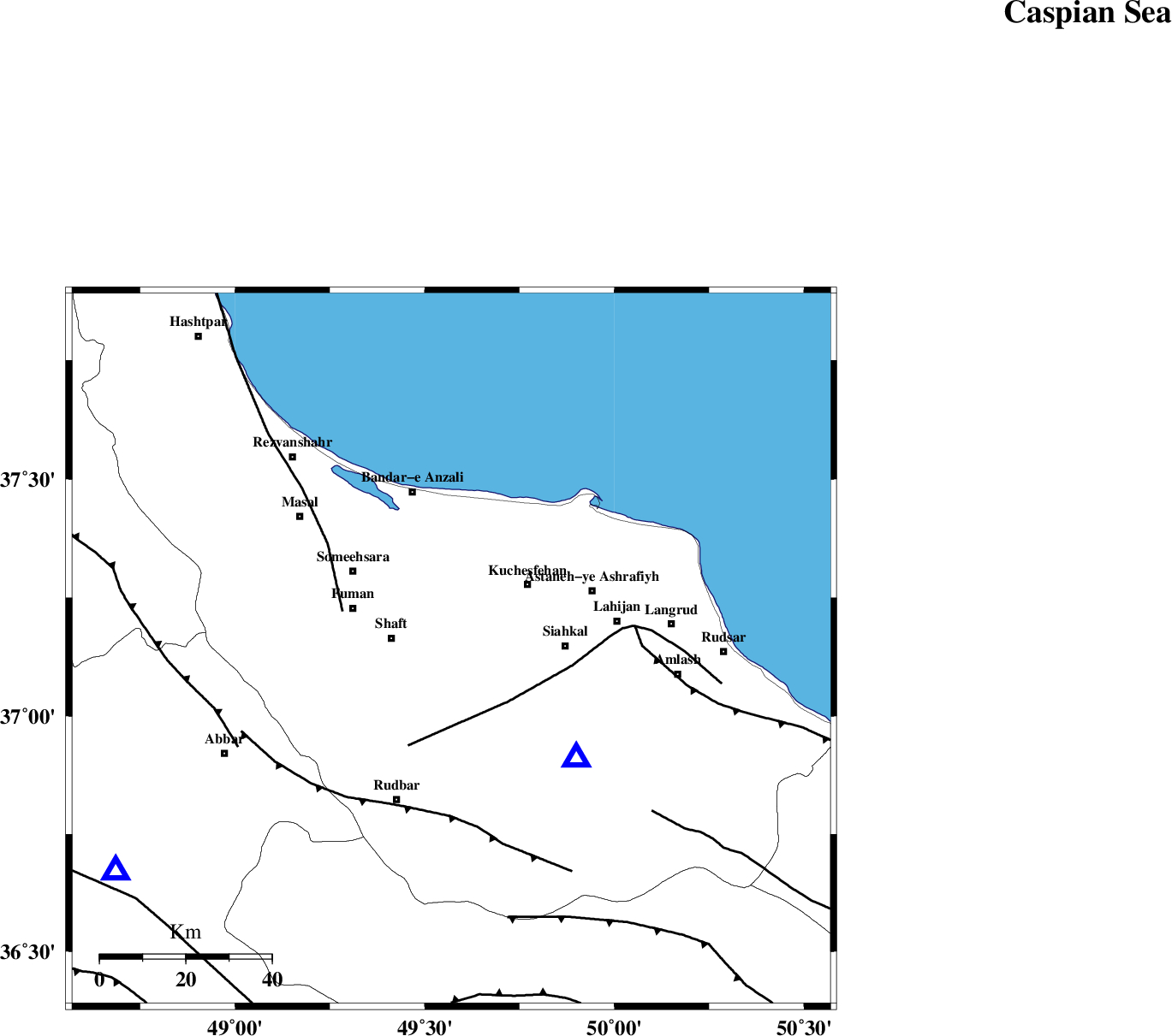
| Location | Lat:37.14 Lon: 49.57 |
| Region | Gilan Province, 15 km South of Rasht |
Nearest Cities |
|
| 4 km North of Jirdeh, Gilan Province | |
| 7 km of Lakan, Gilan Province | |
| 10 km West of Sangar, Gilan Province | |
| 11 km North of Eskolak, Gilan Province | |
| 11 km North of Saravan, Gilan Province | |
| Depth | 14 km |
| Agency | |
Faults within 150 km: |
|
| LAHIJAN_F (Length: 92 km) , Distance to epicenter: 18 km | |
| TALESH_F (Length: 258 km) , Distance to epicenter: 27 km | |
| RUDBAR_F (Length: 93 km) , Distance to epicenter: 38 km | |
| Number of Phases | 5 |
| RMS | 0 |
| Number of Stations | 4 |
| Error in Latitude | >5.4 km |
| Error in Longitude | 2.6 km |
| Error in Depth | 3.9 km |
Download waveform in seisan format
to download seisan software Click here
to access information about IIEES stations Click here
Amplitude | ||||||||
| UID | Agency | Station | Component | Amplitude | Period | Arrival Time | Proccessing Time | Signal Clip |
| 70330 | IIEES | THKV | E | 65.8 | 0.13 | 2010-09-12 07:39:24 | 2010-09-12 07:49:00 | n |
| 70331 | IIEES | THKV | N | 90.5 | 0.12 | 2010-09-12 07:39:25 | 2010-09-12 07:49:00 | n |
| 70332 | IIEES | CHTH | E | 28.5 | 0.12 | 2010-09-12 07:39:29 | 2010-09-12 07:49:00 | n |
Phase | ||||||||||||
| Agency | Station | Component | Phase Type | Phase Quality | First Motion | Observed Arrival Time | Time Residual | Loc. Flag | Input Weight | Distance | Azimuth | |
| IIEES | ZNJK | Z | Pg | E | 2010-09-12 07:38:48 | 0 | y | 94.6 | 237 | |||
| IIEES | THKV | Z | Pg | E | 2010-09-12 07:39:02 | 0.1 | y | 180 | 139 | |||
| IIEES | THKV | E | Sg | E | 2010-09-12 07:39:23 | 0 | y | 180 | 139 | |||
| IIEES | CHTH | Z | Pg | E | 2010-09-12 07:39:04 | -0.1 | y | 195 | 134 | |||
| IIEES | ASAO | Z | Pn | E | 2010-09-12 07:39:16 | 0 | y | 291 | 172 | |||