
Magnitude |
:2.9 |
| Date & Time (UTC) | 2010-08-10 14:40:49.5 |
| Date & Time (Local) | 1389/5/19 19:10:49.5 |
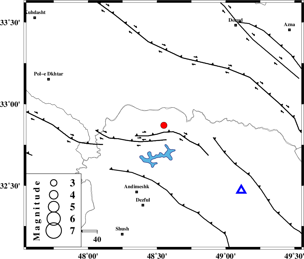
| Location | Lat:32.87 Lon: 48.55 |
| Region | Khoozestan Province, 49 km North-East of Andimeshk |
Nearest Cities |
|
| 23 km North East of Sorkhakan, Khoozestan Province | |
| 26 km North West of Shuy, Khoozestan Province | |
| 32 km North East of Bidruyeh, Khoozestan Province | |
| 35 km North East of Hoseinieh, Khoozestan Province | |
| 41 km South West of Bargsar, Lorestan Province | |
| Depth | 14 km |
| Agency | |
Faults within 150 km: |
|
| BALARUD_F_Z2 (Length: 58 km) , Distance to epicenter: 5 km | |
| BALARUD_F_Z3 (Length: 53 km) , Distance to epicenter: 10 km | |
| MFF2 (Length: 205 km) , Distance to epicenter: 34 km | |
| Number of Phases | 4 |
| RMS | 0.2 |
| Number of Stations | 4 |
| Error in Latitude | >5.9 km |
| Error in Longitude | 24.9 km |
| Error in Depth | 34.8 km |
Download waveform in seisan format
to download seisan software Click here
to access information about IIEES stations Click here
Amplitude | ||||||||
| UID | Agency | Station | Component | Amplitude | Period | Arrival Time | Proccessing Time | Signal Clip |
| 68350 | IIEES | SHGR | N | 471.9 | 0.99 | 2010-08-10 14:41:11 | 2010-08-10 02:50:00 | n |
| 68351 | IIEES | KHMZ | E | 81.4 | 0.49 | 2010-08-10 14:41:50 | 2010-08-10 02:50:00 | n |
| 68352 | IIEES | ASAO | N | 84.5 | 0.22 | 2010-08-10 14:42:09 | 2010-08-10 02:50:00 | n |
| 68353 | IIEES | SNGE | E | 85 | 1.1 | 2010-08-10 14:42:16 | 2010-08-10 02:50:00 | n |
Phase | ||||||||||||
| Agency | Station | Component | Phase Type | Phase Quality | First Motion | Observed Arrival Time | Time Residual | Loc. Flag | Input Weight | Distance | Azimuth | |
| IIEES | SHGR | Z | Pg | E | 2010-08-10 14:41:04 | 0 | y | 87.6 | 164 | |||
| IIEES | KHMZ | Z | Pg | E | 2010-08-10 14:41:16 | 0.2 | y | 163 | 53 | |||
| IIEES | ASAO | Z | Pg | E | 2010-08-10 14:41:27 | -0.2 | y | 231 | 36 | |||
| IIEES | SNGE | Z | Pn | E | 2010-08-10 14:41:31 | 0 | y | 271 | 336 | |||