
Magnitude |
:2.8 |
| Date & Time (UTC) | 2010-08-09 03:53:26.0 |
| Date & Time (Local) | 1389/5/18 08:23:26.0 |
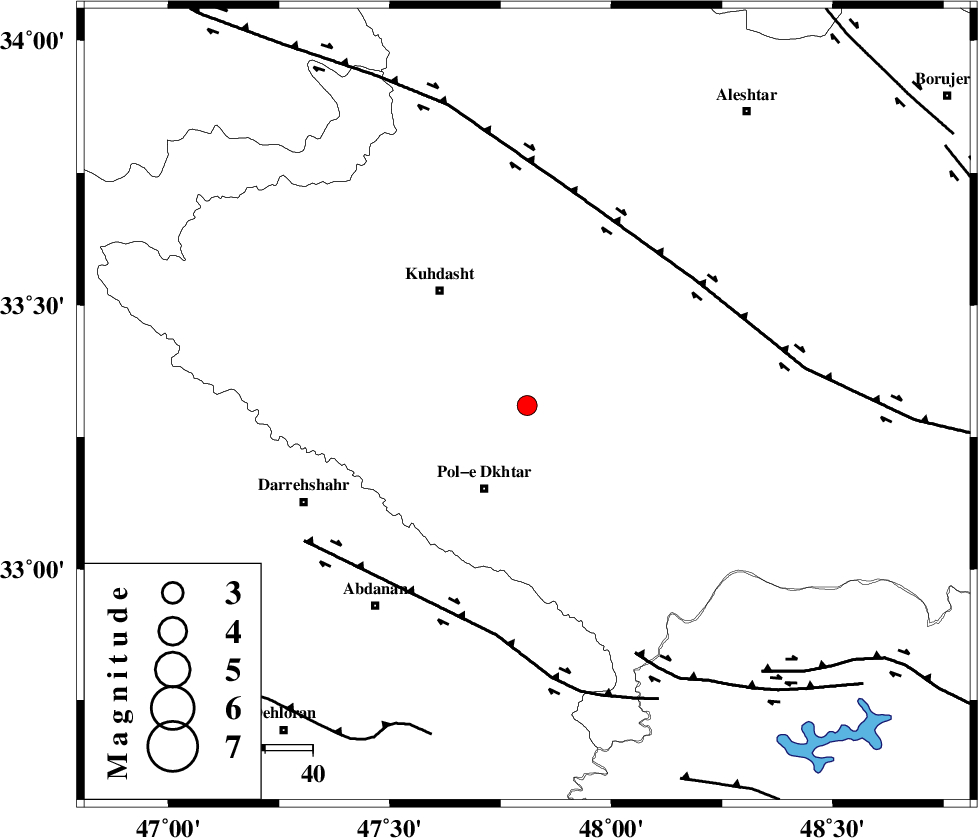
| Location | Lat:33.31 Lon: 47.81 |
| Region | Lorestan Province, 20 km North of Pol-e dokhtar |
Nearest Cities |
|
| 11 km North of Morani, Lorestan Province | |
| 17 km West of Maeulan, Lorestan Province | |
| 20 km North of Pol-e dokhtar, Lorestan Province | |
| 26 km North East of Sarab hammam, Lorestan Province | |
| 29 km South West of Mahmudvand, Lorestan Province | |
| Depth | 14 km |
| Agency | |
Faults within 150 km: |
|
| HZF4 (Length: 492 km) , Distance to epicenter: 44 km | |
| BALARUD_F_Z1 (Length: 87 km) , Distance to epicenter: 49 km | |
| BALARUD_F_Z3 (Length: 53 km) , Distance to epicenter: 57 km | |
| Number of Phases | 5 |
| RMS | 0.2 |
| Number of Stations | 5 |
| Error in Latitude | >3.8 km |
| Error in Longitude | 6.8 km |
| Error in Depth | 6.8 km |
Download waveform in seisan format
to download seisan software Click here
to access information about IIEES stations Click here
Amplitude | ||||||||
| UID | Agency | Station | Component | Amplitude | Period | Arrival Time | Proccessing Time | Signal Clip |
| 68210 | IIEES | SHGR | N | 139 | 0.39 | 2010-08-09 03:54:15 | 2010-08-09 04:06:00 | n |
| 68211 | IIEES | SHGR | E | 124.2 | 0.56 | 2010-08-09 03:54:19 | 2010-08-09 04:06:00 | n |
| 68212 | IIEES | SNGE | E | 80 | 0.59 | 2010-08-09 03:54:31 | 2010-08-09 04:06:00 | n |
| 68213 | IIEES | KHMZ | N | 111.7 | 0.69 | 2010-08-09 03:54:30 | 2010-08-09 04:06:00 | n |
Phase | ||||||||||||
| Agency | Station | Component | Phase Type | Phase Quality | First Motion | Observed Arrival Time | Time Residual | Loc. Flag | Input Weight | Distance | Azimuth | |
| IIEES | SHGR | Z | Pg | E | 2010-08-09 03:53:52 | 0 | y | 162 | 145 | |||
| IIEES | SNGE | Z | Pg | E | 2010-08-09 03:53:59 | -0.1 | y | 203 | 348 | |||
| IIEES | KHMZ | Z | Pg | E | 2010-08-09 03:53:59 | -0.3 | y | 206 | 76 | |||
| IIEES | ASAO | Z | Pn | E | 2010-08-09 03:54:04 | 0.1 | y | 247 | 55 | |||
| IIEES | GHVR | Z | Pn | E | 2010-08-09 03:54:16 | 0.2 | y | 343 | 67 | |||