
Magnitude |
:2.6 |
| Date & Time (UTC) | 2010-08-08 19:44:05.6 |
| Date & Time (Local) | 1389/5/18 00:14:05.6 |
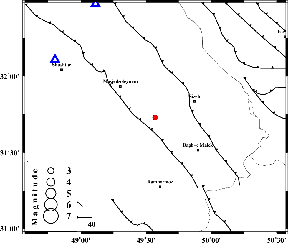
| Location | Lat:31.73 Lon: 49.57 |
| Region | Khoozestan Province, 31 km South-West of Izeh |
Nearest Cities |
|
| 20 km North of Jaru, Khoozestan Province | |
| 21 km West of Chenarestan, Khoozestan Province | |
| 26 km North East of Gazin, Khoozestan Province | |
| 27 km South West of Rasvand, Khoozestan Province | |
| 31 km South West of Izeh, Khoozestan Province | |
| Depth | 14 km |
| Agency | |
Faults within 150 km: |
|
| DEZFUL_EMBAYMENT (Length: 228 km) , Distance to epicenter: 9 km | |
| MFF2 (Length: 205 km) , Distance to epicenter: 26 km | |
| MFF4 (Length: 62 km) , Distance to epicenter: 60 km | |
| Number of Phases | 6 |
| RMS | 0 |
| Number of Stations | 4 |
| Error in Latitude | >2.5 km |
| Error in Longitude | 2.8 km |
| Error in Depth | 4.8 km |
Download waveform in seisan format
to download seisan software Click here
to access information about IIEES stations Click here
Amplitude | ||||||||
| UID | Agency | Station | Component | Amplitude | Period | Arrival Time | Proccessing Time | Signal Clip |
| 68130 | IIEES | SHGR | N | 254.3 | 0.48 | 2010-08-08 19:44:35 | 2010-08-08 07:56:00 | n |
| 68131 | IIEES | SHGR | E | 190.4 | 0.44 | 2010-08-08 19:44:36 | 2010-08-08 07:56:00 | n |
| 68132 | IIEES | KHMZ | E | 49.8 | 0.48 | 2010-08-08 19:45:11 | 2010-08-08 07:56:00 | n |
| 68133 | IIEES | KHMZ | N | 52.3 | 0.44 | 2010-08-08 19:45:11 | 2010-08-08 07:56:00 | n |
| 68134 | IIEES | ASAO | E | 22.8 | 0.56 | 2010-08-08 19:45:40 | 2010-08-08 07:56:00 | n |
| 68135 | IIEES | ASAO | N | 16.8 | 0.6 | 2010-08-08 19:45:41 | 2010-08-08 07:56:00 | n |
Phase | ||||||||||||
| Agency | Station | Component | Phase Type | Phase Quality | First Motion | Observed Arrival Time | Time Residual | Loc. Flag | Input Weight | Distance | Azimuth | |
| IIEES | SHGR | Z | Pg | E | 2010-08-08 19:44:19 | 0 | y | 83.8 | 300 | |||
| IIEES | KHMZ | Z | Pn | E | 2010-08-08 19:44:41 | 0 | y | 226 | 9 | |||
| IIEES | KHMZ | E | Sg | E | 2010-08-08 19:45:09 | 0 | y | 226 | 9 | |||
| IIEES | ASAO | Z | Pn | E | 2010-08-08 19:44:52 | 0 | y | 315 | 8 | |||
| IIEES | NASN | Z | Pn | E | 2010-08-08 19:44:54 | 0 | y | 327 | 68 | |||
| IIEES | NASN | E | S | E | 2010-08-08 19:45:29 | 0 | y | 327 | 68 | |||