
Magnitude |
:3.3 |
| Date & Time (UTC) | 2010-08-06 14:03:52.5 |
| Date & Time (Local) | 1389/5/15 18:33:52.5 |
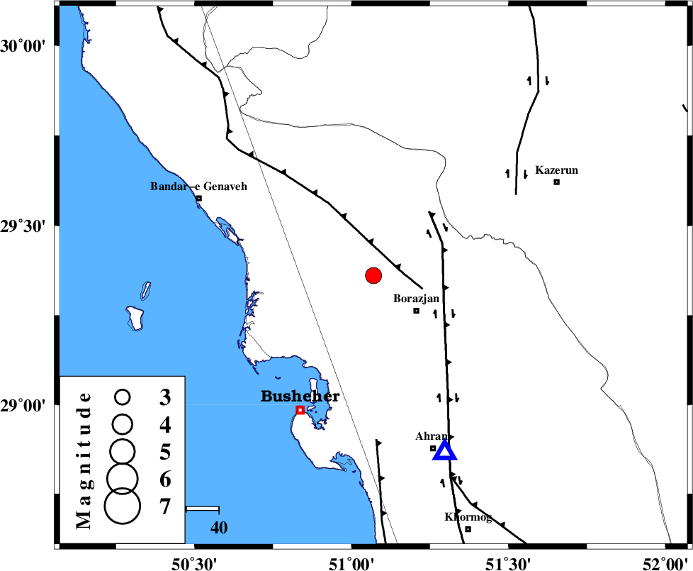
| Location | Lat:29.36 Lon: 51.07 |
| Region | Bushehr Province, 17 km West of Borazjan |
Nearest Cities |
|
| 6 km of Saedabad, Bushehr Province | |
| 9 km North of Ziyarat, Bushehr Province | |
| 11 km West of Nazar aqa, Bushehr Province | |
| 13 km North East of Shabankareh, Bushehr Province | |
| 15 km South of Dehkohneh, Bushehr Province | |
| Depth | 14 km |
| Agency | |
Faults within 150 km: |
|
| ZFF3 (Length: 125 km) , Distance to epicenter: 9 km | |
| BORAZJAN_F (Length: 168 km) , Distance to epicenter: 24 km | |
| KAZERUN_F (Length: 96 km) , Distance to epicenter: 51 km | |
| Number of Phases | 6 |
| RMS | 0.1 |
| Number of Stations | 5 |
| Error in Latitude | >2.7 km |
| Error in Longitude | 2.8 km |
| Error in Depth | 5.2 km |
Download waveform in seisan format
to download seisan software Click here
to access information about IIEES stations Click here
Amplitude | ||||||||
| UID | Agency | Station | Component | Amplitude | Period | Arrival Time | Proccessing Time | Signal Clip |
| 67890 | IIEES | GHIR | N | 233 | 0.56 | 2010-08-06 14:05:16 | 2010-08-06 02:21:00 | n |
| 67891 | IIEES | KRBR | E | 18.1 | 0.56 | 2010-08-06 14:06:22 | 2010-08-06 02:21:00 | n |
Phase | ||||||||||||
| Agency | Station | Component | Phase Type | Phase Quality | First Motion | Observed Arrival Time | Time Residual | Loc. Flag | Input Weight | Distance | Azimuth | |
| IIEES | AHRM | Z | Pg | E | 2010-08-06 14:04:02 | 0 | y | 59.4 | 158 | |||
| IIEES | GHIR | Z | Pn | E | 2010-08-06 14:04:27 | 0 | y | 222 | 122 | |||
| IIEES | GHIR | N | Sg | E | 2010-08-06 14:04:55 | 0 | y | 222 | 122 | |||
| IIEES | NASN | Z | Pn | E | 2010-08-06 14:04:52 | -0.1 | y | 416 | 23 | |||
| IIEES | KHMZ | Z | P | E | 2010-08-06 14:05:02 | 0.1 | y | 497 | 348 | |||
| IIEES | KRBR | Z | Pn | E | 2010-08-06 14:05:09 | 0.1 | y | 555 | 81 | |||