
Magnitude |
:3.3 |
| Date & Time (UTC) | 2010-07-30 02:36:27.7 |
| Date & Time (Local) | 1389/5/8 07:06:27.7 |
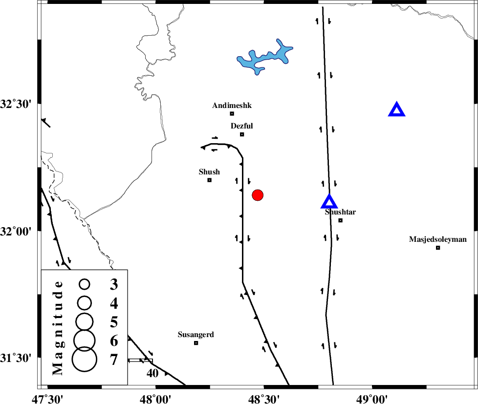
| Location | Lat:32.14 Lon: 48.47 |
| Region | Khoozestan Province, 22 km East of Shush |
Nearest Cities |
|
| 18 km South of Shamsabad, Khoozestan Province | |
| 18 km East of Amaleh teimur, Khoozestan Province | |
| 22 km East of Shush, Khoozestan Province | |
| 27 km South of Dezful, Khoozestan Province | |
| 33 km North West of Sardarabad, Khoozestan Province | |
| Depth | 15 km |
| Agency | |
Faults within 150 km: |
|
| DEZFUL_EMBAYMENT (Length: 228 km) , Distance to epicenter: 33 km | |
| AHVAZ_F (Length: 99 km) , Distance to epicenter: 58 km | |
| BALARUD_F_Z3 (Length: 53 km) , Distance to epicenter: 70 km | |
| Number of Phases | 3 |
| RMS | 0 |
| Number of Stations | 3 |
| Error in Latitude | >3.7 km |
| Error in Longitude | 3.7 km |
| Error in Depth | 0 km |
Download waveform in seisan format
to download seisan software Click here
to access information about IIEES stations Click here
Amplitude | ||||||||
| UID | Agency | Station | Component | Amplitude | Period | Arrival Time | Proccessing Time | Signal Clip |
| 67110 | IIEES | SHGR | N | 3884.6 | 0.22 | 2010-07-30 02:36:48 | 2010-07-30 03:08:00 | n |
| 67111 | IIEES | SHGR | E | 5224.9 | 0.79 | 2010-07-30 02:36:49 | 2010-07-30 03:08:00 | n |
| 67112 | IIEES | KHMZ | E | 279.6 | 0.57 | 2010-07-30 02:37:39 | 2010-07-30 03:08:00 | n |
| 67113 | IIEES | KHMZ | N | 191.5 | 0 | 2010-07-30 02:37:46 | 2010-07-30 03:08:00 | n |
| 67114 | IIEES | SNGE | E | 107.6 | 1.63 | 2010-07-30 02:38:16 | 2010-07-30 03:08:00 | n |
| 67115 | IIEES | SNGE | N | 77.8 | 1.38 | 2010-07-30 02:38:29 | 2010-07-30 03:08:00 | n |
Phase | ||||||||||||
| Agency | Station | Component | Phase Type | Phase Quality | First Motion | Observed Arrival Time | Time Residual | Loc. Flag | Input Weight | Distance | Azimuth | |
| IIEES | SHGR | Z | Pg | E | 2010-07-30 02:36:33 | 0 | y | 31.8 | 96 | |||
| IIEES | KHMZ | Z | Pg | E | 2010-07-30 02:37:04 | 0 | y | 226 | 38 | |||
| IIEES | SNGE | Z | Pn | E | 2010-07-30 02:37:18 | 0 | y | 343 | 343 | |||