
Magnitude |
:2.8 |
| Date & Time (UTC) | 2010-07-28 23:53:47.5 |
| Date & Time (Local) | 1389/5/7 04:23:47.5 |
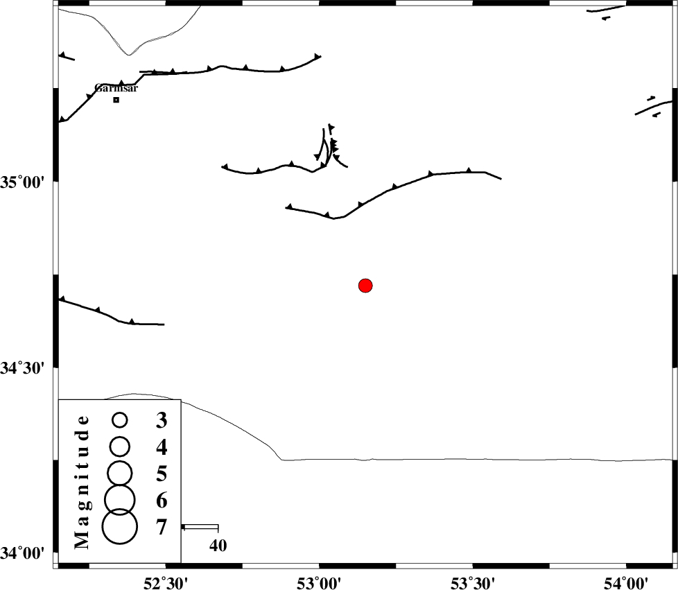
| Location | Lat:34.72 Lon: 53.15 |
| Region | Semnan Province, 97 km South-West of Semnan |
Nearest Cities |
|
| 77 km South of Lasjerd, Semnan Province | |
| 78 km South East of Kohanabad, Semnan Province | |
| 82 km South East of Aradan, Semnan Province | |
| 82 km South of Sorkheh, Semnan Province | |
| 83 km South East of Davarabad, Semnan Province | |
| Depth | 14 km |
| Agency | |
Faults within 150 km: |
|
| KUH_E_GUGERD_F (Length: 73 km) , Distance to epicenter: 21 km | |
| KUH_E_GACHAB_F1 (Length: 53 km) , Distance to epicenter: 38 km | |
| SIAHKUH_F (Length: 154 km) , Distance to epicenter: 59 km | |
| Number of Phases | 5 |
| RMS | 0 |
| Number of Stations | 5 |
| Error in Latitude | >2.3 km |
| Error in Longitude | 8.3 km |
| Error in Depth | 7 km |
Download waveform in seisan format
to download seisan software Click here
to access information about IIEES stations Click here
Amplitude | ||||||||
| UID | Agency | Station | Component | Amplitude | Period | Arrival Time | Proccessing Time | Signal Clip |
| 66970 | IIEES | GHVR | E | 66.7 | 0.56 | 2010-07-28 23:54:40 | 2010-07-29 12:05:00 | n |
| 66971 | IIEES | CHTH | E | 61.2 | 0.56 | 2010-07-28 23:54:51 | 2010-07-29 12:05:00 | n |
| 66972 | IIEES | CHTH | N | 114.8 | 0.32 | 2010-07-28 23:54:51 | 2010-07-29 12:05:00 | n |
| 66973 | IIEES | THKV | N | 61.8 | 0.44 | 2010-07-28 23:54:57 | 2010-07-29 12:05:00 | n |
| 66974 | IIEES | THKV | E | 58.6 | 0.72 | 2010-07-28 23:54:58 | 2010-07-29 12:05:00 | n |
Phase | ||||||||||||
| Agency | Station | Component | Phase Type | Phase Quality | First Motion | Observed Arrival Time | Time Residual | Loc. Flag | Input Weight | Distance | Azimuth | |
| IIEES | DAMV | Z | P | E | 2010-07-28 23:54:11 | 0 | y | 148 | 314 | |||
| IIEES | DAMV | E | Sg | E | 2010-07-28 23:54:30 | 0 | y | 148 | 314 | |||
| IIEES | GHVR | Z | P | E | 2010-07-28 23:54:16 | 0 | y | 177 | 262 | |||
| IIEES | CHTH | Z | P | E | 2010-07-28 23:54:23 | 0 | y | 227 | 306 | |||
| IIEES | ASAO | Z | P | E | 2010-07-28 23:54:31 | 0 | y | 287 | 267 | |||