
Magnitude |
:4 |
| Date & Time (UTC) | 2010-07-18 11:46:16.8 |
| Date & Time (Local) | 1389/4/27 16:16:16.8 |
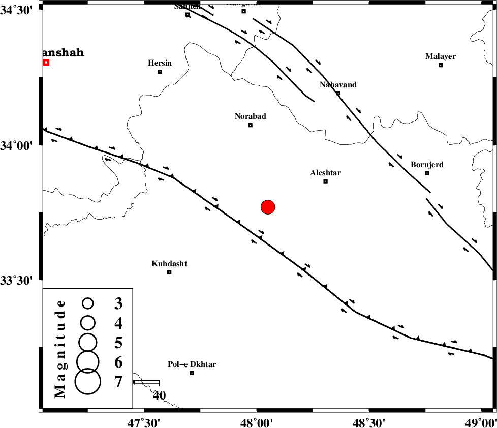
| Location | Lat:33.77 Lon: 48.05 |
| Region | Lorestan Province, 26 km West of Aleshtar |
Nearest Cities |
|
| 16 km South of Firuz Abad, Lorestan Province | |
| 23 km South of Farhadabad, Lorestan Province | |
| 23 km West of Siyahpush, Lorestan Province | |
| 23 km South West of Dehrahim, Lorestan Province | |
| 23 km North of Sarabboreh, Lorestan Province | |
| Depth | 15 km |
| Agency | |
Faults within 150 km: |
|
| HZF4 (Length: 492 km) , Distance to epicenter: 14 km | |
| SAHANEH_F (Length: 77 km) , Distance to epicenter: 47 km | |
| NAHAVAND_F (Length: 102 km) , Distance to epicenter: 52 km | |
| Number of Phases | 7 |
| RMS | 0.5 |
| Number of Stations | 7 |
| Error in Latitude | >7.2 km |
| Error in Longitude | 7.6 km |
| Error in Depth | 0 km |
Download waveform in seisan format
to download seisan software Click here
to access information about IIEES stations Click here
Amplitude | ||||||||
| UID | Agency | Station | Component | Amplitude | Period | Arrival Time | Proccessing Time | Signal Clip |
| 66222 | IIEES | SHGR | E | 2628.5 | 0.64 | 2010-07-18 11:47:16 | 2010-07-20 01:47:00 | n |
| 66223 | IIEES | SHGR | N | 2789.3 | 0.52 | 2010-07-18 11:47:22 | 2010-07-20 01:47:00 | n |
| 66224 | IIEES | GHVR | E | 598.9 | 0.52 | 2010-07-18 11:47:49 | 2010-07-20 01:47:00 | n |
| 66225 | IIEES | GHVR | N | 367.5 | 0.6 | 2010-07-18 11:47:55 | 2010-07-20 01:47:00 | n |
| 66226 | IIEES | DAMV | N | 130.9 | 0.68 | 2010-07-18 11:48:31 | 2010-07-20 01:47:00 | n |
| 66227 | IIEES | DAMV | E | 120.2 | 0.56 | 2010-07-18 11:48:37 | 2010-07-20 01:47:00 | n |
Phase | ||||||||||||
| Agency | Station | Component | Phase Type | Phase Quality | First Motion | Observed Arrival Time | Time Residual | Loc. Flag | Input Weight | Distance | Azimuth | |
| IIEES | SNGE | Z | Pn | E | 2010-07-18 11:46:44 | -0.3 | y | 160 | 336 | |||
| IIEES | SHGR | Z | Pn | E | 2010-07-18 11:46:48 | 0.1 | y | 197 | 159 | |||
| IIEES | GHVR | Z | Pn | E | 2010-07-18 11:47:02 | 0.1 | y | 305 | 74 | |||
| IIEES | ZNJK | Z | Pn | E | 2010-07-18 11:47:05 | 0.6 | y | 327 | 10 | |||
| IIEES | THKV | Z | PN5 | E | 2010-07-18 11:47:08 | 0.7 | y | 351 | 47 | |||
| IIEES | CHTH | Z | PN5 | E | 2010-07-18 11:47:09 | -0.8 | y | 368 | 49 | |||
| IIEES | DAMV | Z | PN5 | E | 2010-07-18 11:47:15 | -0.5 | y | 414 | 59 | |||