
Magnitude |
:3.1 |
| Date & Time (UTC) | 2010-06-12 10:04:04.8 |
| Date & Time (Local) | 1389/3/22 14:34:04.8 |
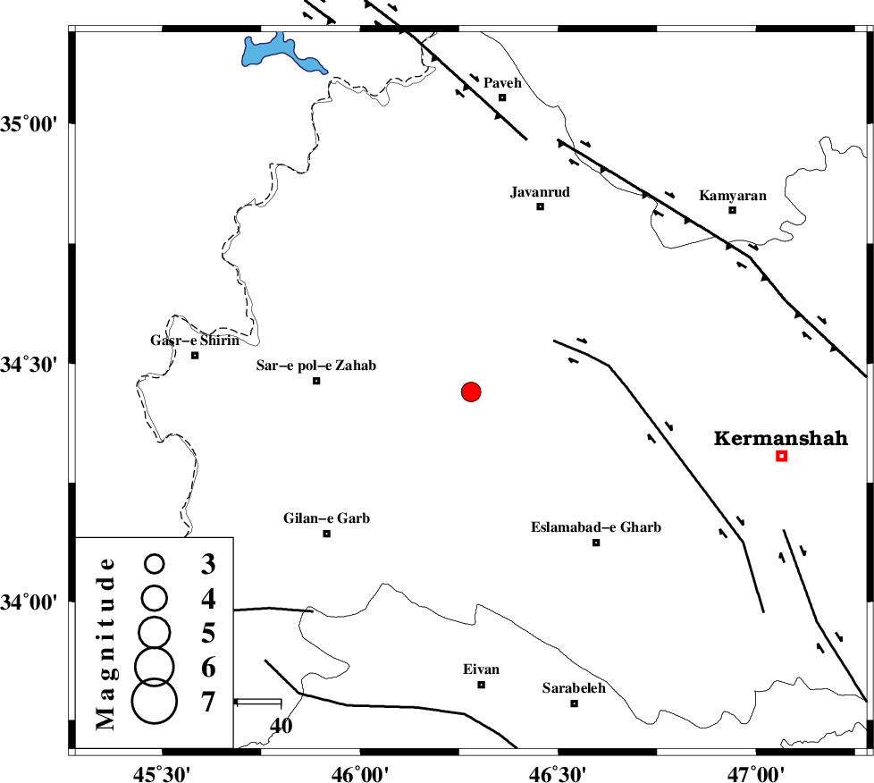
| Location | Lat:34.44 Lon: 46.28 |
| Region | Kermanshah Province, 36 km East of Sar-e pol-e zahab |
Nearest Cities |
|
| 7 km of Zavleh olia, Kermanshah Province | |
| 13 km North West of Gahvareh, Kermanshah Province | |
| 18 km North of Kerend, Kermanshah Province | |
| 21 km East of Rijab, Kermanshah Province | |
| 25 km North of Telesm, Kermanshah Province | |
| Depth | 0 km |
| Agency | |
Faults within 150 km: |
|
| HZF4 (Length: 492 km) , Distance to epicenter: 20 km | |
| MFF8 (Length: 48 km) , Distance to epicenter: 24 km | |
| SARTAKHT_F (Length: 78 km) , Distance to epicenter: 75 km | |
| Number of Phases | 7 |
| RMS | 0.3 |
| Number of Stations | 6 |
| Error in Latitude | >6 km |
| Error in Longitude | 13.8 km |
| Error in Depth | 8.2 km |
Download waveform in seisan format
to download seisan software Click here
to access information about IIEES stations Click here
Amplitude | ||||||||
| UID | Agency | Station | Component | Amplitude | Period | Arrival Time | Proccessing Time | Signal Clip |
| 64174 | IIEES | SNGE | N | 434.9 | 0.71 | 2010-06-12 10:04:55 | 2010-06-13 09:48:00 | n |
| 64175 | IIEES | SNGE | E | 337.8 | 0.54 | 2010-06-12 10:04:57 | 2010-06-13 09:48:00 | n |
| 64176 | IIEES | SHGR | E | 66 | 0.66 | 2010-06-12 10:06:08 | 2010-06-13 09:48:00 | n |
Phase | ||||||||||||
| Agency | Station | Component | Phase Type | Phase Quality | First Motion | Observed Arrival Time | Time Residual | Loc. Flag | Input Weight | Distance | Azimuth | |
| IIEES | SNGE | Z | Pg | E | 2010-06-12 10:04:27 | -0.2 | y | 122 | 53 | |||
| IIEES | ZNJK | Z | Pn | E | 2010-06-12 10:04:55 | 0.3 | y | 330 | 41 | |||
| IIEES | ASAO | Z | Pn | E | 2010-06-12 10:04:57 | 0.4 | y | 344 | 87 | |||
| IIEES | SHGR | Z | Pn | E | 2010-06-12 10:04:57 | -0.1 | y | 349 | 137 | |||
| IIEES | KHMZ | Z | Pn | E | 2010-06-12 10:04:57 | -0.3 | y | 349 | 102 | |||
| IIEES | SHGR | N | Sn | 2010-06-12 10:05:36 | 0.1 | y | 349 | 137 | ||||
| IIEES | GRMI | Z | Pn | E | 2010-06-12 10:05:17 | -0.2 | y | 506 | 16 | |||