
Magnitude |
:3.6 |
| Date & Time (UTC) | 2010-04-12 08:54:17.4 |
| Date & Time (Local) | 1389/1/23 13:24:17.4 |
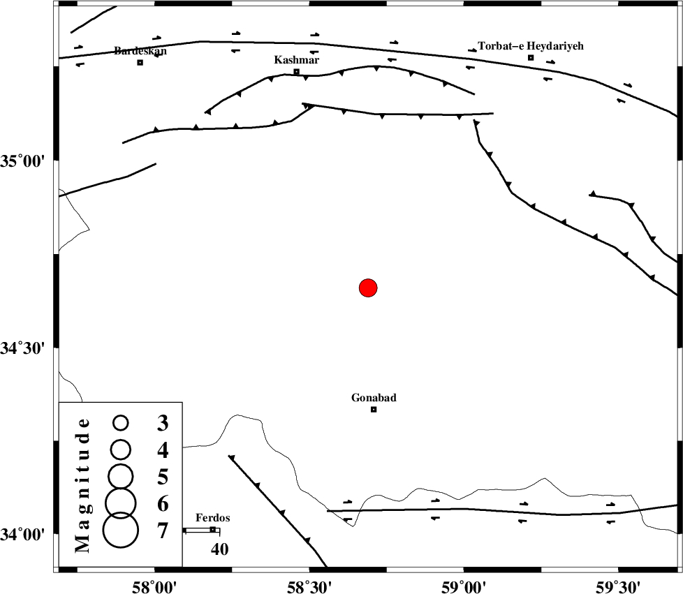
| Location | Lat:34.66 Lon: 58.69 |
| Region | Khorasan(center) Province, 36 km North of Gonabad |
Nearest Cities |
|
| 12 km North of Omrani, Khorasan(center) Province | |
| 28 km South East of Yoonesi, Khorasan(center) Province | |
| 30 km North of Biland, Khorasan(center) Province | |
| 36 km North of Bidokht, Khorasan(center) Province | |
| 36 km North of Gonabad, Khorasan(center) Province | |
| Depth | 32 km |
| Agency | |
Faults within 150 km: |
|
| JANGAL_F (Length: 111 km) , Distance to epicenter: 51 km | |
| DUGHABAD_F (Length: 62 km) , Distance to epicenter: 52 km | |
| MEHDIABAD_F (Length: 64 km) , Distance to epicenter: 54 km | |
| Number of Phases | 4 |
| RMS | 0 |
| Number of Stations | 4 |
| Error in Latitude | >2.6 km |
| Error in Longitude | 2.4 km |
| Error in Depth | 4.4 km |
Download waveform in seisan format
to download seisan software Click here
to access information about IIEES stations Click here
Amplitude | ||||||||
| UID | Agency | Station | Component | Amplitude | Period | Arrival Time | Proccessing Time | Signal Clip |
| 60310 | IIEES | TABS | N | 485.3 | 0.53 | 2010-04-12 08:55:19 | 2010-04-12 09:22:00 | n |
| 60311 | IIEES | SHRT | E | 996.5 | 0.52 | 2010-04-12 08:55:18 | 2010-04-12 09:22:00 | n |
| 60312 | IIEES | SHRT | N | 568.1 | 0.61 | 2010-04-12 08:55:18 | 2010-04-12 09:22:00 | n |
Phase | ||||||||||||
| Agency | Station | Component | Phase Type | Phase Quality | First Motion | Observed Arrival Time | Time Residual | Loc. Flag | Input Weight | Distance | Azimuth | |
| IIEES | TABS | Z | Pg | E | 2010-04-12 08:54:47 | 0 | y | 183 | 233 | |||
| IIEES | SHRT | Z | Pg | E | 2010-04-12 08:54:47 | 0 | y | 186 | 127 | |||
| IIEES | MRVT | Z | Pn | E | 2010-04-12 08:55:14 | 0 | y | 407 | 326 | |||
| IIEES | KRBR | Z | Pn | E | 2010-04-12 08:55:32 | 0 | y | 549 | 200 | |||