
Magnitude |
:4 |
| Date & Time (UTC) | 2010-04-12 08:29:04.2 |
| Date & Time (Local) | 1389/1/23 12:59:04.2 |
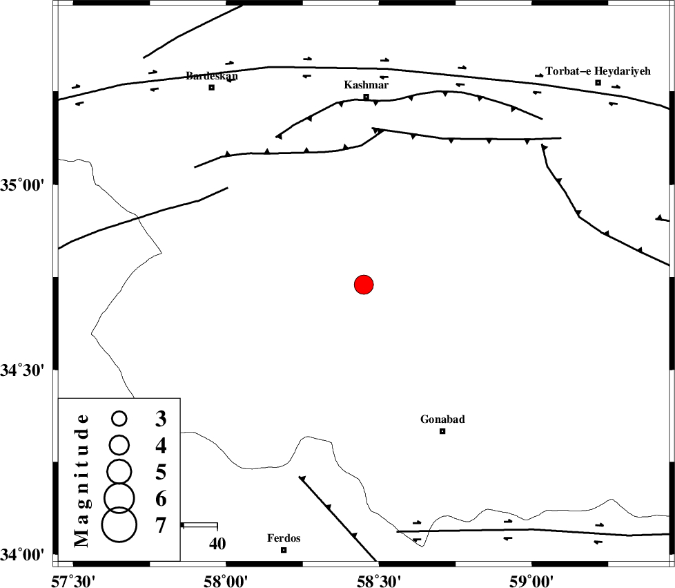
| Location | Lat:34.73 Lon: 58.45 |
| Region | Khorasan(center) Province, 56 km South of Kashmar |
Nearest Cities |
|
| 9 km of Yoonesi, Khorasan(center) Province | |
| 31 km North West of Omrani, Khorasan(center) Province | |
| 34 km North East of Bajestan, Khorasan(center) Province | |
| 40 km North East of Mazar, Khorasan(center) Province | |
| 44 km North East of Zinabad, Khorasan(center) Province | |
| Depth | 41 km |
| Agency | |
Faults within 150 km: |
|
| MEHDIABAD_F (Length: 64 km) , Distance to epicenter: 41 km | |
| DUGHABAD_F (Length: 62 km) , Distance to epicenter: 47 km | |
| NAINI_F (Length: 342 km) , Distance to epicenter: 50 km | |
| Number of Phases | 6 |
| RMS | 0.2 |
| Number of Stations | 6 |
| Error in Latitude | >4.8 km |
| Error in Longitude | 5.2 km |
| Error in Depth | 8.2 km |
Download waveform in seisan format
to download seisan software Click here
to access information about IIEES stations Click here
Amplitude | ||||||||
| UID | Agency | Station | Component | Amplitude | Period | Arrival Time | Proccessing Time | Signal Clip |
| 60290 | IIEES | TABS | E | 1686.4 | 0.38 | 2010-04-12 08:30:02 | 2010-04-12 08:56:00 | n |
| 60291 | IIEES | TABS | N | 2508.2 | 0.5 | 2010-04-12 08:30:04 | 2010-04-12 08:56:00 | n |
| 60292 | IIEES | KRBR | E | 147.8 | 0.51 | 2010-04-12 08:32:04 | 2010-04-12 08:56:00 | n |
| 60293 | IIEES | KRBR | N | 105 | 0.56 | 2010-04-12 08:32:06 | 2010-04-12 08:56:00 | n |
| 60294 | IIEES | NASN | N | 44.8 | 0.35 | 2010-04-12 08:32:00 | 2010-04-12 08:56:00 | n |
Phase | ||||||||||||
| Agency | Station | Component | Phase Type | Phase Quality | First Motion | Observed Arrival Time | Time Residual | Loc. Flag | Input Weight | Distance | Azimuth | |
| IIEES | TABS | Z | Pg | E | 2010-04-12 08:29:32 | 0 | y | 172 | 226 | |||
| IIEES | SHRT | Z | Pn | E | 2010-04-12 08:29:35 | -0.1 | y | 208 | 125 | |||
| IIEES | MRVT | Z | Pn | E | 2010-04-12 08:29:57 | 0.2 | y | 388 | 328 | |||
| IIEES | KRBR | Z | Pn | E | 2010-04-12 08:30:18 | 0.3 | y | 550 | 197 | |||
| IIEES | NASN | Z | P | E | 2010-04-12 08:30:19 | 0 | y | 565 | 249 | |||
| IIEES | DAMV | Z | Pn | E | 2010-04-12 08:30:23 | -0.4 | y | 598 | 281 | |||