
Magnitude |
:3 |
| Date & Time (UTC) | 2009-12-30 12:05:21.2 |
| Date & Time (Local) | 1388/10/9 15:35:21.2 |
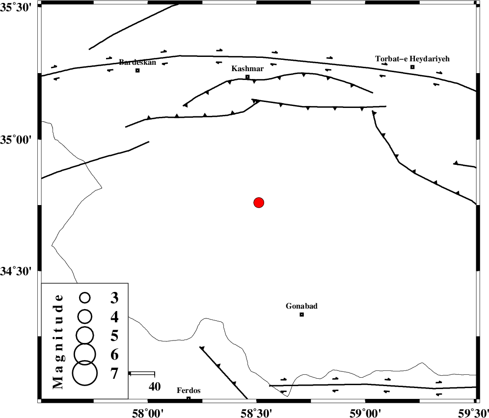
| Location | Lat:34.76 Lon: 58.51 |
| Region | Khorasan(center) Province, 53 km South of Kashmar |
Nearest Cities |
|
| 8 km of Yoonesi, Khorasan(center) Province | |
| 29 km North West of Omrani, Khorasan(center) Province | |
| 38 km South West of Feizabad, Khorasan(center) Province | |
| 40 km South West of Mahneh, Khorasan(center) Province | |
| 41 km North East of Bajestan, Khorasan(center) Province | |
| Depth | 15 km |
| Agency | |
Faults within 150 km: |
|
| MEHDIABAD_F (Length: 64 km) , Distance to epicenter: 39 km | |
| DUGHABAD_F (Length: 62 km) , Distance to epicenter: 44 km | |
| KASHMAR_F (Length: 91 km) , Distance to epicenter: 52 km | |
| Number of Phases | 5 |
| RMS | 0.2 |
| Number of Stations | 3 |
| Error in Latitude | >2.8 km |
| Error in Longitude | 1.9 km |
| Error in Depth | 0 km |
Download waveform in seisan format
to download seisan software Click here
to access information about IIEES stations Click here
Amplitude | ||||||||
| UID | Agency | Station | Component | Amplitude | Period | Arrival Time | Proccessing Time | Signal Clip |
| 59707 | IIEES | TABS | E | 179.4 | 0.41 | 2009-12-30 12:06:14 | 2010-02-08 11:55:00 | n |
| 59708 | IIEES | SHRT | N | 138.5 | 0.15 | 2009-12-30 12:06:22 | 2010-02-08 11:55:00 | n |
Phase | ||||||||||||
| Agency | Station | Component | Phase Type | Phase Quality | First Motion | Observed Arrival Time | Time Residual | Loc. Flag | Input Weight | Distance | Azimuth | |
| IIEES | TABS | Z | Pg | E | 2009-12-30 12:05:50 | -0.3 | y | 178 | 227 | |||
| IIEES | TABS | E | Sg | E | 2009-12-30 12:06:12 | 0.1 | y | 178 | 227 | |||
| IIEES | SHRT | Z | Pg | E | 2009-12-30 12:05:54 | -0.2 | y | 205 | 127 | |||
| IIEES | SHRT | N | Sg | E | 2009-12-30 12:06:19 | 0.2 | y | 205 | 127 | |||
| IIEES | SHRO | Z | Pn | E | 2009-12-30 12:06:02 | 0.1 | y | 266 | 302 | |||