
Magnitude |
:3 |
| Date & Time (UTC) | 2009-12-31 04:27:41.9 |
| Date & Time (Local) | 1388/10/10 07:57:41.9 |
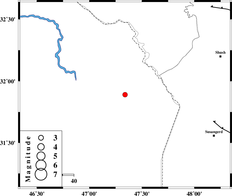
| Location | Lat:31.89 Lon: 47.34 |
| Region | Iraq, 90 km South of Dehloran |
Nearest Cities |
|
| 64 km North West of Bostan, Khoozestan Province | |
| 73 km South of Musian, Ilam Province | |
| 84 km North West of Hoveizeh, Khoozestan Province | |
| 88 km North West of Susangerd, Khoozestan Province | |
| 90 km South of Dehloran, Ilam Province | |
| Depth | 37 km |
| Agency | |
Faults within 150 km: |
|
| AHVAZ_F (Length: 99 km) , Distance to epicenter: 83 km | |
| MFF6 (Length: 144 km) , Distance to epicenter: 88 km | |
| DEZFUL_EMBAYMENT (Length: 228 km) , Distance to epicenter: 110 km | |
| Number of Phases | 4 |
| RMS | 0 |
| Number of Stations | 3 |
| Error in Latitude | >7.5 km |
| Error in Longitude | 5.7 km |
| Error in Depth | 5.3 km |
Download waveform in seisan format
to download seisan software Click here
to access information about IIEES stations Click here
Amplitude | ||||||||
| UID | Agency | Station | Component | Amplitude | Period | Arrival Time | Proccessing Time | Signal Clip |
| 59633 | IIEES | SHGR | E | 530.2 | 0.3 | 2009-12-31 04:28:25 | 2010-02-08 11:55:00 | n |
| 59634 | IIEES | ASAO | N | 15.4 | 0.5 | 2009-12-31 04:29:37 | 2010-02-08 11:55:00 | n |
Phase | ||||||||||||
| Agency | Station | Component | Phase Type | Phase Quality | First Motion | Observed Arrival Time | Time Residual | Loc. Flag | Input Weight | Distance | Azimuth | |
| IIEES | SHGR | Z | Pg | E | 2009-12-31 04:28:05 | 0 | y | 140 | 79 | |||
| IIEES | SHGR | E | Sg | E | 2009-12-31 04:28:22 | 0 | y | 140 | 79 | |||
| IIEES | ASAO | Z | Pn | E | 2009-12-31 04:28:35 | 0 | y | 387 | 40 | |||
| IIEES | NASN | Z | Pn | E | 2009-12-31 04:28:52 | 0 | y | 524 | 77 | |||