
Magnitude |
:3.2 |
| Date & Time (UTC) | 2009-12-11 08:03:42.0 |
| Date & Time (Local) | 1388/9/20 11:33:42.0 |
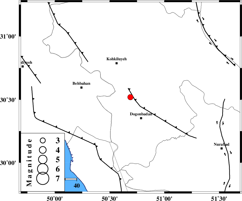
| Location | Lat:30.52 Lon: 50.69 |
| Region | Kohkiluieh va boyerahmad Province, 21 km North-West of Dogonbadan |
Nearest Cities |
|
| 21 km North of Dogonbadan, Kohkiluieh va boyerahmad Province | |
| 32 km South East of Dehdasht, Kohkiluieh va boyerahmad Province | |
| 35 km North West of Abdehgah, Kohkiluieh va boyerahmad Province | |
| 39 km South East of Mansuriyeh, Khoozestan Province | |
| 43 km South of Savari, Kohkiluieh va boyerahmad Province | |
| Depth | 15 km |
| Agency | |
Faults within 150 km: |
|
| MISHAN_F (Length: 76 km) , Distance to epicenter: 5 km | |
| MFF4 (Length: 62 km) , Distance to epicenter: 48 km | |
| RAG_E_SEFID_F (Length: 84 km) , Distance to epicenter: 52 km | |
| Number of Phases | 6 |
| RMS | 0.6 |
| Number of Stations | 6 |
| Error in Latitude | >10.8 km |
| Error in Longitude | 7.6 km |
| Error in Depth | 0 km |
Download waveform in seisan format
to download seisan software Click here
to access information about IIEES stations Click here
Amplitude | ||||||||
| UID | Agency | Station | Component | Amplitude | Period | Arrival Time | Proccessing Time | Signal Clip |
| 59468 | IIEES | SHGR | E | 199 | 0.88 | 2009-12-11 08:04:54 | 2010-02-08 11:55:00 | n |
| 59469 | IIEES | SHGR | N | 193.3 | 0.48 | 2009-12-11 08:04:55 | 2010-02-08 11:55:00 | n |
| 59470 | IIEES | GHIR | N | 59.7 | 0.72 | 2009-12-11 08:05:32 | 2010-02-08 11:55:00 | n |
| 59471 | IIEES | GHIR | E | 46.5 | 0.56 | 2009-12-11 08:05:38 | 2010-02-08 11:55:00 | n |
Phase | ||||||||||||
| Agency | Station | Component | Phase Type | Phase Quality | First Motion | Observed Arrival Time | Time Residual | Loc. Flag | Input Weight | Distance | Azimuth | |
| IIEES | SHGR | Z | Pn | E | 2009-12-11 08:04:21 | 0.7 | y | 252 | 315 | |||
| IIEES | NASN | Z | Pn | E | 2009-12-11 08:04:30 | 0.8 | y | 323 | 38 | |||
| IIEES | GHIR | Z | Pn | E | 2009-12-11 08:04:30 | -0.2 | y | 333 | 137 | |||
| IIEES | KHMZ | Z | Pn | E | 2009-12-11 08:04:34 | -0.6 | y | 364 | 349 | |||
| IIEES | GHVR | Z | Pn | E | 2009-12-11 08:04:44 | -0.1 | y | 443 | 7 | |||
| IIEES | ASAO | Z | Pn | E | 2009-12-11 08:04:44 | -0.9 | y | 451 | 352 | |||