
Magnitude |
:3.4 |
| Date & Time (UTC) | 2009-11-20 09:24:36.4 |
| Date & Time (Local) | 1388/8/29 12:54:36.4 |
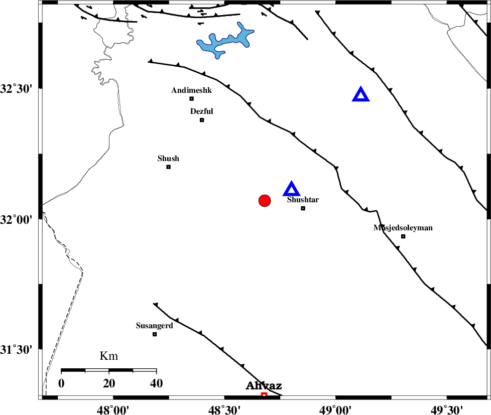
| Location | Lat:32.07 Lon: 48.68 |
| Region | Khoozestan Province, 17 km West of Shushtar |
Nearest Cities |
|
| 12 km North West of Sardarabad, Khoozestan Province | |
| 17 km North West of Shushtar, Khoozestan Province | |
| 21 km North West of Mehdiabad, Khoozestan Province | |
| 22 km South West of Samaleh, Khoozestan Province | |
| 23 km South West of Gatvand, Khoozestan Province | |
| Depth | 31 km |
| Agency | |
Faults within 150 km: |
|
| DEZFUL_EMBAYMENT (Length: 228 km) , Distance to epicenter: 29 km | |
| AHVAZ_F (Length: 99 km) , Distance to epicenter: 63 km | |
| MFF2 (Length: 205 km) , Distance to epicenter: 70 km | |
| Number of Phases | 5 |
| RMS | 0.2 |
| Number of Stations | 4 |
| Error in Latitude | >12.2 km |
| Error in Longitude | 9.4 km |
| Error in Depth | 2.7 km |
Download waveform in seisan format
to download seisan software Click here
to access information about IIEES stations Click here
Amplitude | ||||||||
| UID | Agency | Station | Component | Amplitude | Period | Arrival Time | Proccessing Time | Signal Clip |
| 59255 | IIEES | SHGR | N | 5661.6 | 0.39 | 2009-11-20 09:24:47 | 2010-02-08 11:55:00 | n |
| 59256 | IIEES | SHGR | E | 8518.4 | 0.48 | 2009-11-20 09:24:48 | 2010-02-08 11:55:00 | n |
| 59257 | IIEES | ASAO | N | 184.5 | 0.67 | 2009-11-20 09:26:01 | 2010-02-08 11:55:00 | n |
| 59258 | IIEES | SNGE | E | 61.8 | 0.14 | 2009-11-20 09:26:18 | 2010-02-08 11:55:00 | n |
Phase | ||||||||||||
| Agency | Station | Component | Phase Type | Phase Quality | First Motion | Observed Arrival Time | Time Residual | Loc. Flag | Input Weight | Distance | Azimuth | |
| IIEES | SHGR | Z | Pg | E | 2009-11-20 09:24:41 | -0.2 | y | 12.1 | 71 | |||
| IIEES | SHGR | E | Sg | E | 2009-11-20 09:24:45 | 0.1 | y | 12.1 | 71 | |||
| IIEES | ASAO | Z | Pn | E | 2009-11-20 09:25:20 | -0.2 | y | 302 | 24 | |||
| IIEES | SNGE | Z | Pn | E | 2009-11-20 09:25:27 | 0.2 | y | 357 | 340 | |||
| IIEES | NASN | Z | Pn | E | 2009-11-20 09:25:32 | 0.1 | y | 396 | 77 | |||