
Magnitude |
:2.5 |
| Date & Time (UTC) | 2009-11-10 06:41:05.4 |
| Date & Time (Local) | 1388/8/19 10:11:05.4 |
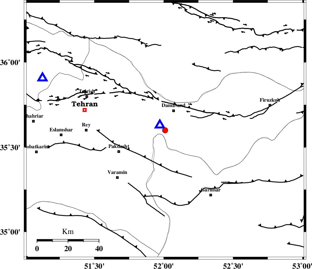
| Location | Lat:35.6 Lon: 52.01 |
| Region | Tehran Province, 14 km South of Damavand |
Nearest Cities |
|
| 6 km of Ab sard, Tehran Province | |
| 12 km West of Mara, Tehran Province | |
| 14 km South of Damavand, Tehran Province | |
| 15 km North West of Kilan, Tehran Province | |
| 18 km South of Abali, Tehran Province | |
| Depth | 10 km |
| Agency | |
Faults within 150 km: |
|
| MOSHA_F (Length: 234 km) , Distance to epicenter: 18 km | |
| EYVANEKEY_F (Length: 74 km) , Distance to epicenter: 23 km | |
| N_TEHRAN_F4 (Length: 115 km) , Distance to epicenter: 32 km | |
| Number of Phases | 5 |
| RMS | 0.2 |
| Number of Stations | 3 |
| Error in Latitude | >4.1 km |
| Error in Longitude | 16.6 km |
| Error in Depth | 2.6 km |
Download waveform in seisan format
to download seisan software Click here
to access information about IIEES stations Click here
Amplitude | ||||||||
| UID | Agency | Station | Component | Amplitude | Period | Arrival Time | Proccessing Time | Signal Clip |
| 59173 | IIEES | GHVR | E | 87.1 | 0.39 | 2009-11-10 06:41:52 | 2010-02-08 11:55:00 | n |
| 59174 | IIEES | ASAO | E | 35 | 0.28 | 2009-11-10 06:42:07 | 2010-02-08 11:55:00 | n |
Phase | ||||||||||||
| Agency | Station | Component | Phase Type | Phase Quality | First Motion | Observed Arrival Time | Time Residual | Loc. Flag | Input Weight | Distance | Azimuth | |
| IIEES | DAMV | Z | Pg | E | 2009-11-10 06:41:07 | 0.2 | y | 4.64 | 316 | |||
| IIEES | DAMV | N | Sg | E | 2009-11-10 06:41:09 | -0.1 | y | 4.64 | 316 | |||
| IIEES | GHVR | Z | Pg | E | 2009-11-10 06:41:29 | -0.2 | y | 142 | 209 | |||
| IIEES | GHVR | N | Sg | E | 2009-11-10 06:41:48 | 0.1 | y | 142 | 209 | |||
| IIEES | ASAO | Z | PN5 | E | 2009-11-10 06:41:40 | 0 | y | 215 | 238 | |||