
Magnitude |
:2.6 |
| Date & Time (UTC) | 2009-10-03 11:36:04.3 |
| Date & Time (Local) | 1388/7/11 15:06:04.3 |
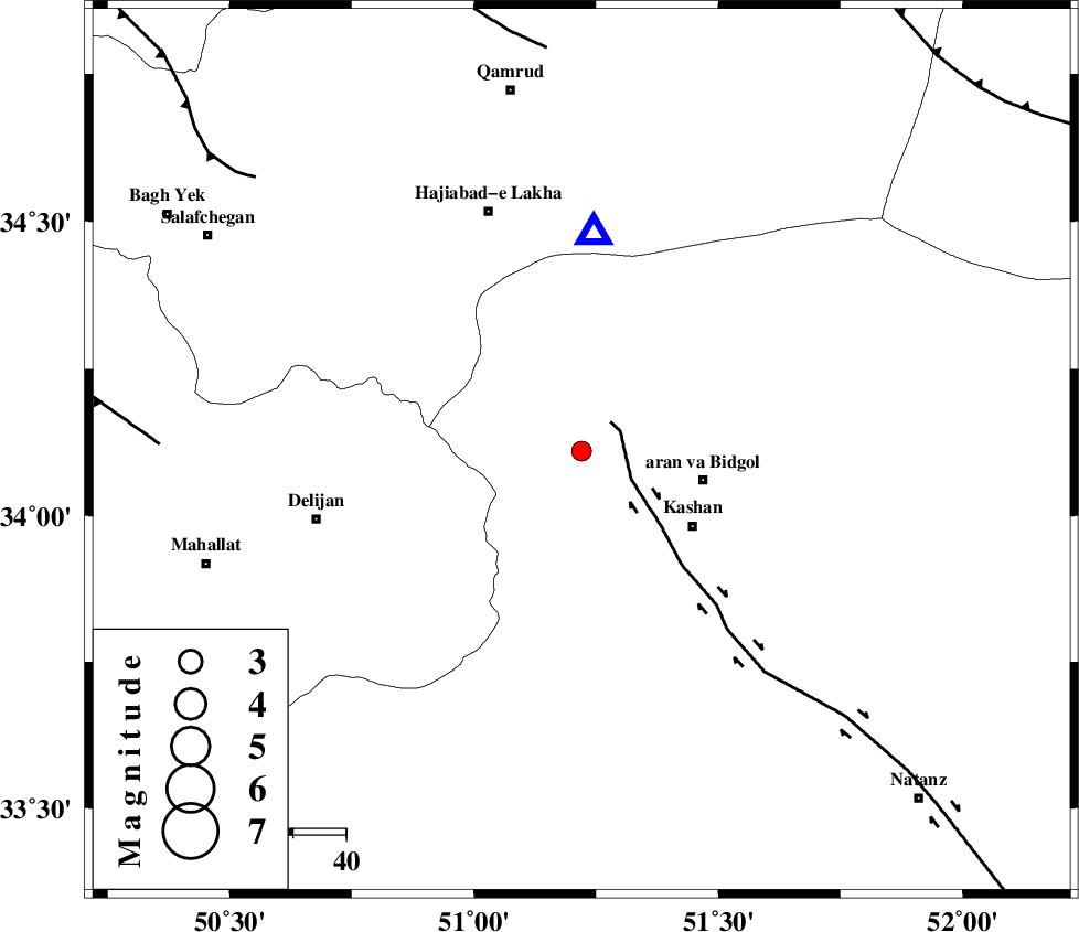
| Location | Lat:34.11 Lon: 51.22 |
| Region | Esfahan Province, 23 km West of Aran va bidgol |
Nearest Cities |
|
| 8 km of Mashgan, Esfahan Province | |
| 9 km North of Astarak, Esfahan Province | |
| 12 km West of Nasrabad, Esfahan Province | |
| 14 km East of Armak, Esfahan Province | |
| 18 km North of Niyasar, Esfahan Province | |
| Depth | 18 km |
| Agency | |
Faults within 150 km: |
|
| KASHAN_F (Length: 44 km) , Distance to epicenter: 8 km | |
| ZEFREH_F (Length: 124 km) , Distance to epicenter: 44 km | |
| KUSHK_E_NOSRAT_F (Length: 230 km) , Distance to epicenter: 76 km | |
| Number of Phases | 5 |
| RMS | 0.4 |
| Number of Stations | 5 |
| Error in Latitude | >4.8 km |
| Error in Longitude | 7.3 km |
| Error in Depth | 0 km |
Download waveform in seisan format
to download seisan software Click here
to access information about IIEES stations Click here
Amplitude | ||||||||
| UID | Agency | Station | Component | Amplitude | Period | Arrival Time | Proccessing Time | Signal Clip |
| 58852 | IIEES | DAMV | E | 114.9 | 0.34 | 2009-10-03 11:37:00 | 2010-02-08 11:55:00 | n |
| 58853 | IIEES | DAMV | N | 56.4 | 0.14 | 2009-10-03 11:37:00 | 2010-02-08 11:55:00 | n |
| 58854 | IIEES | NASN | E | 38.1 | 0.24 | 2009-10-03 11:37:04 | 2010-02-08 11:55:00 | n |
Phase | ||||||||||||
| Agency | Station | Component | Phase Type | Phase Quality | First Motion | Observed Arrival Time | Time Residual | Loc. Flag | Input Weight | Distance | Azimuth | |
| IIEES | GHVR | Z | Pg | E | 2009-10-03 11:36:13 | -0.8 | y | 41.7 | 3 | |||
| IIEES | KHMZ | Z | Pg | E | 2009-10-03 11:36:25 | 0.1 | y | 123 | 251 | |||
| IIEES | DAMV | Z | Pg | E | 2009-10-03 11:36:35 | 0.5 | y | 183 | 22 | |||
| IIEES | THKV | Z | Pg | E | 2009-10-03 11:36:38 | 0.1 | y | 203 | 351 | |||
| IIEES | NASN | Z | Pg | E | 2009-10-03 11:36:38 | 0 | y | 207 | 134 | |||