
Magnitude |
:2.9 |
| Date & Time (UTC) | 2009-09-22 18:01:59.0 |
| Date & Time (Local) | 1388/6/31 21:31:59.0 |
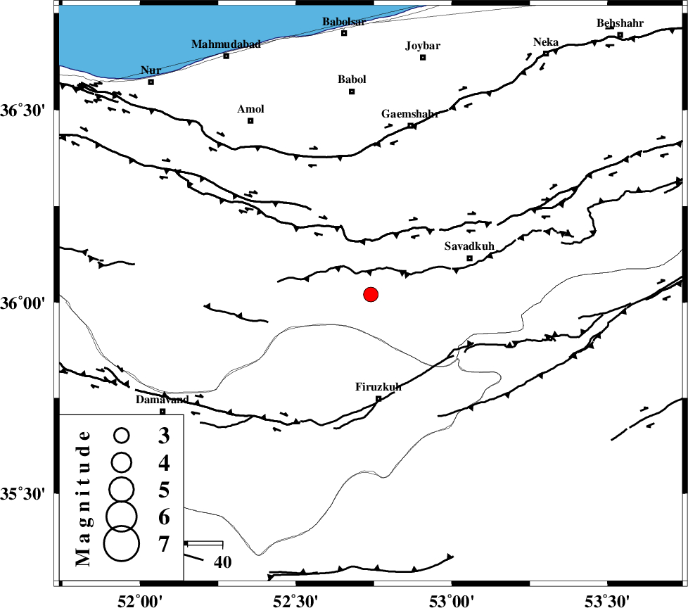
| Location | Lat:36.02 Lon: 52.74 |
| Region | Mazandaran Province, 30 km North of Firuzkuh |
Nearest Cities |
|
| 9 km of Alasht, Mazandaran Province | |
| 21 km South of Firoozjah-e sabet, Mazandaran Province | |
| 22 km West of Elahband, Mazandaran Province | |
| 25 km North of Shahrabad, Tehran Province | |
| 27 km South West of Zirab, Mazandaran Province | |
| Depth | 16 km |
| Agency | |
Faults within 150 km: |
|
| N_ALBORZ_F (Length: 360 km) , Distance to epicenter: 17 km | |
| MOSHA_F (Length: 234 km) , Distance to epicenter: 38 km | |
| KHAZAR_F (Length: 523 km) , Distance to epicenter: 39 km | |
| Number of Phases | 6 |
| RMS | 0.1 |
| Number of Stations | 6 |
| Error in Latitude | >7.7 km |
| Error in Longitude | 11.5 km |
| Error in Depth | 7.1 km |
Download waveform in seisan format
to download seisan software Click here
to access information about IIEES stations Click here
Amplitude | ||||||||
| UID | Agency | Station | Component | Amplitude | Period | Arrival Time | Proccessing Time | Signal Clip |
| 58597 | IIEES | CHTH | E | 75.3 | 0.36 | 2009-09-22 18:02:46 | 2009-10-25 09:10:00 | n |
| 58598 | IIEES | THKV | N | 151.9 | 0.72 | 2009-09-22 18:02:56 | 2009-10-25 09:10:00 | n |
| 58599 | IIEES | THKV | E | 147.4 | 0.84 | 2009-09-22 18:03:01 | 2009-10-25 09:10:00 | n |
| 58600 | IIEES | GHVR | N | 254.5 | 0.48 | 2009-09-22 18:03:13 | 2009-10-25 09:10:00 | n |
| 58601 | IIEES | GHVR | E | 207.4 | 0.52 | 2009-09-22 18:03:13 | 2009-10-25 09:10:00 | n |
| 58602 | IIEES | ASAO | E | 38 | 0.48 | 2009-09-22 18:03:28 | 2009-10-25 09:10:00 | n |
| 58603 | IIEES | ASAO | N | 39.7 | 0.44 | 2009-09-22 18:03:29 | 2009-10-25 09:10:00 | n |
Phase | ||||||||||||
| Agency | Station | Component | Phase Type | Phase Quality | First Motion | Observed Arrival Time | Time Residual | Loc. Flag | Input Weight | Distance | Azimuth | |
| IIEES | DAMV | Z | Pg | E | 2009-09-22 18:02:13 | -0.1 | y | 81.7 | 238 | |||
| IIEES | CHTH | Z | Pg | E | 2009-09-22 18:02:23 | -0.1 | y | 146 | 266 | |||
| IIEES | THKV | Z | Pg | E | 2009-09-22 18:02:27 | 0.1 | y | 168 | 267 | |||
| IIEES | GHVR | Z | Pg | E | 2009-09-22 18:02:34 | 0.1 | y | 218 | 219 | |||
| IIEES | ASAO | Z | Pn | E | 2009-09-22 18:02:43 | 0 | y | 296 | 237 | |||
| IIEES | NASN | Z | Pn | E | 2009-09-22 18:02:51 | 0 | y | 357 | 179 | |||