
Magnitude |
:4 |
| Date & Time (UTC) | 2009-08-23 18:51:21.2 |
| Date & Time (Local) | 1388/6/1 23:21:21.2 |
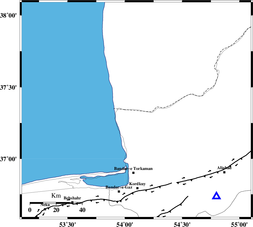
| Location | Lat:37.34 Lon: 54.1 |
| Region | 49 km North of Bandar-e torkaman |
Nearest Cities |
|
| 27 km North of Gomishtappeh, Golestan Province | |
| 38 km North West of Banavar, Golestan Province | |
| 48 km North West of Aq Qaleh, Golestan Province | |
| 49 km North of Bandar-e torkaman, Golestan Province | |
| 51 km North West of Qanqarmeh, Golestan Province | |
| Depth | 14 km |
| Agency | |
Faults within 150 km: |
|
| KHAZAR_F (Length: 523 km) , Distance to epicenter: 60 km | |
| N_ALBORZ_F (Length: 360 km) , Distance to epicenter: 85 km | |
| SHAVAR_F (Length: 87 km) , Distance to epicenter: 90 km | |
| Number of Phases | 8 |
| RMS | 0.2 |
| Number of Stations | 6 |
| Error in Latitude | >4.2 km |
| Error in Longitude | 5.1 km |
| Error in Depth | 11 km |
Download waveform in seisan format
to download seisan software Click here
to access information about IIEES stations Click here
Amplitude | ||||||||
| UID | Agency | Station | Component | Amplitude | Period | Arrival Time | Proccessing Time | Signal Clip |
| 58444 | IIEES | DAMV | E | 702.7 | 0.44 | 2009-08-23 18:52:41 | 2009-10-27 01:20:00 | n |
| 58445 | IIEES | DAMV | N | 695.7 | 0.52 | 2009-08-23 18:52:44 | 2009-10-27 01:20:00 | n |
| 58446 | IIEES | THKV | E | 854.8 | 0.48 | 2009-08-23 18:53:01 | 2009-10-27 01:20:00 | n |
| 58447 | IIEES | THKV | N | 1022.3 | 0.48 | 2009-08-23 18:53:02 | 2009-10-27 01:20:00 | n |
| 58448 | IIEES | ASAO | E | 78.3 | 0.52 | 2009-08-23 18:53:40 | 2009-10-27 01:20:00 | n |
| 58449 | IIEES | ASAO | N | 101.2 | 0.6 | 2009-08-23 18:53:43 | 2009-10-27 01:20:00 | n |
Phase | ||||||||||||
| Agency | Station | Component | Phase Type | Phase Quality | First Motion | Observed Arrival Time | Time Residual | Loc. Flag | Input Weight | Distance | Azimuth | |
| IIEES | MRVT | Z | Pg | E | 2009-08-23 18:51:50 | -0.1 | y | 180 | 78 | |||
| IIEES | MRVT | N | Sg | E | 2009-08-23 18:52:12 | 0.1 | y | 180 | 78 | |||
| IIEES | SHRO | Z | Pg | E | 2009-08-23 18:51:58 | -0.3 | y | 227 | 130 | |||
| IIEES | SHRO | E | Sg | E | 2009-08-23 18:52:25 | 0.1 | y | 227 | 130 | |||
| IIEES | DAMV | Z | Pn | E | 2009-08-23 18:52:02 | -0.1 | y | 269 | 226 | |||
| IIEES | BJRD | Z | Pn | E | 2009-08-23 18:52:05 | 0 | y | 296 | 81 | |||
| IIEES | THKV | Z | Pn | E | 2009-08-23 18:52:09 | -0.2 | y | 328 | 242 | |||
| IIEES | ASAO | Z | Pn | E | 2009-08-23 18:52:29 | 0.6 | y | 481 | 231 | |||