
Magnitude |
:3 |
| Date & Time (UTC) | 2009-08-11 23:03:54.8 |
| Date & Time (Local) | 1388/5/21 03:33:54.8 |
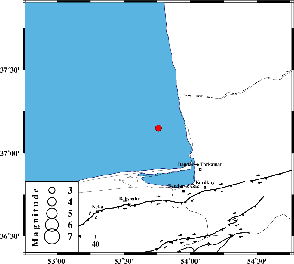
| Location | Lat:37.15 Lon: 53.76 |
| Region | Caspian Sea, 39 km North-West of Bandar-e torkaman |
Nearest Cities |
|
| 29 km North West of Gomishtappeh, Golestan Province | |
| 39 km North West of Bandar-e torkaman, Golestan Province | |
| 43 km North West of Sijval, Golestan Province | |
| 44 km North West of Banavar, Golestan Province | |
| 45 km North West of Bandar-e gaz, Golestan Province | |
| Depth | 36 km |
| Agency | |
Faults within 150 km: |
|
| KHAZAR_F (Length: 523 km) , Distance to epicenter: 48 km | |
| N_ALBORZ_F (Length: 360 km) , Distance to epicenter: 74 km | |
| SHAVAR_F (Length: 87 km) , Distance to epicenter: 87 km | |
| Number of Phases | 5 |
| RMS | 0.4 |
| Number of Stations | 4 |
| Error in Latitude | >15.2 km |
| Error in Longitude | 8.2 km |
| Error in Depth | 0 km |
Download waveform in seisan format
to download seisan software Click here
to access information about IIEES stations Click here
Amplitude | ||||||||
| UID | Agency | Station | Component | Amplitude | Period | Arrival Time | Proccessing Time | Signal Clip |
| 58200 | IIEES | MRVT | E | 91.8 | 0.4 | 2009-08-11 23:04:54 | 2009-10-27 01:20:00 | n |
| 58201 | IIEES | DAMV | E | 115.3 | 0.27 | 2009-08-11 23:05:00 | 2009-10-27 01:20:00 | n |
Phase | ||||||||||||
| Agency | Station | Component | Phase Type | Phase Quality | First Motion | Observed Arrival Time | Time Residual | Loc. Flag | Input Weight | Distance | Azimuth | |
| IIEES | MRVT | Z | Pg | E | 2009-08-11 23:04:29 | 0.7 | y | 214 | 74 | |||
| IIEES | MRVT | E | Sg | E | 2009-08-11 23:04:53 | -0.5 | y | 214 | 74 | |||
| IIEES | DAMV | Z | Pg | E | 2009-08-11 23:04:32 | -0.1 | y | 233 | 224 | |||
| IIEES | CHTH | Z | Pn | E | 2009-08-11 23:04:34 | 0.2 | y | 273 | 240 | |||
| IIEES | ZNJK | Z | Pn | E | 2009-08-11 23:04:56 | -0.3 | y | 455 | 265 | |||