
Magnitude |
:3.6 |
| Date & Time (UTC) | 2010-03-24 21:54:35.3 |
| Date & Time (Local) | 1389/1/5 02:24:35.3 |
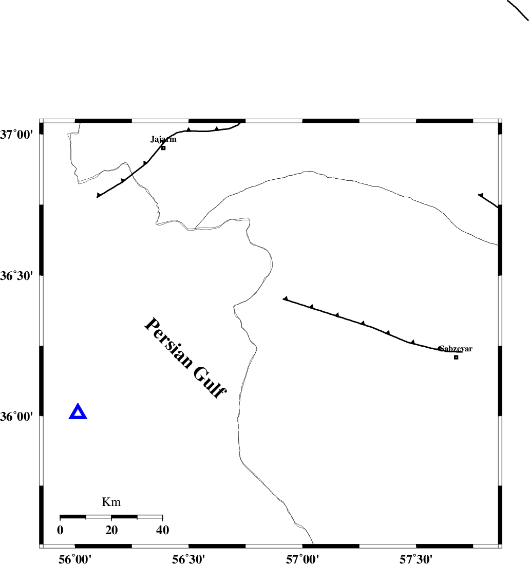
| Location | Lat:36.29 Lon: 56.86 |
| Region | Khorasan(center) Province, 74 km West of Sabzevar |
Nearest Cities |
|
| 6 km of Davarzan, Khorasan(center) Province | |
| 19 km West of Sadkharu, Khorasan(center) Province | |
| 26 km South East of Frumad, Semnan Province | |
| 41 km South West of Dasturan, Khorasan(center) Province | |
| 42 km South West of Jogtay, Khorasan(center) Province | |
| Depth | 18 km |
| Agency | |
Faults within 150 km: |
|
| SABZEVAR_F (Length: 81 km) , Distance to epicenter: 15 km | |
| JOGHATAI_F (Length: 70 km) , Distance to epicenter: 40 km | |
| MEYAMEY_F (Length: 141 km) , Distance to epicenter: 59 km | |
| Number of Phases | 7 |
| RMS | 0.1 |
| Number of Stations | 7 |
| Error in Latitude | >1.5 km |
| Error in Longitude | 3.5 km |
| Error in Depth | 6.6 km |
Download waveform in seisan format
to download seisan software Click here
to access information about IIEES stations Click here
Amplitude | ||||||||
| UID | Agency | Station | Component | Amplitude | Period | Arrival Time | Proccessing Time | Signal Clip |
| 57530 | IIEES | MRVT | E | 1007 | 0.56 | 2010-03-24 21:55:34 | 2010-03-24 10:19:00 | n |
| 57531 | IIEES | MRVT | N | 612.2 | 0.52 | 2010-03-24 21:55:35 | 2010-03-24 10:19:00 | n |
| 57532 | IIEES | TABS | N | 244.3 | 0.6 | 2010-03-24 21:56:10 | 2010-03-24 10:19:00 | n |
| 57533 | IIEES | SHRT | E | 64 | 0.56 | 2010-03-24 21:56:49 | 2010-03-24 10:19:00 | n |
Phase | ||||||||||||
| Agency | Station | Component | Phase Type | Phase Quality | First Motion | Observed Arrival Time | Time Residual | Loc. Flag | Input Weight | Distance | Azimuth | |
| IIEES | BJRD | Z | P | E | 2010-03-24 21:55:02 | 0 | y | 164 | 17 | |||
| IIEES | TABS | Z | Pn | E | 2010-03-24 21:55:19 | 0.1 | y | 294 | 175 | |||
| IIEES | TABS | N | Sg | E | 2010-03-24 21:55:57 | 0 | y | 294 | 175 | |||
| IIEES | SHRT | E | Sg | E | 2010-03-24 21:56:35 | -0.1 | y | 429 | 132 | |||
| IIEES | DAMV | Z | P | E | 2010-03-24 21:55:38 | 0 | y | 447 | 262 | |||
| IIEES | NASN | Z | Pn | E | 2010-03-24 21:55:49 | -0.3 | y | 536 | 225 | |||
| IIEES | ASAO | Z | P | E | 2010-03-24 21:56:03 | 0.1 | y | 649 | 255 | |||