
Magnitude |
:2.9 |
| Date & Time (UTC) | 2010-03-24 21:04:33.3 |
| Date & Time (Local) | 1389/1/5 01:34:33.3 |
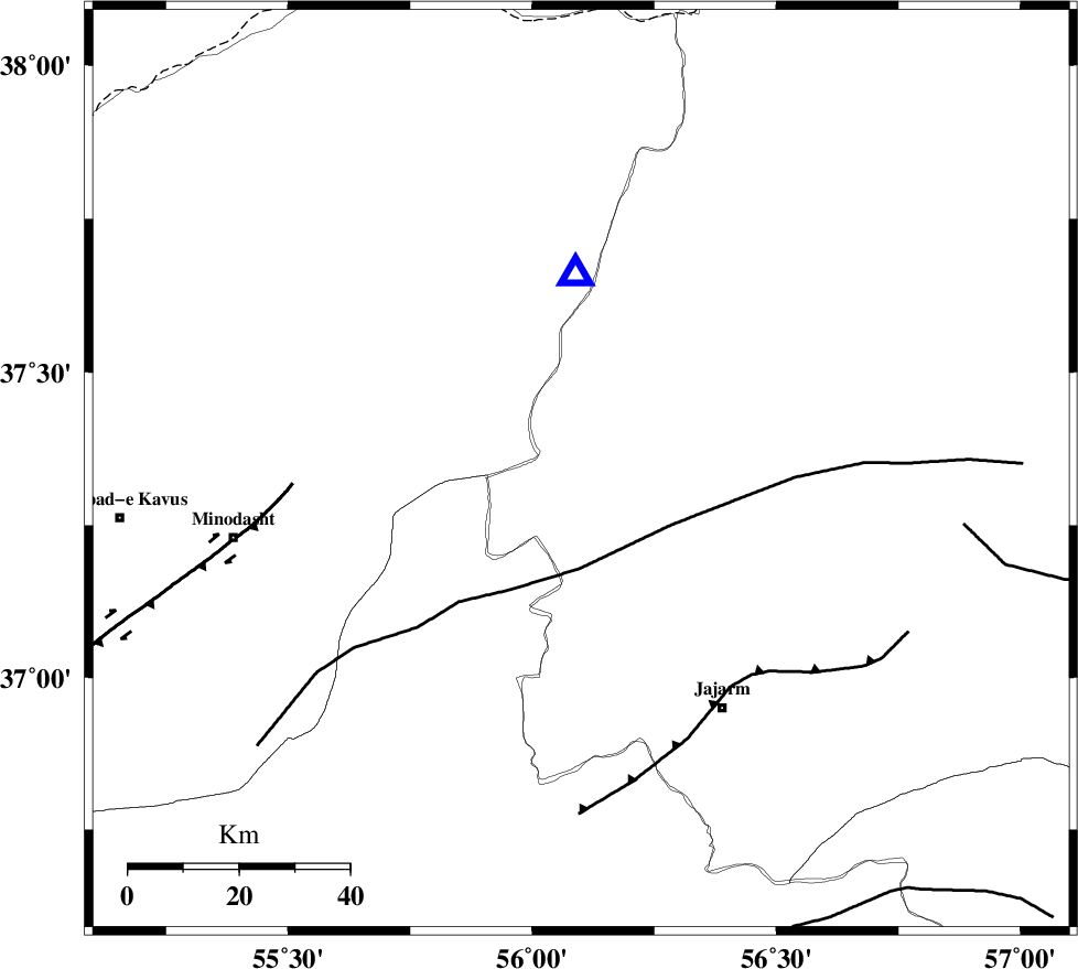
| Location | Lat:37.34 Lon: 56.1 |
| Region | Khorasan(north) Province, 54 km East of Kalaleh |
Nearest Cities |
|
| 36 km South East of Golidagh, Golestan Province | |
| 43 km East of Aq qamish, Golestan Province | |
| 43 km North West of Garmeh, Khorasan(north) Province | |
| 44 km North East of Rezvan, Semnan Province | |
| 44 km North East of Nardin, Semnan Province | |
| Depth | 46 km |
| Agency | |
Faults within 150 km: |
|
| ROBATE_QARABIL_F (Length: 168 km) , Distance to epicenter: 18 km | |
| JAJARAM_F (Length: 77 km) , Distance to epicenter: 48 km | |
| ESFARAYEN_F (Length: 111 km) , Distance to epicenter: 70 km | |
| Number of Phases | 6 |
| RMS | 0.1 |
| Number of Stations | 5 |
| Error in Latitude | >2.1 km |
| Error in Longitude | 4.3 km |
| Error in Depth | 5 km |
Download waveform in seisan format
to download seisan software Click here
to access information about IIEES stations Click here
Amplitude | ||||||||
| UID | Agency | Station | Component | Amplitude | Period | Arrival Time | Proccessing Time | Signal Clip |
| 57510 | IIEES | MRVT | E | 979.1 | 0.52 | 2010-03-24 21:04:52 | 2010-03-24 09:33:00 | n |
| 57511 | IIEES | MRVT | N | 673.1 | 0.2 | 2010-03-24 21:04:53 | 2010-03-24 09:33:00 | n |
| 57512 | IIEES | DAMV | N | 16.6 | 0.56 | 2010-03-24 21:06:31 | 2010-03-24 09:33:00 | n |
| 57513 | IIEES | DAMV | E | 20 | 0.56 | 2010-03-24 21:06:44 | 2010-03-24 09:33:00 | n |
Phase | ||||||||||||
| Agency | Station | Component | Phase Type | Phase Quality | First Motion | Observed Arrival Time | Time Residual | Loc. Flag | Input Weight | Distance | Azimuth | |
| IIEES | BJRD | Z | Pg | E | 2010-03-24 21:04:54 | 0 | y | 123 | 70 | |||
| IIEES | BJRD | E | Sg | E | 2010-03-24 21:05:09 | 0.1 | y | 123 | 70 | |||
| IIEES | DAMV | Z | P | E | 2010-03-24 21:05:29 | 0.1 | y | 415 | 244 | |||
| IIEES | TABS | Z | Pn | E | 2010-03-24 21:05:30 | -0.1 | y | 420 | 167 | |||
| IIEES | TABS | E | Sg | E | 2010-03-24 21:06:27 | 0.1 | y | 420 | 167 | |||
| IIEES | SHRT | Z | P | E | 2010-03-24 21:05:47 | -0.3 | y | 559 | 136 | |||