
Magnitude |
:2.7 |
| Date & Time (UTC) | 2010-02-20 06:49:11.9 |
| Date & Time (Local) | 1388/12/1 10:19:11.9 |
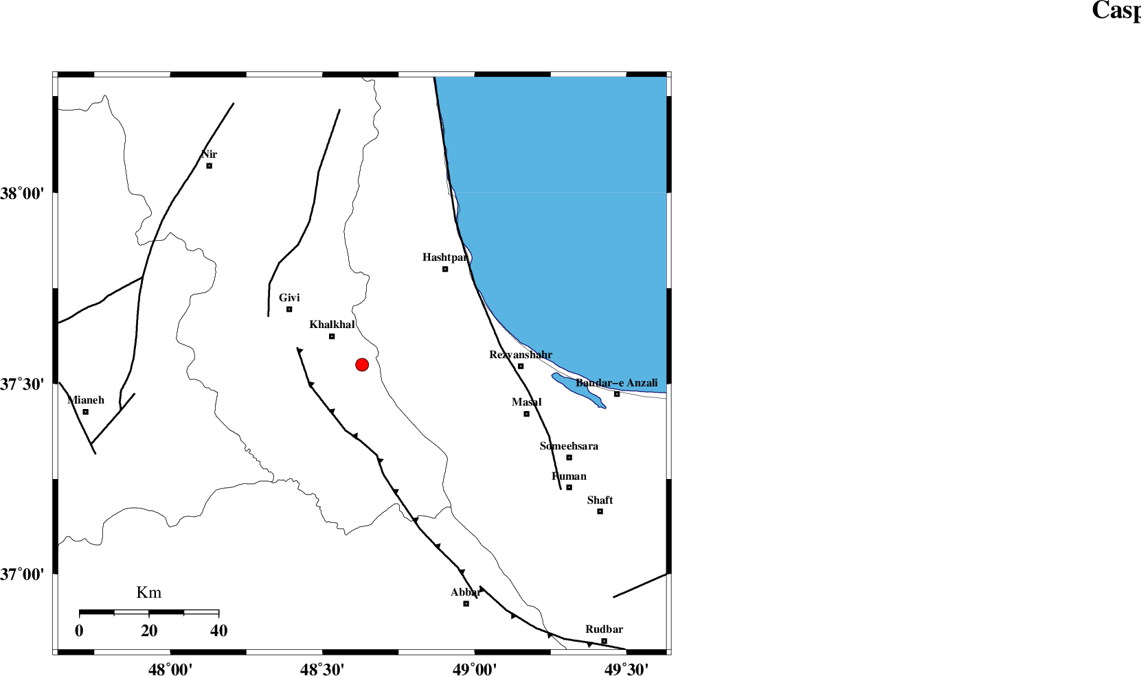
| Location | Lat:37.55 Lon: 48.63 |
| Region | 12 km East of Khalkhal, Ardebil Province |
Nearest Cities |
|
| 9 km of Khojin, Ardebil Province | |
| 12 km of Khalkhal, Ardebil Province | |
| 20 km North of Kalur, Ardebil Province | |
| 22 km West of Ardeh, Gilan Province | |
| 22 km East of Gazaz, Ardebil Province | |
| Depth | 15 km |
| Agency | |
Faults within 150 km: |
|
| MASULEL_F (Length: 90 km) , Distance to epicenter: 16 km | |
| SANGAVAR_F (Length: 61 km) , Distance to epicenter: 31 km | |
| TALESH_F (Length: 258 km) , Distance to epicenter: 40 km | |
| Number of Phases | 7 |
| RMS | 0.2 |
| Number of Stations | 6 |
| Error in Latitude | >2.1 km |
| Error in Longitude | 9.7 km |
| Error in Depth | 8 km |
Download waveform in seisan format
to download seisan software Click here
to access information about IIEES stations Click here
Amplitude | ||||||||
| UID | Agency | Station | Component | Amplitude | Period | Arrival Time | Proccessing Time | Signal Clip |
| 55790 | IIEES | ZNJK | N | 192.8 | 0.17 | 2010-02-20 06:49:48 | 2010-02-20 07:09:00 | n |
| 55791 | IIEES | GRMI | E | 141.4 | 0.22 | 2010-02-20 06:50:00 | 2010-02-20 07:09:00 | n |
| 55792 | IIEES | CHTH | N | 26.3 | 0.4 | 2010-02-20 06:50:32 | 2010-02-20 07:09:00 | n |
Phase | ||||||||||||
| Agency | Station | Component | Phase Type | Phase Quality | First Motion | Observed Arrival Time | Time Residual | Loc. Flag | Input Weight | Distance | Azimuth | |
| IIEES | ZNJK | Z | Pg | E | 2010-02-20 06:49:28 | -0.1 | y | 97.2 | 177 | |||
| IIEES | ZNJK | E | Sg | E | 2010-02-20 06:49:40 | 0.1 | y | 97.2 | 177 | |||
| IIEES | GRMI | Z | Pg | E | 2010-02-20 06:49:37 | 0 | y | 155 | 335 | |||
| IIEES | CHTH | Z | Pn | E | 2010-02-20 06:49:55 | -0.3 | y | 287 | 128 | |||
| IIEES | ASAO | Z | Pn | E | 2010-02-20 06:50:04 | 0.2 | y | 355 | 159 | |||
| IIEES | KHMZ | Z | Pn | E | 2010-02-20 06:50:14 | -0.1 | y | 439 | 164 | |||
| IIEES | MRVT | Z | Pn | E | 2010-02-20 06:50:41 | 0.3 | y | 658 | 87 | |||