
Magnitude |
:4.3 |
| Date & Time (UTC) | 2010-02-19 11:25:48.6 |
| Date & Time (Local) | 1388/11/30 14:55:48.6 |
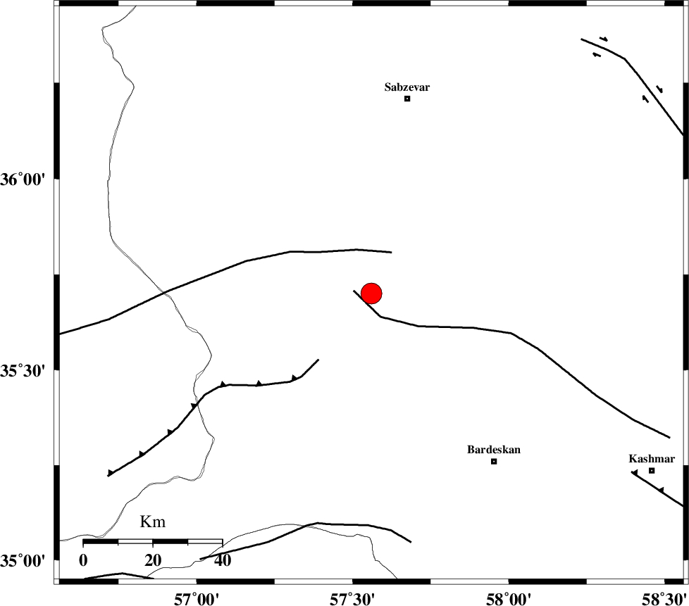
| Location | Lat:35.7 Lon: 57.56 |
| Region | 57 km South-West of Sabzevar, Khorasan(center) Province |
Nearest Cities |
|
| 12 km of Bejdan, Khorasan(center) Province | |
| 23 km South West of Tondak, Khorasan(center) Province | |
| 34 km South West of Sheshtamad, Khorasan(center) Province | |
| 52 km North West of Kabudan, Khorasan(center) Province | |
| 52 km North West of Ghaleh meidan, Khorasan(center) Province | |
| Depth | 42 km |
| Agency | |
Faults within 150 km: |
|
| BIJVARD_F (Length: 83 km) , Distance to epicenter: 42 km | |
| DORUNEH_F (Length: 713 km) , Distance to epicenter: 49 km | |
| BALHAR_F (Length: 117 km) , Distance to epicenter: 49 km | |
| Number of Phases | 9 |
| RMS | 0.1 |
| Number of Stations | 7 |
| Error in Latitude | >0.8 km |
| Error in Longitude | 2.1 km |
| Error in Depth | 2.1 km |
Download waveform in seisan format
to download seisan software Click here
to access information about IIEES stations Click here
Amplitude | ||||||||
| UID | Agency | Station | Component | Amplitude | Period | Arrival Time | Proccessing Time | Signal Clip |
| 55708 | IIEES | TABS | E | 1303.1 | 0.52 | 2010-02-19 11:26:58 | 2010-02-19 11:46:00 | n |
| 55709 | IIEES | TABS | N | 2052 | 0.84 | 2010-02-19 11:27:02 | 2010-02-19 11:46:00 | n |
| 55710 | IIEES | SHRT | N | 1231.4 | 0.52 | 2010-02-19 11:27:33 | 2010-02-19 11:46:00 | n |
| 55711 | IIEES | SHRT | E | 1207.7 | 0.48 | 2010-02-19 11:27:34 | 2010-02-19 11:46:00 | n |
Phase | ||||||||||||
| Agency | Station | Component | Phase Type | Phase Quality | First Motion | Observed Arrival Time | Time Residual | Loc. Flag | Input Weight | Distance | Azimuth | |
| IIEES | BJRD | Z | P | E | 2010-02-19 11:26:21 | 0.1 | y | 222 | 356 | |||
| IIEES | BJRD | E | Sg | E | 2010-02-19 11:26:50 | 0 | y | 222 | 356 | |||
| IIEES | TABS | Z | P | E | 2010-02-19 11:26:22 | 0 | y | 231 | 190 | |||
| IIEES | TABS | N | Sg | E | 2010-02-19 11:26:53 | 0 | y | 231 | 190 | |||
| IIEES | SHRT | Z | P | E | 2010-02-19 11:26:35 | -0.1 | y | 338 | 132 | |||
| IIEES | DAMV | Z | P | E | 2010-02-19 11:26:56 | -0.1 | y | 506 | 271 | |||
| IIEES | CHTH | Z | P | E | 2010-02-19 11:27:06 | 0.1 | y | 582 | 274 | |||
| IIEES | GHVR | Z | P | E | 2010-02-19 11:27:07 | -0.1 | y | 592 | 259 | |||
| IIEES | KHMZ | Z | P | E | 2010-02-19 11:27:24 | 0 | y | 729 | 255 | |||