
Magnitude |
:2.8 |
| Date & Time (UTC) | 2010-02-17 13:08:22.5 |
| Date & Time (Local) | 1388/11/28 16:38:22.5 |
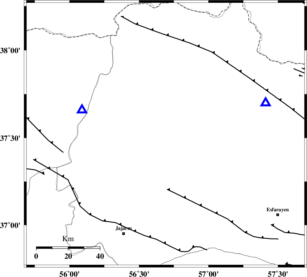
| Location | Lat:37.52 Lon: 56.69 |
| Region | 22 km West of Ashkhaneh, Khorasan(north) Province |
Nearest Cities |
|
| 22 km West of Ashkhaneh, Khorasan(north) Province | |
| 23 km North West of Shogan, Khorasan(north) Province | |
| 31 km South West of Pish qaleh, Khorasan(north) Province | |
| 40 km South East of Garmab, Khorasan(north) Province | |
| 53 km South West of Tangehzar, Khorasan(north) Province | |
| Depth | 34 km |
| Agency | |
Faults within 150 km: |
|
| ROBATE_QARABIL_F (Length: 168 km) , Distance to epicenter: 19 km | |
| ESFARAYEN_F (Length: 111 km) , Distance to epicenter: 34 km | |
| JAJARAM_F (Length: 77 km) , Distance to epicenter: 50 km | |
| Number of Phases | 5 |
| RMS | 0 |
| Number of Stations | 5 |
| Error in Latitude | >2.8 km |
| Error in Longitude | 2.2 km |
| Error in Depth | 3.6 km |
Download waveform in seisan format
to download seisan software Click here
to access information about IIEES stations Click here
Amplitude | ||||||||
| UID | Agency | Station | Component | Amplitude | Period | Arrival Time | Proccessing Time | Signal Clip |
| 55590 | IIEES | MRVT | E | 532.1 | 0.2 | 2010-02-17 13:08:42 | 2010-02-17 02:48:00 | n |
| 55591 | IIEES | MRVT | N | 542 | 0.6 | 2010-02-17 13:08:42 | 2010-02-17 02:48:00 | n |
Phase | ||||||||||||
| Agency | Station | Component | Phase Type | Phase Quality | First Motion | Observed Arrival Time | Time Residual | Loc. Flag | Input Weight | Distance | Azimuth | |
| IIEES | MRVT | Z | Pg | E | 2010-02-17 13:08:33 | 0 | y | 55 | 287 | |||
| IIEES | BJRD | Z | Pg | E | 2010-02-17 13:08:34 | 0 | y | 67 | 72 | |||
| IIEES | SHRD | Z | Pg | E | 2010-02-17 13:08:51 | 0 | y | 178 | 200 | |||
| IIEES | TABS | Z | Pn | E | 2010-02-17 13:09:21 | 0 | y | 431 | 175 | |||
| IIEES | SHRT | Z | Pn | E | 2010-02-17 13:09:35 | 0 | y | 539 | 142 | |||