
Magnitude |
:3.2 |
| Date & Time (UTC) | 2010-02-07 08:13:04.4 |
| Date & Time (Local) | 1388/11/18 11:43:04.4 |
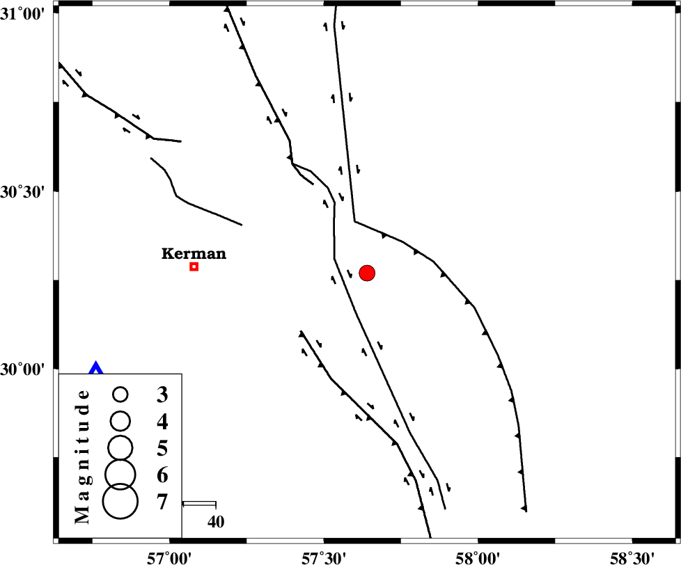
| Location | Lat:30.27 Lon: 57.64 |
| Region | 53 km East of Kerman, Kerman Province |
Nearest Cities |
|
| 11 km North of Sirch, Kerman Province | |
| 17 km South of Shahdad, Kerman Province | |
| 18 km North of Jushan, Kerman Province | |
| 26 km South West of Estehkam, Kerman Province | |
| 42 km North East of Langar, Kerman Province | |
| Depth | 15 km |
| Agency | |
Faults within 150 km: |
|
| GOLBAF_SIRCH_F (Length: 114 km) , Distance to epicenter: 11 km | |
| SHAHDAD_F (Length: 108 km) , Distance to epicenter: 15 km | |
| NAYBAND_F (Length: 258 km) , Distance to epicenter: 17 km | |
| Number of Phases | 4 |
| RMS | 0 |
| Number of Stations | 3 |
| Error in Latitude | >0.9 km |
| Error in Longitude | 1.4 km |
| Error in Depth | 0 km |
Download waveform in seisan format
to download seisan software Click here
to access information about IIEES stations Click here
Amplitude | ||||||||
| UID | Agency | Station | Component | Amplitude | Period | Arrival Time | Proccessing Time | Signal Clip |
| 55097 | IIEES | KRBR | E | 874.5 | 0.14 | 2010-02-07 08:13:32 | 2010-02-07 08:37:00 | n |
| 55098 | IIEES | ZHSF | E | 88.7 | 0.62 | 2010-02-07 08:14:33 | 2010-02-07 08:37:00 | n |
| 55099 | IIEES | ZHSF | N | 72 | 0.37 | 2010-02-07 08:14:39 | 2010-02-07 08:37:00 | n |
Phase | ||||||||||||
| Agency | Station | Component | Phase Type | Phase Quality | First Motion | Observed Arrival Time | Time Residual | Loc. Flag | Input Weight | Distance | Azimuth | |
| IIEES | KRBR | Z | Pg | E | 2010-02-07 08:13:20 | 0 | y | 90.3 | 250 | |||
| IIEES | ZHSF | Z | Pn | E | 2010-02-07 08:13:50 | 0 | y | 312 | 103 | |||
| IIEES | BNDS | Z | P | E | 2010-02-07 08:13:55 | 0 | y | 349 | 205 | |||
| IIEES | BNDS | Z | Pn | E | 2010-02-07 08:13:55 | 0 | y | 349 | 205 | |||