
Magnitude |
:4 |
| Date & Time (UTC) | 2010-01-18 03:13:41.1 |
| Date & Time (Local) | 1388/10/28 06:43:41.1 |
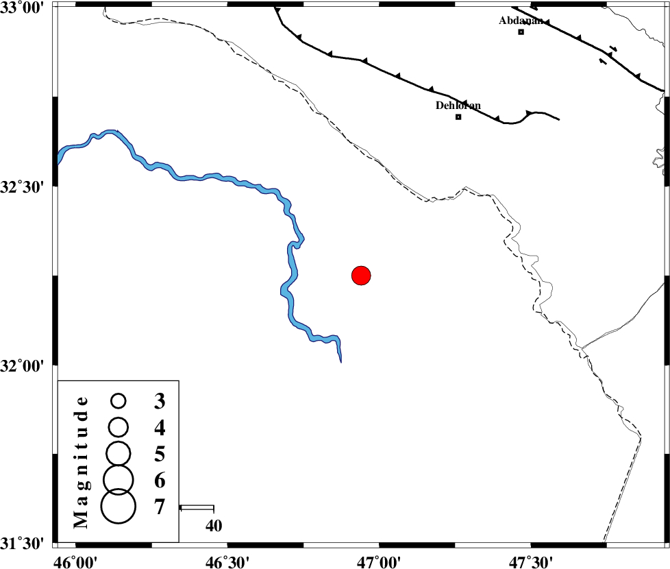
| Location | Lat:32.25 Lon: 46.94 |
| Region | 58 km South-West of Dehloran, Ilam Province |
Nearest Cities |
|
| 51 km South West of Musian, Ilam Province | |
| 58 km South West of Dehloran, Ilam Province | |
| 64 km South of Bishehzar, Ilam Province | |
| 90 km South West of Abdanan, Ilam Province | |
| 93 km South West of Sarabbagh, Ilam Province | |
| Depth | 46 km |
| Agency | |
Faults within 150 km: |
|
| MFF6 (Length: 144 km) , Distance to epicenter: 61 km | |
| BALARUD_F_Z1 (Length: 87 km) , Distance to epicenter: 96 km | |
| ZFF4 (Length: 128 km) , Distance to epicenter: 110 km | |
| Number of Phases | 9 |
| RMS | 0 |
| Number of Stations | 7 |
| Error in Latitude | >1.9 km |
| Error in Longitude | 3.3 km |
| Error in Depth | 3.2 km |
Download waveform in seisan format
to download seisan software Click here
to access information about IIEES stations Click here
Amplitude | ||||||||
| UID | Agency | Station | Component | Amplitude | Period | Arrival Time | Proccessing Time | Signal Clip |
| 54210 | IIEES | SHGR | E | 1798.8 | 0.8 | 2010-01-18 03:14:34 | 2010-01-18 03:29:00 | n |
| 54211 | IIEES | SHGR | N | 1219.6 | 0.68 | 2010-01-18 03:14:35 | 2010-01-18 03:29:00 | n |
| 54212 | IIEES | SNGE | N | 446.3 | 0.52 | 2010-01-18 03:15:09 | 2010-01-18 03:29:00 | n |
| 54213 | IIEES | ASAO | N | 385.9 | 0.6 | 2010-01-18 03:15:30 | 2010-01-18 03:29:00 | n |
| 54214 | IIEES | ASAO | E | 285.1 | 0.6 | 2010-01-18 03:15:32 | 2010-01-18 03:29:00 | n |
| 54215 | IIEES | GHVR | E | 187.9 | 0.68 | 2010-01-18 03:15:54 | 2010-01-18 03:29:00 | n |
Phase | ||||||||||||
| Agency | Station | Component | Phase Type | Phase Quality | First Motion | Observed Arrival Time | Time Residual | Loc. Flag | Input Weight | Distance | Azimuth | |
| IIEES | SHGR | Z | Pg | E | 2010-01-18 03:14:10 | 0 | y | 177 | 95 | |||
| IIEES | SHGR | E | Sg | E | 2010-01-18 03:14:31 | 0 | y | 177 | 95 | |||
| IIEES | SNGE | Z | Pn | E | 2010-01-18 03:14:25 | 0 | y | 318 | 7 | |||
| IIEES | KHMZ | Z | P | E | 2010-01-18 03:14:26 | 0 | y | 328 | 59 | |||
| IIEES | ASAO | Z | Pn | E | 2010-01-18 03:14:33 | -0.1 | y | 384 | 48 | |||
| IIEES | ASAO | E | Sg | E | 2010-01-18 03:15:26 | 0 | y | 384 | 48 | |||
| IIEES | GHVR | Z | Pn | E | 2010-01-18 03:14:44 | 0.1 | y | 471 | 57 | |||
| IIEES | ZNJK | Z | Pn | E | 2010-01-18 03:14:50 | 0.1 | y | 516 | 18 | |||
| IIEES | NASN | Z | Pn | E | 2010-01-18 03:14:55 | 0 | y | 555 | 82 | |||