
Magnitude |
:3.5 |
| Date & Time (UTC) | 2010-01-09 08:27:30.9 |
| Date & Time (Local) | 1388/10/19 11:57:30.9 |
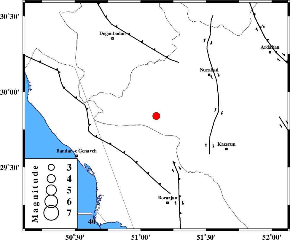
| Location | Lat:29.84 Lon: 51.12 |
| Region | 49 km South-West of Nurabad, Fars Province |
Nearest Cities |
|
| 26 km South of Babamonir, Fars Province | |
| 37 km North West of Khesht, Fars Province | |
| 42 km North West of Kamaraj, Fars Province | |
| 43 km North East of Dehkohneh, Bushehr Province | |
| 43 km South West of Ahangari, Fars Province | |
| Depth | 15 km |
| Agency | |
Faults within 150 km: |
|
| BORAZJAN_F (Length: 168 km) , Distance to epicenter: 36 km | |
| ZFF3 (Length: 125 km) , Distance to epicenter: 36 km | |
| KAZERUN_F (Length: 96 km) , Distance to epicenter: 42 km | |
| Number of Phases | 5 |
| RMS | 0.3 |
| Number of Stations | 5 |
| Error in Latitude | >4.6 km |
| Error in Longitude | 2.9 km |
| Error in Depth | 0 km |
Download waveform in seisan format
to download seisan software Click here
to access information about IIEES stations Click here
Amplitude | ||||||||
| UID | Agency | Station | Component | Amplitude | Period | Arrival Time | Proccessing Time | Signal Clip |
| 53696 | IIEES | GHIR | N | 156.8 | 0.66 | 2010-01-09 08:29:01 | 2010-01-09 08:51:00 | n |
| 53697 | IIEES | GHIR | E | 244.3 | 0.69 | 2010-01-09 08:29:05 | 2010-01-09 08:51:00 | n |
| 53698 | IIEES | SHGR | E | 243.7 | 0.59 | 2010-01-09 08:29:00 | 2010-01-09 08:51:00 | n |
| 53699 | IIEES | SHGR | N | 167 | 0.59 | 2010-01-09 08:29:09 | 2010-01-09 08:51:00 | n |
Phase | ||||||||||||
| Agency | Station | Component | Phase Type | Phase Quality | First Motion | Observed Arrival Time | Time Residual | Loc. Flag | Input Weight | Distance | Azimuth | |
| IIEES | GHIR | Z | Pn | E | 2010-01-09 08:28:09 | -0.1 | y | 251 | 133 | |||
| IIEES | SHGR | Z | Pn | E | 2010-01-09 08:28:20 | 0.2 | y | 335 | 319 | |||
| IIEES | NASN | Z | Pn | E | 2010-01-09 08:28:23 | -0.2 | y | 366 | 26 | |||
| IIEES | ASAO | Z | Pn | E | 2010-01-09 08:28:44 | -0.2 | y | 532 | 349 | |||
| IIEES | TABS | Z | Pn | E | 2010-01-09 08:29:07 | 0.5 | y | 708 | 52 | |||