
Magnitude |
:2.9 |
| Date & Time (UTC) | 2010-01-08 00:07:37.6 |
| Date & Time (Local) | 1388/10/18 03:37:37.6 |
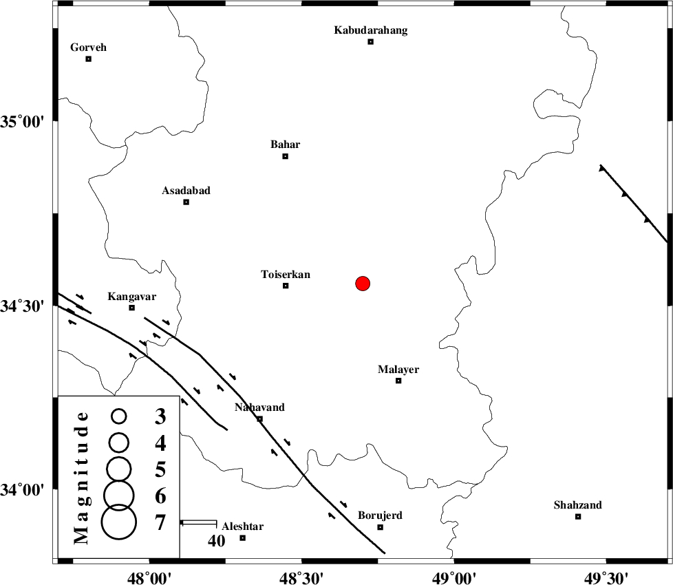
| Location | Lat:34.56 Lon: 48.7 |
| Region | 22 km East of Tuyserkan, Hamedan Province |
Nearest Cities |
|
| 13 km South of Gonbad, Hamedan Province | |
| 14 km North of Jokar, Hamedan Province | |
| 20 km South East of Aberu, Hamedan Province | |
| 21 km North East of Seyyed shahab, Hamedan Province | |
| 22 km South East of Qonjan, Hamedan Province | |
| Depth | 14 km |
| Agency | |
Faults within 150 km: |
|
| NAHAVAND_F (Length: 102 km) , Distance to epicenter: 50 km | |
| SAHANEH_F (Length: 77 km) , Distance to epicenter: 60 km | |
| TAFRESH_F (Length: 117 km) , Distance to epicenter: 80 km | |
| Number of Phases | 6 |
| RMS | 0.2 |
| Number of Stations | 5 |
| Error in Latitude | >9.3 km |
| Error in Longitude | 4 km |
| Error in Depth | 7.4 km |
Download waveform in seisan format
to download seisan software Click here
to access information about IIEES stations Click here
Amplitude | ||||||||
| UID | Agency | Station | Component | Amplitude | Period | Arrival Time | Proccessing Time | Signal Clip |
| 53650 | IIEES | SNGE | N | 474 | 0.36 | 2010-01-08 00:08:22 | 2010-01-08 12:24:00 | n |
| 53651 | IIEES | GHVR | N | 84 | 0.6 | 2010-01-08 00:08:48 | 2010-01-08 12:24:00 | n |
| 53652 | IIEES | GHVR | E | 73.7 | 0.68 | 2010-01-08 00:08:48 | 2010-01-08 12:24:00 | n |
| 53653 | IIEES | DAMV | N | 20.9 | 0.48 | 2010-01-08 00:09:19 | 2010-01-08 12:24:00 | n |
Phase | ||||||||||||
| Agency | Station | Component | Phase Type | Phase Quality | First Motion | Observed Arrival Time | Time Residual | Loc. Flag | Input Weight | Distance | Azimuth | |
| IIEES | SNGE | Z | Pg | E | 2010-01-08 00:08:00 | -0.2 | y | 137 | 296 | |||
| IIEES | GHVR | Z | Pn | E | 2010-01-08 00:08:14 | 0.1 | y | 234 | 91 | |||
| IIEES | GHVR | N | Sg | E | 2010-01-08 00:08:43 | -0.4 | y | 234 | 91 | |||
| IIEES | CHTH | Z | Pn | E | 2010-01-08 00:08:18 | 0.2 | y | 267 | 55 | |||
| IIEES | DAMV | Z | Pn | E | 2010-01-08 00:08:25 | 0.2 | y | 321 | 67 | |||
| IIEES | NASN | N | Pn | E | 2010-01-08 00:08:39 | 0.2 | y | 428 | 116 | |||