
Magnitude |
:2.5 |
| Date & Time (UTC) | 2009-04-20 08:30:39.1 |
| Date & Time (Local) | 1388/1/31 13:00:39.1 |
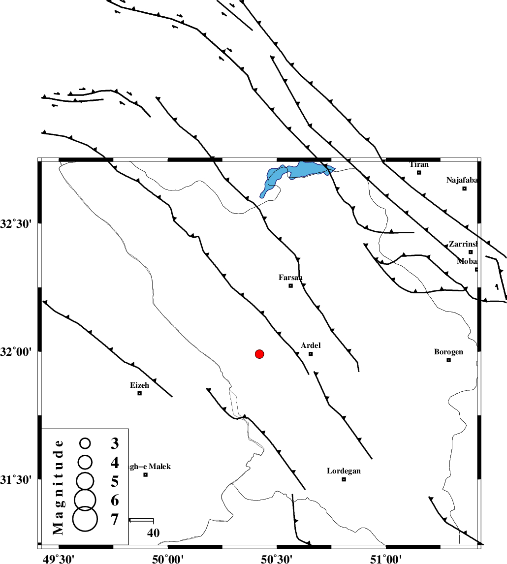
| Location | Lat:31.99 Lon: 50.42 |
| Region | 22 km West of Ardel, Chaharmahal Bakhtiari Province |
Nearest Cities |
|
| 16 km West of Rostamabad, Chaharmahal Bakhtiari Province | |
| 19 km North West of Dupelan, Chaharmahal Bakhtiari Province | |
| 22 km West of Ardel, Chaharmahal Bakhtiari Province | |
| 29 km North West of Sarkhun, Chaharmahal Bakhtiari Province | |
| 30 km North East of Dehdez, Khoozestan Province | |
| Depth | 46 km |
| Agency | |
Faults within 150 km: |
|
| ZARDKUH_F (Length: 139 km) , Distance to epicenter: 8 km | |
| DOPOLAN_F (Length: 107 km) , Distance to epicenter: 10 km | |
| SABZKUH_F (Length: 67 km) , Distance to epicenter: 13 km | |
| Number of Phases | 5 |
| RMS | 0.1 |
| Number of Stations | 3 |
| Error in Latitude | >4.6 km |
| Error in Longitude | 1.7 km |
| Error in Depth | 4 km |
Download waveform in seisan format
to download seisan software Click here
to access information about IIEES stations Click here
Amplitude | ||||||||
| UID | Agency | Station | Component | Amplitude | Period | Arrival Time | Proccessing Time | Signal Clip |
| 52486 | IIEES | SHGR | N | 143.4 | 0.66 | 2009-04-20 08:31:33 | 2009-07-13 01:52:00 | n |
| 52487 | IIEES | KHMZ | N | 24.3 | 0.61 | 2009-04-20 08:31:44 | 2009-07-13 01:52:00 | n |
Phase | ||||||||||||
| Agency | Station | Component | Phase Type | Phase Quality | First Motion | Observed Arrival Time | Time Residual | Loc. Flag | Input Weight | Distance | Azimuth | |
| IIEES | SHGR | Z | Pg | E | 2009-04-20 08:31:04 | -0.1 | y | 153 | 275 | |||
| IIEES | SHGR | E | Sg | E | 2009-04-20 08:31:23 | 0.1 | y | 153 | 275 | |||
| IIEES | KHMZ | Z | Pg | E | 2009-04-20 08:31:11 | -0.1 | y | 198 | 348 | |||
| IIEES | NASN | Z | Pn | E | 2009-04-20 08:31:13 | 0 | y | 242 | 68 | |||
| IIEES | NASN | N | Sg | E | 2009-04-20 08:31:47 | 0.1 | y | 242 | 68 | |||