
Magnitude |
:3.1 |
| Date & Time (UTC) | 2009-03-24 04:21:15.7 |
| Date & Time (Local) | 1388/1/4 08:51:15.7 |
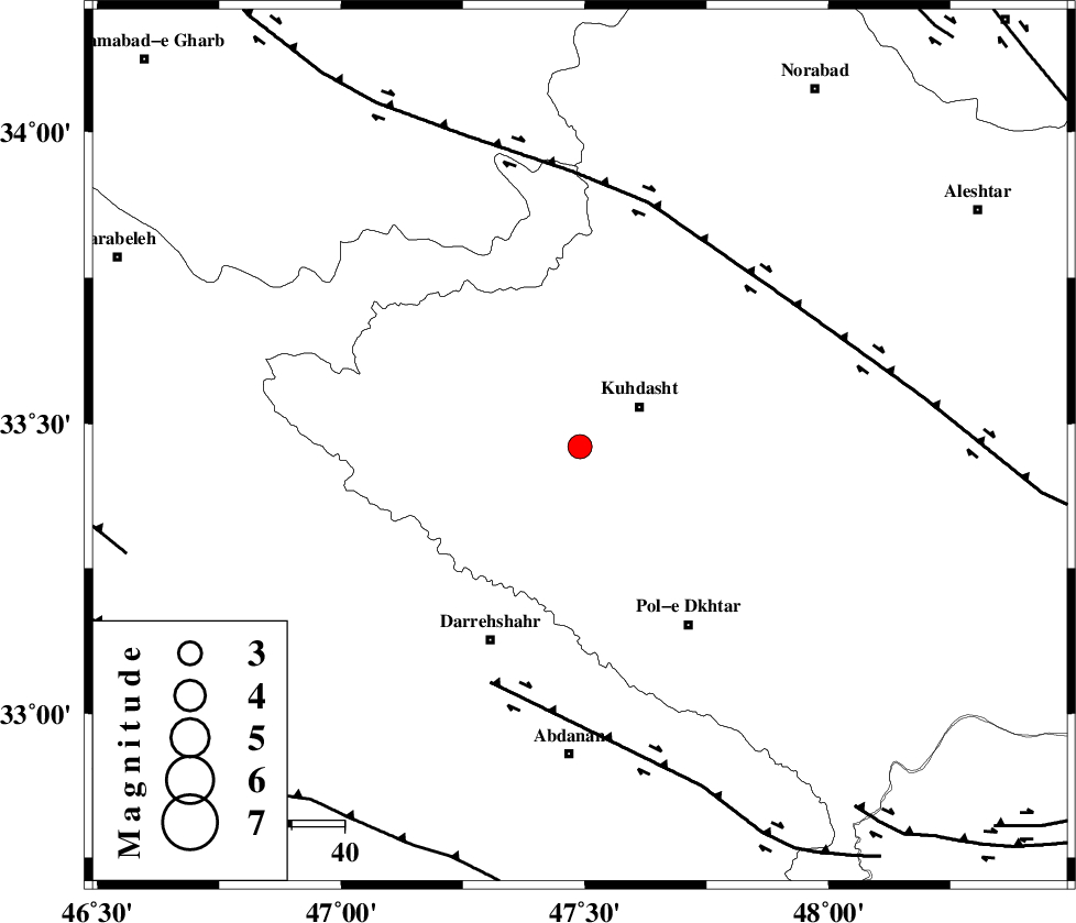
| Location | Lat:33.46 Lon: 47.49 |
| Region | 13 km West of Kuhdasht, Lorestan Province |
Nearest Cities |
|
| 4 km of Ashtarheh golgol, Lorestan Province | |
| 14 km West of Kuhdasht, Lorestan Province | |
| 15 km North of Suri, Lorestan Province | |
| 15 km North East of Kunani, Lorestan Province | |
| 20 km North of Chaqabol, Lorestan Province | |
| Depth | 14 km |
| Agency | |
Faults within 150 km: |
|
| HZF4 (Length: 492 km) , Distance to epicenter: 48 km | |
| BALARUD_F_Z1 (Length: 87 km) , Distance to epicenter: 48 km | |
| MFF6 (Length: 144 km) , Distance to epicenter: 82 km | |
| Number of Phases | 5 |
| RMS | 0.3 |
| Number of Stations | 5 |
| Error in Latitude | >6.5 km |
| Error in Longitude | 12.7 km |
| Error in Depth | 11.2 km |
Download waveform in seisan format
to download seisan software Click here
to access information about IIEES stations Click here
Amplitude | ||||||||
| UID | Agency | Station | Component | Amplitude | Period | Arrival Time | Proccessing Time | Signal Clip |
| 52261 | IIEES | SNGE | E | 332.8 | 0.68 | 2009-03-24 04:22:15 | 2009-06-27 08:52:00 | n |
| 52262 | IIEES | SHGR | E | 197 | 0.37 | 2009-03-24 04:22:19 | 2009-06-27 08:52:00 | n |
| 52263 | IIEES | SHGR | N | 242.3 | 0.55 | 2009-03-24 04:22:21 | 2009-06-27 08:52:00 | n |
| 52264 | IIEES | KHMZ | E | 55.9 | 0.63 | 2009-03-24 04:22:33 | 2009-06-27 08:52:00 | n |
Phase | ||||||||||||
| Agency | Station | Component | Phase Type | Phase Quality | First Motion | Observed Arrival Time | Time Residual | Loc. Flag | Input Weight | Distance | Azimuth | |
| IIEES | SNGE | Z | Pg | E | 2009-03-24 04:21:45 | -0.2 | y | 182 | 356 | |||
| IIEES | SHGR | Z | Pg | E | 2009-03-24 04:21:47 | 0 | y | 194 | 140 | |||
| IIEES | KHMZ | Z | Pg | E | 2009-03-24 04:21:53 | -0.4 | y | 232 | 82 | |||
| IIEES | CHTH | Z | Pn | E | 2009-03-24 04:22:17 | 0.4 | y | 430 | 50 | |||
| IIEES | DAMV | Z | Pn | E | 2009-03-24 04:22:23 | 0.4 | y | 477 | 58 | |||