
Magnitude |
:3 |
| Date & Time (UTC) | 2009-03-21 21:13:01.0 |
| Date & Time (Local) | 1388/1/2 01:43:01.0 |
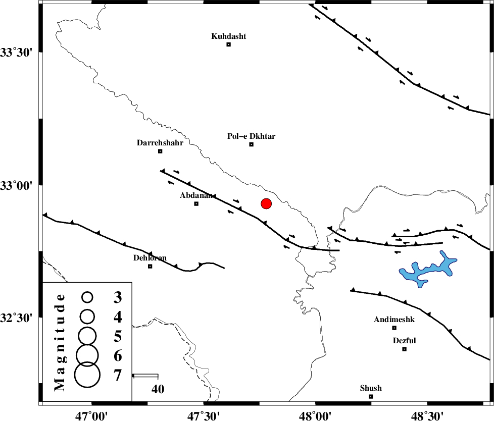
| Location | Lat:32.93 Lon: 47.78 |
| Region | 25 km South of Pol-e dokhtar, Lorestan Province |
Nearest Cities |
|
| 20 km North East of Sarabbagh, Ilam Province | |
| 20 km South of Sarab hammam, Lorestan Province | |
| 26 km South of Pol-e dokhtar, Lorestan Province | |
| 29 km East of Abdanan, Ilam Province | |
| 35 km South of Morani, Lorestan Province | |
| Depth | 14 km |
| Agency | |
Faults within 150 km: |
|
| BALARUD_F_Z1 (Length: 87 km) , Distance to epicenter: 7 km | |
| BALARUD_F_Z3 (Length: 53 km) , Distance to epicenter: 27 km | |
| MFF6 (Length: 144 km) , Distance to epicenter: 32 km | |
| Number of Phases | 5 |
| RMS | 0.2 |
| Number of Stations | 4 |
| Error in Latitude | >4.1 km |
| Error in Longitude | 8.1 km |
| Error in Depth | 8.7 km |
Download waveform in seisan format
to download seisan software Click here
to access information about IIEES stations Click here
Amplitude | ||||||||
| UID | Agency | Station | Component | Amplitude | Period | Arrival Time | Proccessing Time | Signal Clip |
| 52231 | IIEES | SHGR | E | 261.2 | 0.88 | 2009-03-21 21:13:44 | 2009-06-27 08:52:00 | n |
| 52232 | IIEES | SNGE | E | 97.7 | 0.72 | 2009-03-21 21:14:20 | 2009-06-27 08:52:00 | n |
| 52233 | IIEES | SNGE | N | 114 | 0.36 | 2009-03-21 21:14:20 | 2009-06-27 08:52:00 | n |
| 52234 | IIEES | GHVR | E | 31.1 | 0.34 | 2009-03-21 21:14:58 | 2009-06-27 08:52:00 | n |
| 52235 | IIEES | GHVR | N | 26.9 | 1.13 | 2009-03-21 21:15:00 | 2009-06-27 08:52:00 | n |
Phase | ||||||||||||
| Agency | Station | Component | Phase Type | Phase Quality | First Motion | Observed Arrival Time | Time Residual | Loc. Flag | Input Weight | Distance | Azimuth | |
| IIEES | SHGR | Z | Pg | E | 2009-03-21 21:13:23 | 0.1 | y | 132 | 133 | |||
| IIEES | KHMZ | Z | Pg | E | 2009-03-21 21:13:37 | -0.1 | y | 222 | 66 | |||
| IIEES | SNGE | Z | Pg | E | 2009-03-21 21:13:40 | -0.3 | y | 243 | 351 | |||
| IIEES | SNGE | Z | Sg | E | 2009-03-21 21:14:10 | 0.2 | y | 243 | 351 | |||
| IIEES | GHVR | Z | Pn | E | 2009-03-21 21:13:54 | 0.1 | y | 364 | 61 | |||