
Magnitude |
:2.6 |
| Date & Time (UTC) | 2009-03-20 23:24:10.6 |
| Date & Time (Local) | 1388/1/1 02:54:10.6 |
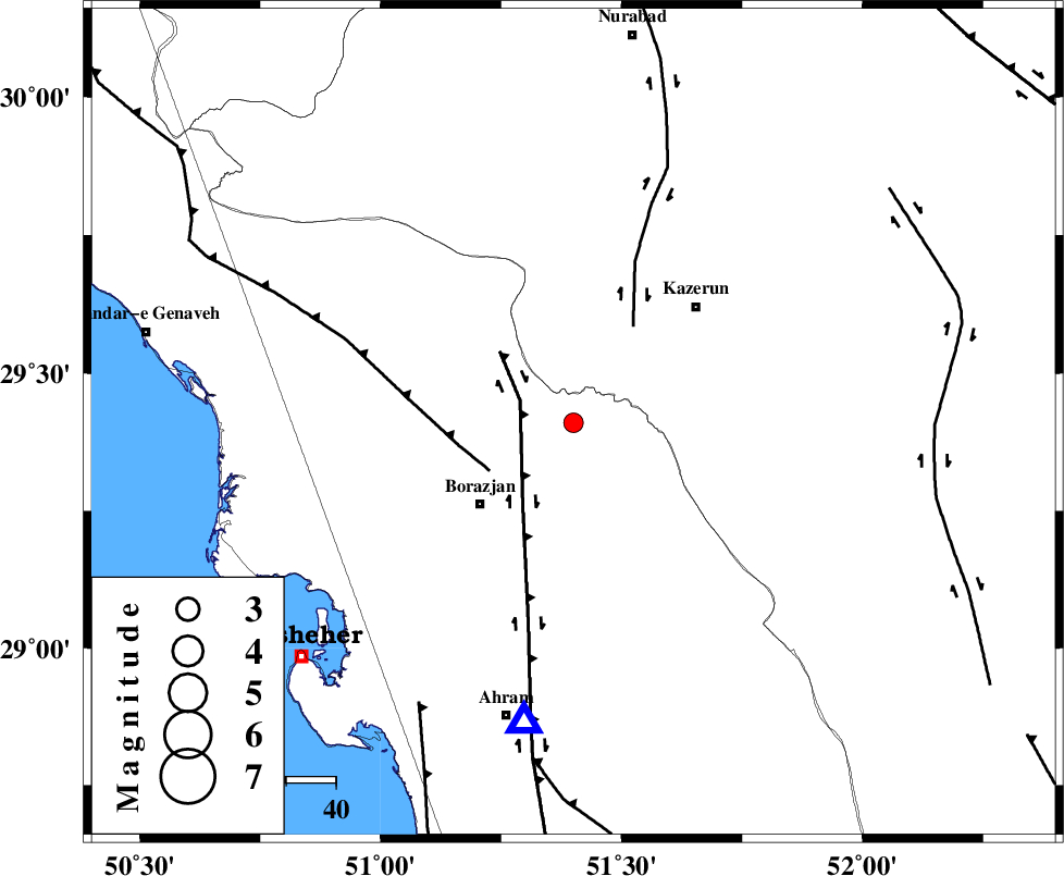
| Location | Lat:29.41 Lon: 51.4 |
| Region | 25 km North-East of Borazjan, Bushehr Province |
Nearest Cities |
|
| 10 km East of Dalki, Bushehr Province | |
| 18 km South of Khesht, Fars Province | |
| 21 km North East of Nazar aqa, Bushehr Province | |
| 25 km North East of Borazjan, Bushehr Province | |
| 26 km South of Kamaraj, Fars Province | |
| Depth | 18 km |
| Agency | |
Faults within 150 km: |
|
| BORAZJAN_F (Length: 168 km) , Distance to epicenter: 12 km | |
| ZFF3 (Length: 125 km) , Distance to epicenter: 19 km | |
| KAZERUN_F (Length: 96 km) , Distance to epicenter: 23 km | |
| Number of Phases | 4 |
| RMS | 0.1 |
| Number of Stations | 4 |
| Error in Latitude | >11.6 km |
| Error in Longitude | 10 km |
| Error in Depth | 16 km |
Download waveform in seisan format
to download seisan software Click here
to access information about IIEES stations Click here
Amplitude | ||||||||
| UID | Agency | Station | Component | Amplitude | Period | Arrival Time | Proccessing Time | Signal Clip |
| 52228 | IIEES | GHIR | E | 87.7 | 0.44 | 2009-03-20 23:25:16 | 2009-06-27 08:52:00 | n |
| 52229 | IIEES | GHIR | N | 61.4 | 0.4 | 2009-03-20 23:25:20 | 2009-06-27 08:52:00 | n |
| 52230 | IIEES | KRBR | E | 2.7 | 0.07 | 2009-03-20 23:25:43 | 2009-06-27 08:52:00 | n |
Phase | ||||||||||||
| Agency | Station | Component | Phase Type | Phase Quality | First Motion | Observed Arrival Time | Time Residual | Loc. Flag | Input Weight | Distance | Azimuth | |
| IIEES | GHIR | Z | Pg | E | 2009-03-20 23:24:43 | 0 | y | 199 | 128 | |||
| IIEES | NASN | Z | Pn | E | 2009-03-20 23:25:07 | 0.1 | y | 399 | 19 | |||
| IIEES | KHMZ | Z | Pn | E | 2009-03-20 23:25:20 | 0 | y | 499 | 345 | |||
| IIEES | KRBR | Z | Pn | E | 2009-03-20 23:25:23 | -0.1 | y | 523 | 82 | |||