
Magnitude |
:2.9 |
| Date & Time (UTC) | 2009-03-10 23:01:14.9 |
| Date & Time (Local) | 1387/12/21 02:31:14.9 |
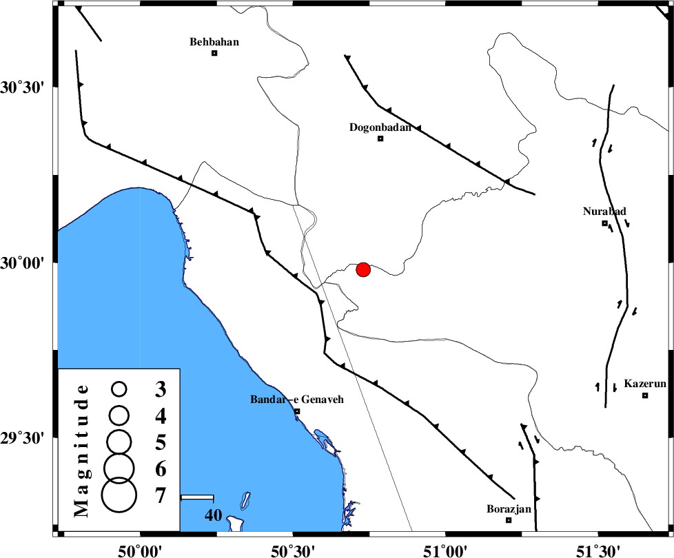
| Location | Lat:29.98 Lon: 50.73 |
| Region | 41 km South of Dogonbadan, Kohkiluieh va boyerahmad Province |
Nearest Cities |
|
| 39 km North East of Mohammad salehi, Bushehr Province | |
| 40 km East of Siyahmakan-e bozorg, Bushehr Province | |
| 42 km South of Dogonbadan, Kohkiluieh va boyerahmad Province | |
| 46 km West of Babamonir, Fars Province | |
| 48 km North East of Emamhasan, Bushehr Province | |
| Depth | 14 km |
| Agency | |
Faults within 150 km: |
|
| ZFF3 (Length: 125 km) , Distance to epicenter: 17 km | |
| RAG_E_SEFID_F (Length: 84 km) , Distance to epicenter: 39 km | |
| MISHAN_F (Length: 76 km) , Distance to epicenter: 48 km | |
| Number of Phases | 4 |
| RMS | 0.1 |
| Number of Stations | 3 |
| Error in Latitude | >3.6 km |
| Error in Longitude | 6.4 km |
| Error in Depth | 8.5 km |
Download waveform in seisan format
to download seisan software Click here
to access information about IIEES stations Click here
Amplitude | ||||||||
| UID | Agency | Station | Component | Amplitude | Period | Arrival Time | Proccessing Time | Signal Clip |
| 52152 | IIEES | GHIR | N | 54.6 | 1.17 | 2009-03-10 23:02:44 | 2009-06-27 08:52:00 | n |
| 52153 | IIEES | GHIR | E | 74.7 | 0.49 | 2009-03-10 23:02:58 | 2009-06-27 08:52:00 | n |
| 52154 | IIEES | NASN | N | 19 | 0.52 | 2009-03-10 23:02:50 | 2009-06-27 08:52:00 | n |
Phase | ||||||||||||
| Agency | Station | Component | Phase Type | Phase Quality | First Motion | Observed Arrival Time | Time Residual | Loc. Flag | Input Weight | Distance | Azimuth | |
| IIEES | GHIR | Z | PN5 | E | 2009-03-10 23:01:58 | 0.1 | y | 289 | 130 | |||
| IIEES | GHIR | E | Sg | E | 2009-03-10 23:02:36 | -0.1 | y | 289 | 130 | |||
| IIEES | NASN | Z | Pn | E | 2009-03-10 23:02:08 | 0 | y | 370 | 32 | |||
| IIEES | SNGE | Z | Pn | E | 2009-03-10 23:02:43 | -0.1 | y | 650 | 332 | |||