
Magnitude |
:2.7 |
| Date & Time (UTC) | 2009-01-23 01:49:47.7 |
| Date & Time (Local) | 1387/11/4 05:19:47.7 |
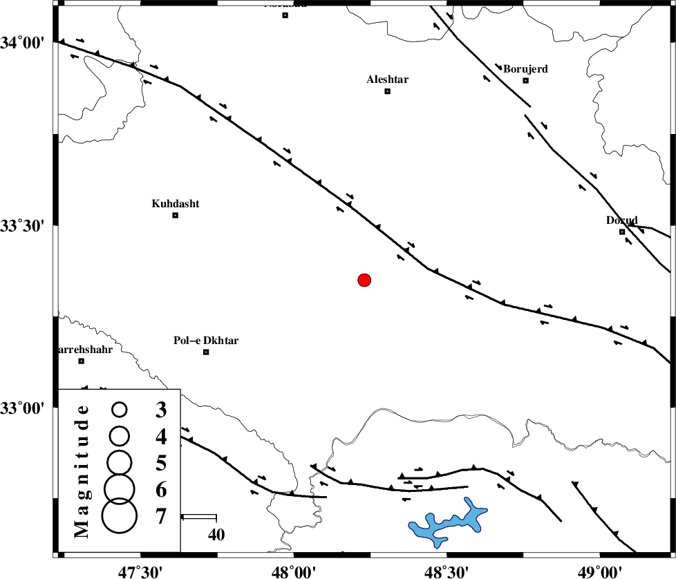
| Location | Lat:33.35 Lon: 48.23 |
| Region | 19 km South-West of Khorramabad, Lorestan Province |
Nearest Cities |
|
| 6 km of Shoorab-e sofla, Lorestan Province | |
| 12 km West of Daraei, Lorestan Province | |
| 14 km South of Godar-e mahmudvand, Lorestan Province | |
| 16 km South West of Badrabad-e sofla, Lorestan Province | |
| 19 km South West of Khorramabad, Lorestan Province | |
| Depth | 18 km |
| Agency | |
Faults within 150 km: |
|
| HZF4 (Length: 492 km) , Distance to epicenter: 20 km | |
| BALARUD_F_Z3 (Length: 53 km) , Distance to epicenter: 59 km | |
| BALARUD_F_Z2 (Length: 58 km) , Distance to epicenter: 61 km | |
| Number of Phases | 6 |
| RMS | 0.2 |
| Number of Stations | 4 |
| Error in Latitude | >1.5 km |
| Error in Longitude | 3.2 km |
| Error in Depth | 0 km |
Download waveform in seisan format
to download seisan software Click here
to access information about IIEES stations Click here
Amplitude | ||||||||
| UID | Agency | Station | Component | Amplitude | Period | Arrival Time | Proccessing Time | Signal Clip |
| 51740 | IIEES | SHGR | N | 93.2 | 0.63 | 2009-01-23 01:50:34 | 2009-06-27 08:52:00 | n |
| 51741 | IIEES | ASAO | N | 68.2 | 0.21 | 2009-01-23 01:50:52 | 2009-06-27 08:52:00 | n |
Phase | ||||||||||||
| Agency | Station | Component | Phase Type | Phase Quality | First Motion | Observed Arrival Time | Time Residual | Loc. Flag | Input Weight | Distance | Azimuth | |
| IIEES | SHGR | Z | Pg | E | 2009-01-23 01:50:12 | 0 | y | 147 | 159 | |||
| IIEES | SHGR | N | Sg | E | 2009-01-23 01:50:31 | 0.1 | y | 147 | 159 | |||
| IIEES | KHMZ | Z | Pg | E | 2009-01-23 01:50:15 | -0.2 | y | 167 | 74 | |||
| IIEES | SNGE | Z | Pg | E | 2009-01-23 01:50:22 | 0.1 | y | 210 | 337 | |||
| IIEES | ASAO | Z | Pg | E | 2009-01-23 01:50:22 | -0.3 | y | 213 | 51 | |||
| IIEES | ASAO | N | Sg | E | 2009-01-23 01:50:49 | 0.3 | y | 213 | 51 | |||