
Magnitude |
:3.2 |
| Date & Time (UTC) | 2009-01-14 07:51:03.2 |
| Date & Time (Local) | 1387/10/25 11:21:03.2 |
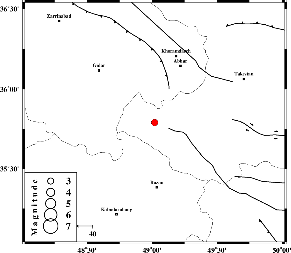
| Location | Lat:35.79 Lon: 49.02 |
| Region | 43 km South-West of Abhar, Zanjan Province |
Nearest Cities |
|
| 24 km North West of Ab-e garm, Ghazvin Province | |
| 30 km North West of Avaj, Ghazvin Province | |
| 32 km South West of Darsajin, Zanjan Province | |
| 33 km North East of Kahla, Zanjan Province | |
| 35 km West of Hoseynabad, Ghazvin Province | |
| Depth | 14 km |
| Agency | |
Faults within 150 km: |
|
| KUSHK_E_NOSRAT_F (Length: 230 km) , Distance to epicenter: 10 km | |
| SOLTANIYEH_F (Length: 119 km) , Distance to epicenter: 26 km | |
| ZANJAN_F (Length: 137 km) , Distance to epicenter: 49 km | |
| Number of Phases | 8 |
| RMS | 0.2 |
| Number of Stations | 6 |
| Error in Latitude | >1.7 km |
| Error in Longitude | 2 km |
| Error in Depth | 7.1 km |
Download waveform in seisan format
to download seisan software Click here
to access information about IIEES stations Click here
Amplitude | ||||||||
| UID | Agency | Station | Component | Amplitude | Period | Arrival Time | Proccessing Time | Signal Clip |
| 51706 | IIEES | THKV | E | 322 | 0.47 | 2009-01-14 07:51:58 | 2009-06-27 08:52:00 | n |
| 51707 | IIEES | SNGE | N | 355.8 | 0.5 | 2009-01-14 07:51:53 | 2009-06-27 08:52:00 | n |
| 51708 | IIEES | SNGE | E | 296.5 | 0.5 | 2009-01-14 07:51:58 | 2009-06-27 08:52:00 | n |
| 51709 | IIEES | DAMV | N | 126.6 | 0.51 | 2009-01-14 07:52:29 | 2009-06-27 08:52:00 | n |
Phase | ||||||||||||
| Agency | Station | Component | Phase Type | Phase Quality | First Motion | Observed Arrival Time | Time Residual | Loc. Flag | Input Weight | Distance | Azimuth | |
| IIEES | ZNJK | Z | Pg | E | 2009-01-14 07:51:20 | 0.2 | y | 102 | 343 | |||
| IIEES | ZNJK | E | Sg | E | 2009-01-14 07:51:33 | -0.1 | y | 102 | 343 | |||
| IIEES | ASAO | Z | Pg | E | 2009-01-14 07:51:30 | 0.1 | y | 165 | 146 | |||
| IIEES | THKV | Z | Pg | E | 2009-01-14 07:51:31 | 0.2 | y | 168 | 85 | |||
| IIEES | SNGE | Z | Pg | E | 2009-01-14 07:51:31 | -0.1 | y | 171 | 243 | |||
| IIEES | SNGE | N | Sg | E | 2009-01-14 07:51:52 | 0 | y | 171 | 243 | |||
| IIEES | CHTH | Z | Pg | E | 2009-01-14 07:51:34 | -0.4 | y | 191 | 85 | |||
| IIEES | DAMV | Z | Pn | E | 2009-01-14 07:51:44 | 0.1 | y | 268 | 93 | |||