
Magnitude |
:2.8 |
| Date & Time (UTC) | 2009-01-03 12:59:16.0 |
| Date & Time (Local) | 1387/10/14 16:29:16.0 |
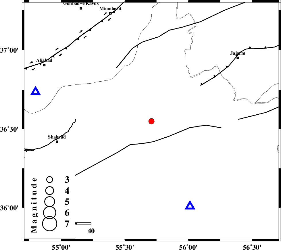
| Location | Lat:36.55 Lon: 55.71 |
| Region | 67 km North-East of Shahrud, Semnan Province |
Nearest Cities |
|
| 17 km North of Miamay, Semnan Province | |
| 38 km South East of Kalateh khanj, Semnan Province | |
| 50 km South of Qaleh qafeh, Semnan Province | |
| 51 km South East of Farsian, Golestan Province | |
| 54 km North West of Biarjomand, Semnan Province | |
| Depth | 14 km |
| Agency | |
Faults within 150 km: |
|
| MEYAMEY_F (Length: 141 km) , Distance to epicenter: 15 km | |
| JAJARAM_F (Length: 77 km) , Distance to epicenter: 43 km | |
| ROBATE_QARABIL_F (Length: 168 km) , Distance to epicenter: 45 km | |
| Number of Phases | 7 |
| RMS | 0.3 |
| Number of Stations | 5 |
| Error in Latitude | >5.9 km |
| Error in Longitude | 6.4 km |
| Error in Depth | 12.7 km |
Download waveform in seisan format
to download seisan software Click here
to access information about IIEES stations Click here
Amplitude | ||||||||
| UID | Agency | Station | Component | Amplitude | Period | Arrival Time | Proccessing Time | Signal Clip |
| 51625 | IIEES | MRVT | E | 185.8 | 0.54 | 2009-01-03 12:59:59 | 2009-06-27 08:52:00 | n |
| 51626 | IIEES | MRVT | N | 183.1 | 0.36 | 2009-01-03 12:59:59 | 2009-06-27 08:52:00 | n |
| 51627 | IIEES | DAMV | E | 36.8 | 1.08 | 2009-01-03 13:01:03 | 2009-06-27 08:52:00 | n |
| 51628 | IIEES | DAMV | N | 27.6 | 0.3 | 2009-01-03 13:01:08 | 2009-06-27 08:52:00 | n |
Phase | ||||||||||||
| Agency | Station | Component | Phase Type | Phase Quality | First Motion | Observed Arrival Time | Time Residual | Loc. Flag | Input Weight | Distance | Azimuth | |
| IIEES | MRVT | Z | Pg | E | 2009-01-03 12:59:36 | -0.7 | y | 128 | 15 | |||
| IIEES | MRVT | E | Sg | E | 2009-01-03 12:59:53 | 0.4 | y | 128 | 15 | |||
| IIEES | TABS | Z | Pn | E | 2009-01-03 13:00:06 | 0 | y | 346 | 158 | |||
| IIEES | DAMV | Z | Pn | E | 2009-01-03 13:00:07 | 0.2 | y | 352 | 254 | |||
| IIEES | DAMV | N | Sg | E | 2009-01-03 13:00:54 | -0.3 | y | 352 | 254 | |||
| IIEES | CHTH | Z | Pn | E | 2009-01-03 13:00:16 | 0.3 | y | 418 | 262 | |||
| IIEES | THKV | Z | Pn | E | 2009-01-03 13:00:18 | 0.1 | y | 440 | 262 | |||