
Magnitude |
:3.2 |
| Date & Time (UTC) | 2008-11-05 09:46:57.3 |
| Date & Time (Local) | 1387/8/15 13:16:57.3 |
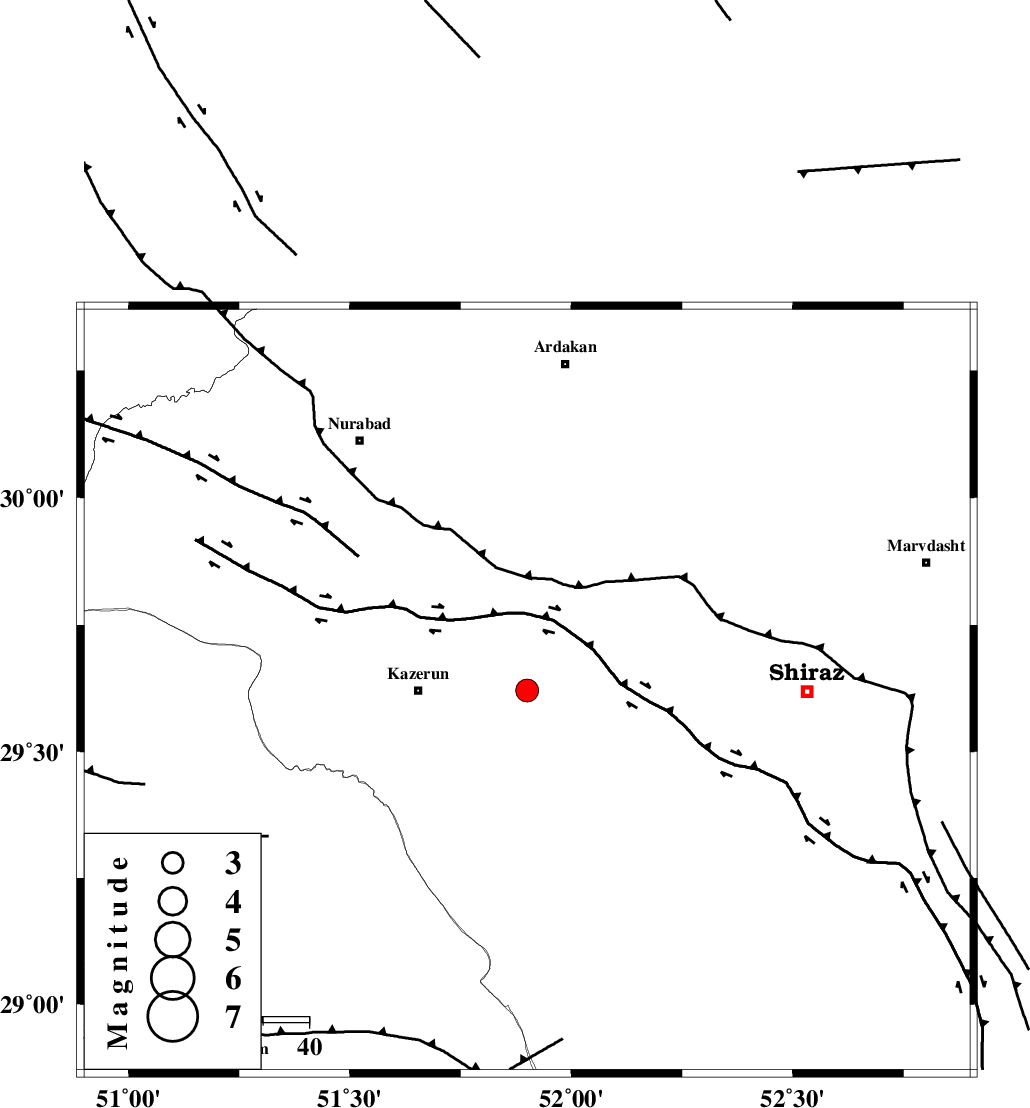
| Location | Lat:29.62 Lon: 51.9 |
| Region | 24 km East of Kazerun, Fars Province |
Nearest Cities |
|
| 5 km North of Kalani, Fars Province | |
| 24 km East of Kazerun, Fars Province | |
| 24 km North East of Mehranjan, Fars Province | |
| 28 km South East of Nodan, Fars Province | |
| 29 km North West of Richi, Fars Province | |
| Depth | 15 km |
| Agency | |
Faults within 150 km: |
|
| KAREBASS_F (Length: 98 km) , Distance to epicenter: 26 km | |
| KAZERUN_F (Length: 96 km) , Distance to epicenter: 37 km | |
| SABZ_PUSHAN_F_Z3 (Length: 37 km) , Distance to epicenter: 50 km | |
| Number of Phases | 7 |
| RMS | 0.2 |
| Number of Stations | 7 |
| Error in Latitude | >4.6 km |
| Error in Longitude | 1.9 km |
| Error in Depth | 0 km |
Download waveform in seisan format
to download seisan software Click here
to access information about IIEES stations Click here
Amplitude | ||||||||
| UID | Agency | Station | Component | Amplitude | Period | Arrival Time | Proccessing Time | Signal Clip |
| 51097 | IIEES | KRBR | N | 40.6 | 0.44 | 2008-11-05 09:48:57 | 2009-05-17 10:07:00 | n |
| 51098 | IIEES | BNDS | N | 18.3 | 0.3 | 2008-11-05 09:48:53 | 2009-05-17 10:07:00 | n |
Phase | ||||||||||||
| Agency | Station | Component | Phase Type | Phase Quality | First Motion | Observed Arrival Time | Time Residual | Loc. Flag | Input Weight | Distance | Azimuth | |
| IIEES | NASN | Z | Pn | E | 2008-11-05 09:47:50 | -0.2 | y | 363 | 14 | |||
| IIEES | KRBR | Z | Pn | E | 2008-11-05 09:48:03 | 0.2 | y | 471 | 84 | |||
| IIEES | BNDS | Z | Pn | E | 2008-11-05 09:48:05 | -0.1 | y | 485 | 119 | |||
| IIEES | ASAO | Z | Pn | E | 2008-11-05 09:48:16 | 0.3 | y | 575 | 343 | |||
| IIEES | DAMV | Z | Pn | E | 2008-11-05 09:48:27 | -0.1 | y | 667 | 1 | |||
| IIEES | TABS | Z | Pn | E | 2008-11-05 09:48:27 | 0 | y | 667 | 47 | |||
| IIEES | SNGE | Z | Pn | E | 2008-11-05 09:48:37 | -0.1 | y | 743 | 326 | |||