
Magnitude |
:3.1 |
| Date & Time (UTC) | 2008-10-03 03:19:07.8 |
| Date & Time (Local) | 1387/7/12 06:49:07.8 |
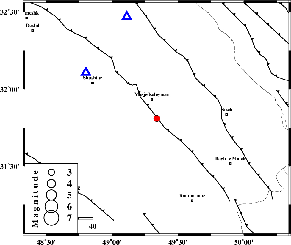
| Location | Lat:31.81 Lon: 49.34 |
| Region | 14 km South of Masjed Soleyman, Khoozestan Province |
Nearest Cities |
|
| 14 km South of Masjed Soleyman, Khoozestan Province | |
| 28 km North of Gazin, Khoozestan Province | |
| 35 km North West of Jaru, Khoozestan Province | |
| 42 km North West of Chenarestan, Khoozestan Province | |
| 42 km East of Arabhasan, Khoozestan Province | |
| Depth | 15 km |
| Agency | |
Faults within 150 km: |
|
| DEZFUL_EMBAYMENT (Length: 228 km) , Distance to epicenter: 7 km | |
| MFF2 (Length: 205 km) , Distance to epicenter: 40 km | |
| AGHAJARI_F (Length: 88 km) , Distance to epicenter: 69 km | |
| Number of Phases | 5 |
| RMS | 0.1 |
| Number of Stations | 6 |
| Error in Latitude | >7.7 km |
| Error in Longitude | 1.6 km |
| Error in Depth | 0 km |
Download waveform in seisan format
to download seisan software Click here
to access information about IIEES stations Click here
Amplitude | ||||||||
| UID | Agency | Station | Component | Amplitude | Period | Arrival Time | Proccessing Time | Signal Clip |
| 50628 | IIEES | ASAO | N | 57.7 | 0.6 | 2008-10-03 03:20:37 | 2009-05-17 10:07:00 | n |
| 50629 | IIEES | ASAO | E | 50.9 | 0.6 | 2008-10-03 03:20:38 | 2009-05-17 10:07:00 | n |
| 50630 | IIEES | GHVR | E | 51.5 | 0.64 | 2008-10-03 03:20:42 | 2009-05-17 10:07:00 | n |
| 50631 | IIEES | GHVR | N | 64.3 | 0.68 | 2008-10-03 03:20:43 | 2009-05-17 10:07:00 | n |
Phase | ||||||||||||
| Agency | Station | Component | Phase Type | Phase Quality | First Motion | Observed Arrival Time | Time Residual | Loc. Flag | Input Weight | Distance | Azimuth | |
| IIEES | ASAO | Z | Pn | E | 2008-10-03 03:19:54 | 0 | y | 311 | 12 | |||
| IIEES | NASN | Z | Pn | E | 2008-10-03 03:19:58 | 0 | y | 345 | 71 | |||
| IIEES | SNGE | Z | Pn | E | 2008-10-03 03:20:06 | 0.1 | y | 408 | 334 | |||
| IIEES | DAMV | E | Pn | E | 2008-10-03 03:20:16 | 0.1 | y | 489 | 29 | |||
| IIEES | ZNJK | Z | Pn | E | 2008-10-03 03:20:22 | -0.1 | y | 543 | 354 | |||