
Magnitude |
:3 |
| Date & Time (UTC) | 2008-09-26 21:16:20.6 |
| Date & Time (Local) | 1387/7/6 00:46:20.6 |
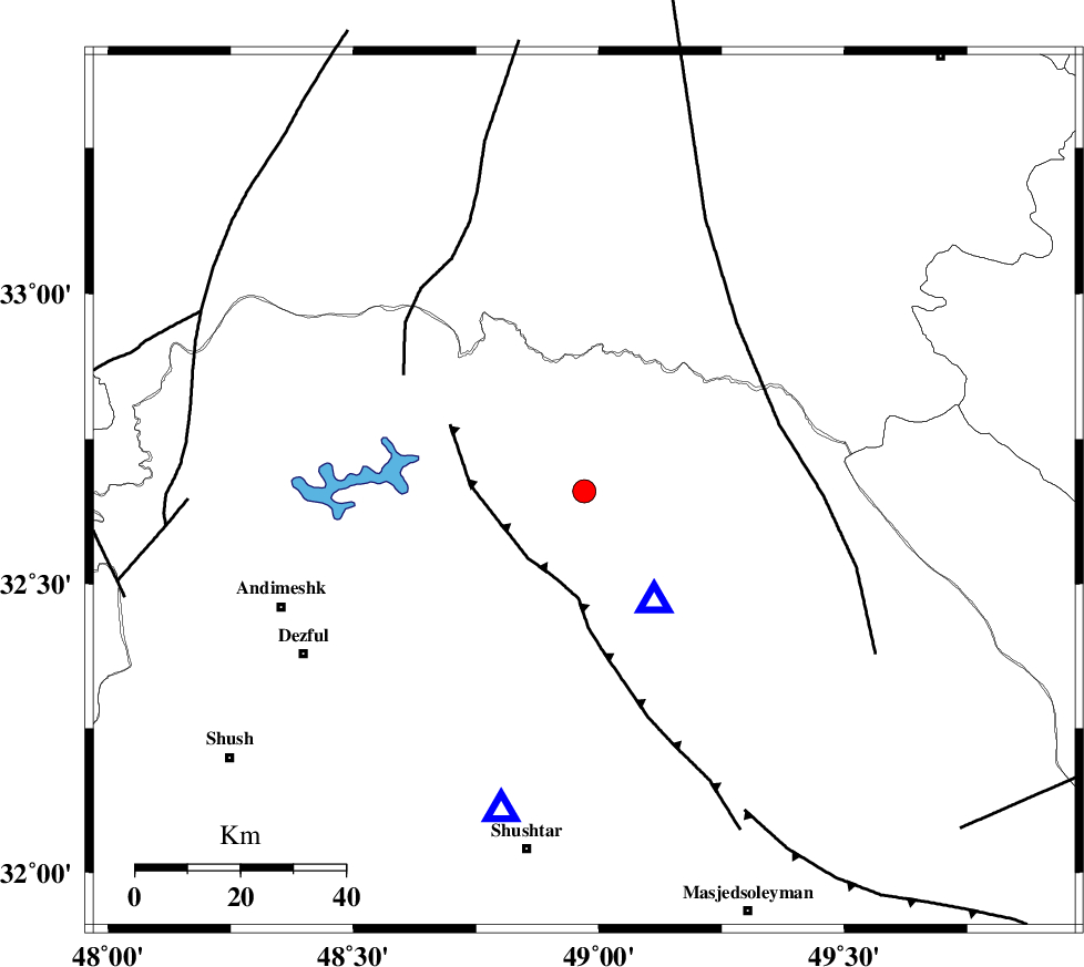
| Location | Lat:32.66 Lon: 48.97 |
| Region | 32 km North-West of Lali, Khoozestan Province |
Nearest Cities |
|
| 21 km South East of Shuy, Khoozestan Province | |
| 21 km North East of Sardasht, Khoozestan Province | |
| 33 km North West of Lali, Khoozestan Province | |
| 41 km North East of Mahur berenji, Khoozestan Province | |
| 43 km South of Bargsar, Lorestan Province | |
| Depth | 15 km |
| Agency | |
Faults within 150 km: |
|
| MFF2 (Length: 205 km) , Distance to epicenter: 5 km | |
| BALARUD_F_Z2 (Length: 58 km) , Distance to epicenter: 9 km | |
| BALARUD_F_Z3 (Length: 53 km) , Distance to epicenter: 40 km | |
| Number of Phases | 4 |
| RMS | 0.2 |
| Number of Stations | 4 |
| Error in Latitude | >8.4 km |
| Error in Longitude | 2.4 km |
| Error in Depth | 0 km |
Download waveform in seisan format
to download seisan software Click here
to access information about IIEES stations Click here
Amplitude | ||||||||
| UID | Agency | Station | Component | Amplitude | Period | Arrival Time | Proccessing Time | Signal Clip |
| 50572 | IIEES | ASAO | E | 105.7 | 0.56 | 2008-09-26 21:17:32 | 2009-05-05 01:27:00 | n |
| 50573 | IIEES | ASAO | N | 150 | 0.72 | 2008-09-26 21:17:32 | 2009-05-05 01:27:00 | n |
| 50574 | IIEES | GHVR | E | 35.1 | 0.52 | 2008-09-26 21:17:44 | 2009-05-05 01:27:00 | n |
| 50575 | IIEES | GHVR | N | 61.8 | 0.52 | 2008-09-26 21:17:48 | 2009-05-05 01:27:00 | n |
Phase | ||||||||||||
| Agency | Station | Component | Phase Type | Phase Quality | First Motion | Observed Arrival Time | Time Residual | Loc. Flag | Input Weight | Distance | Azimuth | |
| IIEES | ASAO | Z | Pn | E | 2008-09-26 21:16:56 | -0.2 | y | 231 | 25 | |||
| IIEES | GHVR | Z | Pn | E | 2008-09-26 21:17:04 | 0.2 | y | 292 | 46 | |||
| IIEES | SNGE | Z | Pn | E | 2008-09-26 21:17:06 | 0 | y | 309 | 331 | |||
| IIEES | NASN | Z | Pn | E | 2008-09-26 21:17:13 | -0.1 | y | 360 | 86 | |||