
Magnitude |
:2.9 |
| Date & Time (UTC) | 2008-09-19 05:43:58.3 |
| Date & Time (Local) | 1387/6/29 10:13:58.3 |
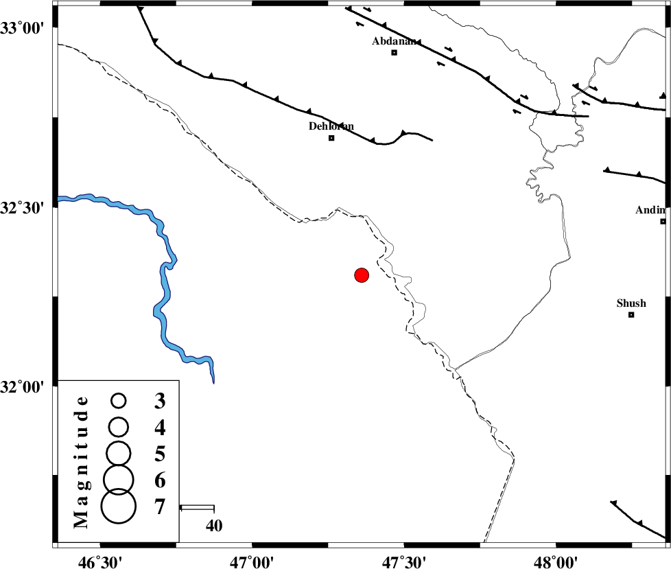
| Location | Lat:32.31 Lon: 47.36 |
| Region | 43 km South of Dehloran, Ilam Province |
Nearest Cities |
|
| 26 km South of Musian, Ilam Province | |
| 44 km South East of Dehloran, Ilam Province | |
| 68 km South East of Bishehzar, Ilam Province | |
| 68 km South West of Sarabbagh, Ilam Province | |
| 70 km South West of Abdanan, Ilam Province | |
| Depth | 16 km |
| Agency | |
Faults within 150 km: |
|
| MFF6 (Length: 144 km) , Distance to epicenter: 41 km | |
| BALARUD_F_Z1 (Length: 87 km) , Distance to epicenter: 72 km | |
| DEZFUL_EMBAYMENT (Length: 228 km) , Distance to epicenter: 81 km | |
| Number of Phases | 5 |
| RMS | 0 |
| Number of Stations | 3 |
| Error in Latitude | >3.2 km |
| Error in Longitude | 4.8 km |
| Error in Depth | 4.3 km |
Download waveform in seisan format
to download seisan software Click here
to access information about IIEES stations Click here
Amplitude | ||||||||
| UID | Agency | Station | Component | Amplitude | Period | Arrival Time | Proccessing Time | Signal Clip |
| 50479 | IIEES | SHGR | N | 359.2 | 0.4 | 2008-09-19 05:44:41 | 2009-05-05 01:27:00 | n |
| 50480 | IIEES | SHGR | E | 380.2 | 0.44 | 2008-09-19 05:44:41 | 2009-05-05 01:27:00 | n |
| 50481 | IIEES | SNGE | E | 20.9 | 0.57 | 2008-09-19 05:45:35 | 2009-05-05 01:27:00 | n |
Phase | ||||||||||||
| Agency | Station | Component | Phase Type | Phase Quality | First Motion | Observed Arrival Time | Time Residual | Loc. Flag | Input Weight | Distance | Azimuth | |
| IIEES | SHGR | Z | Pg | E | 2008-09-19 05:44:21 | 0 | y | 138 | 99 | |||
| IIEES | SHGR | E | Sg | E | 2008-09-19 05:44:38 | 0 | y | 138 | 99 | |||
| IIEES | SNGE | Z | Pn | E | 2008-09-19 05:44:44 | -0.1 | y | 308 | 360 | |||
| IIEES | SNGE | E | Sg | E | 2008-09-19 05:45:25 | 0 | y | 308 | 360 | |||
| IIEES | ASAO | Z | Pn | E | 2008-09-19 05:44:49 | 0.1 | y | 351 | 44 | |||