
Magnitude |
:3.4 |
| Date & Time (UTC) | 2008-09-18 05:20:21.6 |
| Date & Time (Local) | 1387/6/28 09:50:21.6 |
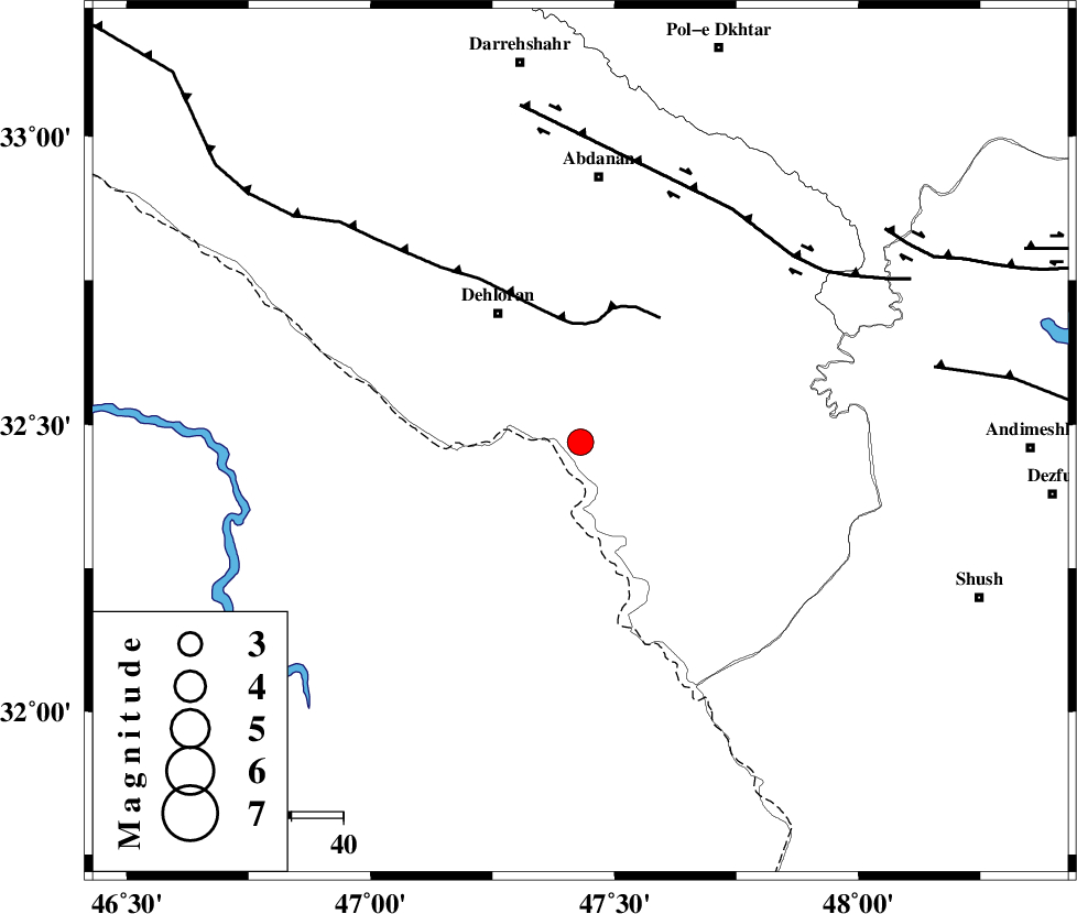
| Location | Lat:32.47 Lon: 47.43 |
| Region | 29 km South-East of Dehloran, Ilam Province |
Nearest Cities |
|
| 11 km of Musian, Ilam Province | |
| 29 km South East of Dehloran, Ilam Province | |
| 49 km South West of Sarabbagh, Ilam Province | |
| 51 km South of Abdanan, Ilam Province | |
| 58 km South East of Bishehzar, Ilam Province | |
| Depth | 14 km |
| Agency | |
Faults within 150 km: |
|
| MFF6 (Length: 144 km) , Distance to epicenter: 23 km | |
| BALARUD_F_Z1 (Length: 87 km) , Distance to epicenter: 54 km | |
| DEZFUL_EMBAYMENT (Length: 228 km) , Distance to epicenter: 70 km | |
| Number of Phases | 7 |
| RMS | 0.1 |
| Number of Stations | 6 |
| Error in Latitude | >2.4 km |
| Error in Longitude | 5.5 km |
| Error in Depth | 6.2 km |
Download waveform in seisan format
to download seisan software Click here
to access information about IIEES stations Click here
Amplitude | ||||||||
| UID | Agency | Station | Component | Amplitude | Period | Arrival Time | Proccessing Time | Signal Clip |
| 50473 | IIEES | SNGE | E | 105.2 | 0.56 | 2008-09-18 05:21:59 | 2009-05-05 01:27:00 | n |
| 50474 | IIEES | ASAO | N | 143.1 | 0.68 | 2008-09-18 05:22:04 | 2009-05-05 01:27:00 | n |
| 50475 | IIEES | GHVR | N | 88.1 | 0.59 | 2008-09-18 05:22:10 | 2009-05-05 01:27:00 | n |
| 50476 | IIEES | DAMV | N | 27.5 | 0.48 | 2008-09-18 05:23:08 | 2009-05-05 01:27:00 | n |
Phase | ||||||||||||
| Agency | Station | Component | Phase Type | Phase Quality | First Motion | Observed Arrival Time | Time Residual | Loc. Flag | Input Weight | Distance | Azimuth | |
| IIEES | SHGR | Z | Pg | E | 2008-09-18 05:20:44 | 0 | y | 135 | 107 | |||
| IIEES | SNGE | Z | Pn | E | 2008-09-18 05:21:05 | 0 | y | 291 | 358 | |||
| IIEES | ASAO | Z | Pn | E | 2008-09-18 05:21:11 | 0.2 | y | 334 | 46 | |||
| IIEES | ASAO | E | Sg | E | 2008-09-18 05:21:55 | 0 | y | 334 | 46 | |||
| IIEES | GHVR | Z | Pn | E | 2008-09-18 05:21:21 | 0 | y | 419 | 57 | |||
| IIEES | CHTH | Z | Pn | E | 2008-09-18 05:21:32 | -0.2 | y | 511 | 41 | |||
| IIEES | DAMV | Z | Pn | E | 2008-09-18 05:21:37 | 0.1 | y | 546 | 49 | |||