
Magnitude |
:2.7 |
| Date & Time (UTC) | 2008-09-17 23:13:52.1 |
| Date & Time (Local) | 1387/6/28 03:43:52.1 |
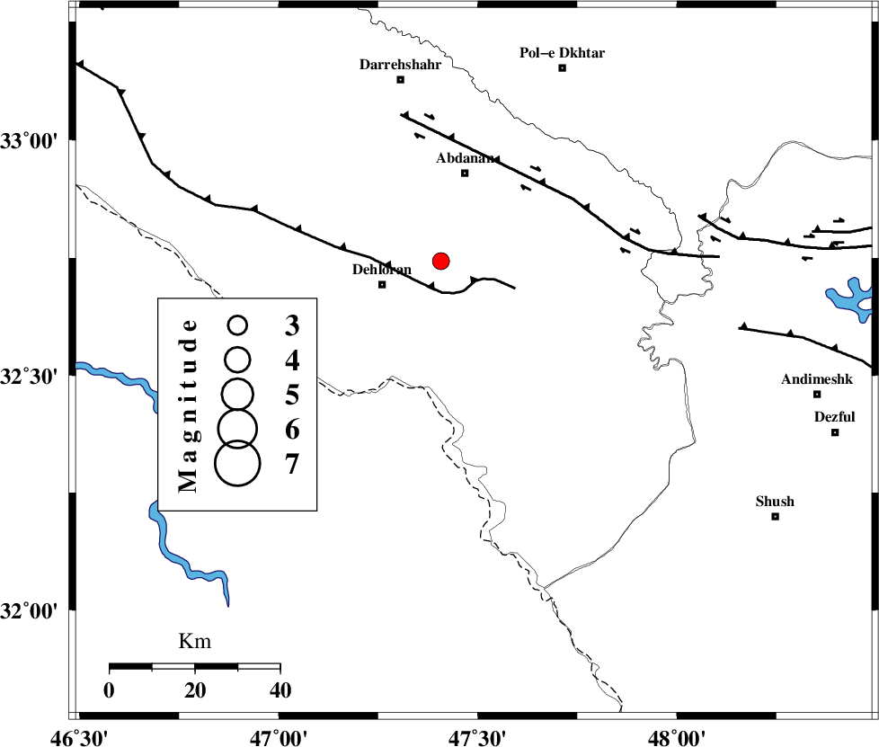
| Location | Lat:32.53 Lon: 47.49 |
| Region | 28 km South-East of Dehloran, Ilam Province |
Nearest Cities |
|
| 12 km East of Musian, Ilam Province | |
| 28 km South East of Dehloran, Ilam Province | |
| 42 km South of Sarabbagh, Ilam Province | |
| 45 km South of Abdanan, Ilam Province | |
| 58 km South East of Bishehzar, Ilam Province | |
| Depth | 29 km |
| Agency | |
Faults within 150 km: |
|
| MFF6 (Length: 144 km) , Distance to epicenter: 17 km | |
| BALARUD_F_Z1 (Length: 87 km) , Distance to epicenter: 45 km | |
| DEZFUL_EMBAYMENT (Length: 228 km) , Distance to epicenter: 63 km | |
| Number of Phases | 5 |
| RMS | 0 |
| Number of Stations | 4 |
| Error in Latitude | >7.8 km |
| Error in Longitude | 6.7 km |
| Error in Depth | 7.6 km |
Download waveform in seisan format
to download seisan software Click here
to access information about IIEES stations Click here
Amplitude | ||||||||
| UID | Agency | Station | Component | Amplitude | Period | Arrival Time | Proccessing Time | Signal Clip |
| 50465 | IIEES | SHGR | E | 244.7 | 0.36 | 2008-09-17 23:14:35 | 2009-05-05 01:27:00 | n |
| 50466 | IIEES | GHVR | E | 10.8 | 0.48 | 2008-09-17 23:15:40 | 2009-05-05 01:27:00 | n |
| 50467 | IIEES | GHVR | N | 10.6 | 0.84 | 2008-09-17 23:16:05 | 2009-05-05 01:27:00 | n |
Phase | ||||||||||||
| Agency | Station | Component | Phase Type | Phase Quality | First Motion | Observed Arrival Time | Time Residual | Loc. Flag | Input Weight | Distance | Azimuth | |
| IIEES | SHGR | Z | Pg | E | 2008-09-17 23:14:13 | 0 | y | 132 | 110 | |||
| IIEES | SHGR | E | Sg | E | 2008-09-17 23:14:29 | 0 | y | 132 | 110 | |||
| IIEES | ASAO | Z | Pn | E | 2008-09-17 23:14:39 | 0 | y | 325 | 46 | |||
| IIEES | GHVR | Z | Pn | E | 2008-09-17 23:14:49 | 0 | y | 411 | 57 | |||
| IIEES | NASN | Z | Pn | E | 2008-09-17 23:15:00 | 0 | y | 500 | 85 | |||