
Magnitude |
:3.5 |
| Date & Time (UTC) | 2008-09-09 21:31:25.4 |
| Date & Time (Local) | 1387/6/20 02:01:25.4 |
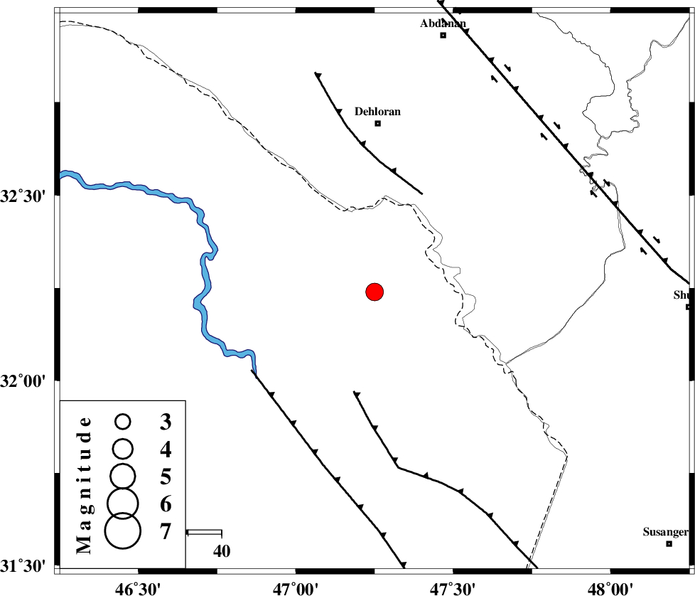
| Location | Lat:32.24 Lon: 47.25 |
| Region | 50 km South of Dehloran, Ilam Province |
Nearest Cities |
|
| 36 km South West of Musian, Ilam Province | |
| 50 km South of Dehloran, Ilam Province | |
| 70 km South East of Bishehzar, Ilam Province | |
| 79 km South West of Sarabbagh, Ilam Province | |
| 79 km South West of Abdanan, Ilam Province | |
| Depth | 15 km |
| Agency | |
Faults within 150 km: |
|
| MFF6 (Length: 144 km) , Distance to epicenter: 51 km | |
| BALARUD_F_Z1 (Length: 87 km) , Distance to epicenter: 84 km | |
| DEZFUL_EMBAYMENT (Length: 228 km) , Distance to epicenter: 94 km | |
| Number of Phases | 7 |
| RMS | 0.3 |
| Number of Stations | 7 |
| Error in Latitude | >21.9 km |
| Error in Longitude | 5 km |
| Error in Depth | 0 km |
Download waveform in seisan format
to download seisan software Click here
to access information about IIEES stations Click here
Amplitude | ||||||||
| UID | Agency | Station | Component | Amplitude | Period | Arrival Time | Proccessing Time | Signal Clip |
| 50212 | IIEES | SNGE | E | 198 | 0.38 | 2008-09-09 21:33:01 | 2009-05-05 01:27:00 | n |
| 50213 | IIEES | ASAO | N | 91.3 | 0.71 | 2008-09-09 21:33:09 | 2009-05-05 01:27:00 | n |
| 50214 | IIEES | ASAO | E | 117.3 | 0.4 | 2008-09-09 21:33:09 | 2009-05-05 01:27:00 | n |
| 50215 | IIEES | GHVR | E | 76.3 | 1.47 | 2008-09-09 21:33:16 | 2009-05-05 01:27:00 | n |
| 50216 | IIEES | GHVR | N | 79.7 | 1.18 | 2008-09-09 21:33:17 | 2009-05-05 01:27:00 | n |
Phase | ||||||||||||
| Agency | Station | Component | Phase Type | Phase Quality | First Motion | Observed Arrival Time | Time Residual | Loc. Flag | Input Weight | Distance | Azimuth | |
| IIEES | SNGE | Z | Pn | E | 2008-09-09 21:32:12 | 0.1 | y | 317 | 2 | |||
| IIEES | ASAO | Z | Pn | E | 2008-09-09 21:32:18 | 0.4 | y | 364 | 44 | |||
| IIEES | GHVR | Z | Pn | E | 2008-09-09 21:32:28 | 0.3 | y | 448 | 55 | |||
| IIEES | ZNJK | Z | Pn | E | 2008-09-09 21:32:36 | -0.3 | y | 509 | 15 | |||
| IIEES | NASN | Z | Pn | E | 2008-09-09 21:32:38 | -0.1 | y | 526 | 82 | |||
| IIEES | CHTH | Z | Pn | E | 2008-09-09 21:32:40 | -0.3 | y | 542 | 40 | |||
| IIEES | DAMV | Z | Pn | E | 2008-09-09 21:32:44 | -0.5 | y | 576 | 48 | |||