
Magnitude |
:3 |
| Date & Time (UTC) | 2008-09-08 15:51:45.7 |
| Date & Time (Local) | 1387/6/18 20:21:45.7 |
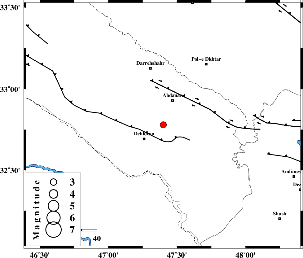
| Location | Lat:32.78 Lon: 47.4 |
| Region | 16 km East of Dehloran, Ilam Province |
Nearest Cities |
|
| 16 km North East of Dehloran, Ilam Province | |
| 18 km South of Abdanan, Ilam Province | |
| 20 km South West of Sarabbagh, Ilam Province | |
| 26 km North of Musian, Ilam Province | |
| 40 km South of Darreh Shahr, Ilam Province | |
| Depth | 14 km |
| Agency | |
Faults within 150 km: |
|
| MFF6 (Length: 144 km) , Distance to epicenter: 10 km | |
| BALARUD_F_Z1 (Length: 87 km) , Distance to epicenter: 32 km | |
| BALARUD_F_Z3 (Length: 53 km) , Distance to epicenter: 61 km | |
| Number of Phases | 6 |
| RMS | 0.1 |
| Number of Stations | 4 |
| Error in Latitude | >2.2 km |
| Error in Longitude | 5.5 km |
| Error in Depth | 7.8 km |
Download waveform in seisan format
to download seisan software Click here
to access information about IIEES stations Click here
Amplitude | ||||||||
| UID | Agency | Station | Component | Amplitude | Period | Arrival Time | Proccessing Time | Signal Clip |
| 50172 | IIEES | SHGR | N | 470.9 | 0.6 | 2008-09-08 15:52:33 | 2009-05-05 01:27:00 | n |
| 50173 | IIEES | SHGR | E | 352.4 | 0.44 | 2008-09-08 15:52:38 | 2009-05-05 01:27:00 | n |
| 50174 | IIEES | SNGE | E | 73.1 | 0.52 | 2008-09-08 15:53:04 | 2009-05-05 01:27:00 | n |
| 50175 | IIEES | ASAO | E | 34.9 | 0.44 | 2008-09-08 15:53:24 | 2009-05-05 01:27:00 | n |
| 50176 | IIEES | ASAO | N | 40.1 | 0.72 | 2008-09-08 15:53:25 | 2009-05-05 01:27:00 | n |
| 50177 | IIEES | GHVR | E | 22.7 | 0.72 | 2008-09-08 15:53:48 | 2009-05-05 01:27:00 | n |
| 50178 | IIEES | GHVR | N | 17 | 0.72 | 2008-09-08 15:53:50 | 2009-05-05 01:27:00 | n |
Phase | ||||||||||||
| Agency | Station | Component | Phase Type | Phase Quality | First Motion | Observed Arrival Time | Time Residual | Loc. Flag | Input Weight | Distance | Azimuth | |
| IIEES | SHGR | Z | Pg | E | 2008-09-08 15:52:10 | -0.1 | y | 151 | 119 | |||
| IIEES | SHGR | E | Sg | E | 2008-09-08 15:52:29 | 0 | y | 151 | 119 | |||
| IIEES | SNGE | Z | Pn | E | 2008-09-08 15:52:25 | -0.1 | y | 257 | 359 | |||
| IIEES | ASAO | Z | Pn | E | 2008-09-08 15:52:32 | 0.2 | y | 313 | 50 | |||
| IIEES | ASAO | N | Sg | E | 2008-09-08 15:53:13 | -0.1 | y | 313 | 50 | |||
| IIEES | GHVR | Z | Pn | E | 2008-09-08 15:52:43 | 0.1 | y | 404 | 61 | |||