
Magnitude |
:2.9 |
| Date & Time (UTC) | 2008-09-08 06:57:19.7 |
| Date & Time (Local) | 1387/6/18 11:27:19.7 |
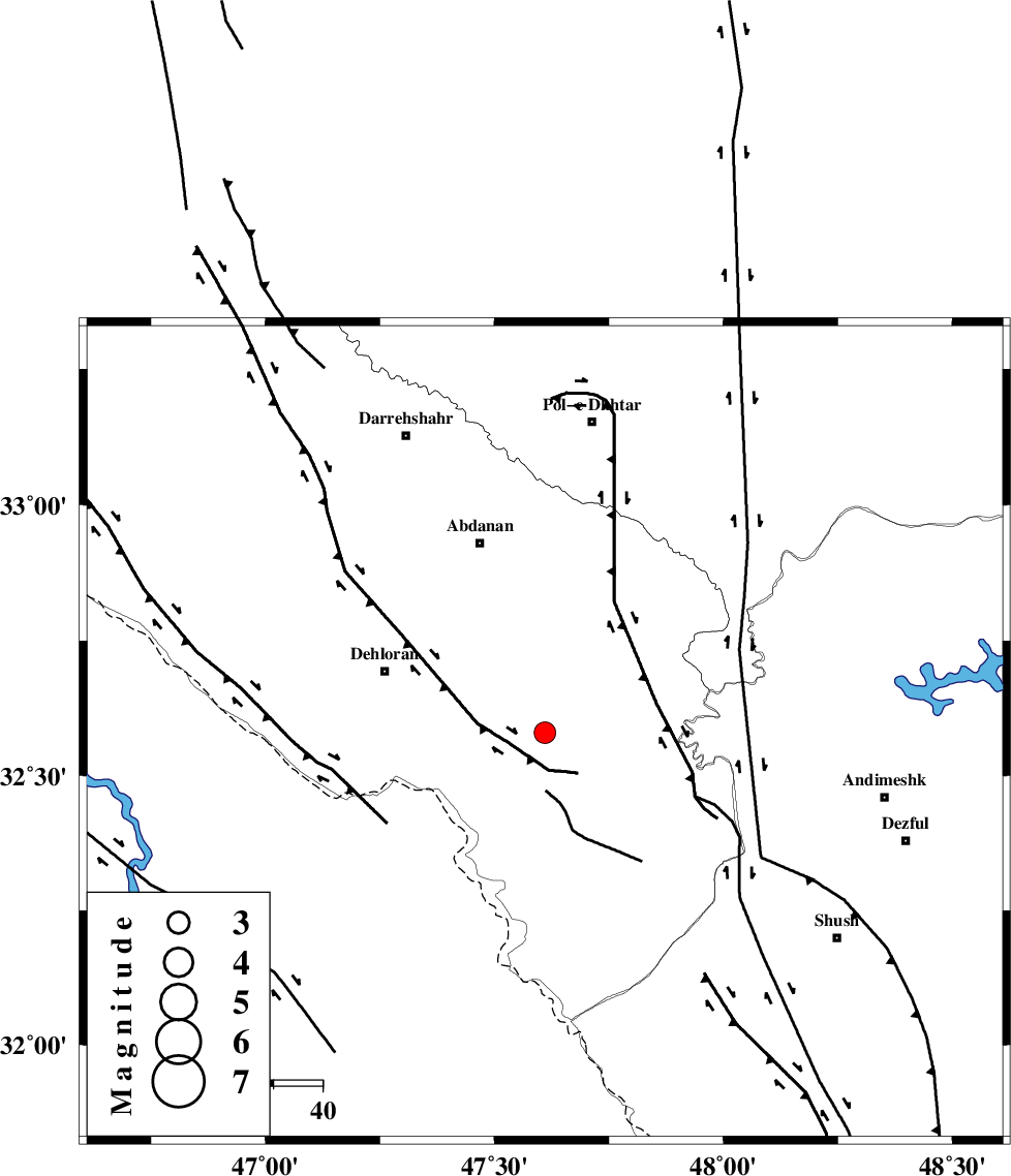
| Location | Lat:32.58 Lon: 47.61 |
| Region | 35 km South-East of Dehloran, Ilam Province |
Nearest Cities |
|
| 24 km North East of Musian, Ilam Province | |
| 35 km South East of Dehloran, Ilam Province | |
| 36 km South of Sarabbagh, Ilam Province | |
| 41 km South East of Abdanan, Ilam Province | |
| 58 km South of Sarab hammam, Lorestan Province | |
| Depth | 14 km |
| Agency | |
Faults within 150 km: |
|
| MFF6 (Length: 144 km) , Distance to epicenter: 12 km | |
| BALARUD_F_Z1 (Length: 87 km) , Distance to epicenter: 34 km | |
| BALARUD_F_Z3 (Length: 53 km) , Distance to epicenter: 51 km | |
| Number of Phases | 5 |
| RMS | 0.1 |
| Number of Stations | 4 |
| Error in Latitude | >5.4 km |
| Error in Longitude | 11 km |
| Error in Depth | 5.1 km |
Download waveform in seisan format
to download seisan software Click here
to access information about IIEES stations Click here
Amplitude | ||||||||
| UID | Agency | Station | Component | Amplitude | Period | Arrival Time | Proccessing Time | Signal Clip |
| 50169 | IIEES | SHGR | N | 643.6 | 0.47 | 2008-09-08 06:58:00 | 2009-05-05 01:27:00 | n |
| 50170 | IIEES | SNGE | E | 55.7 | 0.51 | 2008-09-08 06:58:40 | 2009-05-05 01:27:00 | n |
| 50171 | IIEES | NASN | N | 5.7 | 0.56 | 2008-09-08 06:59:55 | 2009-05-05 01:27:00 | n |
Phase | ||||||||||||
| Agency | Station | Component | Phase Type | Phase Quality | First Motion | Observed Arrival Time | Time Residual | Loc. Flag | Input Weight | Distance | Azimuth | |
| IIEES | SHGR | Z | Pg | E | 2008-09-08 06:57:40 | -0.1 | y | 124 | 114 | |||
| IIEES | SNGE | Z | Pn | E | 2008-09-08 06:58:02 | 0 | y | 280 | 355 | |||
| IIEES | SNGE | E | Sg | E | 2008-09-08 06:58:38 | -0.1 | y | 280 | 355 | |||
| IIEES | ZNJK | Z | Pn | E | 2008-09-08 06:58:25 | 0.2 | y | 465 | 12 | |||
| IIEES | NASN | Z | Pn | E | 2008-09-08 06:58:28 | 0.1 | y | 488 | 86 | |||